La Ferrière-Harang
| La Ferrière-Harang | |
|---|---|
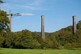 Souleuvre viaduct under construction | |
 La Ferrière-Harang Location within Normandy region  La Ferrière-Harang | |
| Coordinates: 48°58′33″N 0°53′23″W / 48.9758°N 0.8897°WCoordinates: 48°58′33″N 0°53′23″W / 48.9758°N 0.8897°W | |
| Country | France |
| Region | Normandy |
| Department | Calvados |
| Arrondissement | Vire |
| Canton | Condé-sur-Noireau |
| Government | |
| • Mayor (2008–2014) | Alain Simoni |
| Area1 | 11.43 km2 (4.41 sq mi) |
| Population (2008)2 | 303 |
| • Density | 27/km2 (69/sq mi) |
| Time zone | UTC+1 (CET) |
| • Summer (DST) | UTC+2 (CEST) |
| INSEE/Postal code | 14264 /14350 |
| Elevation |
75–243 m (246–797 ft) (avg. 179 m or 587 ft) |
|
1 French Land Register data, which excludes lakes, ponds, glaciers > 1 km2 (0.386 sq mi or 247 acres) and river estuaries. 2 Population without double counting: residents of multiple communes (e.g., students and military personnel) only counted once. | |
La Ferrière-Harang is a former commune in the Calvados department in the Normandy region in northwestern France. On 1 January 2016, it was merged into the new commune of Souleuvre-en-Bocage.[1]
Population
| Historical population | ||
|---|---|---|
| Year | Pop. | ±% |
| 1962 | 443 | — |
| 1968 | 377 | −14.9% |
| 1975 | 351 | −6.9% |
| 1982 | 302 | −14.0% |
| 1990 | 266 | −11.9% |
| 1999 | 282 | +6.0% |
| 2008 | 303 | +7.4% |
See also
References
- ↑ Arrêté préfectoral 1 December 2015 (in French)
| Wikimedia Commons has media related to La Ferrière-Harang. |
| Authority control |
|---|
This article is issued from
Wikipedia.
The text is licensed under Creative Commons - Attribution - Sharealike.
Additional terms may apply for the media files.