Val de Drôme
| Val de Drôme | |
|---|---|
| Commune | |
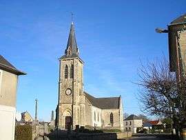 The church in Sept-Vents | |
 Val de Drôme Location within Normandy region  Val de Drôme | |
| Coordinates: 49°04′34″N 0°49′12″W / 49.076°N 0.820°WCoordinates: 49°04′34″N 0°49′12″W / 49.076°N 0.820°W | |
| Country | France |
| Region | Normandy |
| Department | Calvados |
| Arrondissement | Vire |
| Canton | Aunay-sur-Odon |
| Intercommunality | Pré-Bocage Intercom |
| Area1 | 27.62 km2 (10.66 sq mi) |
| Population (2013)2 | 820 |
| • Density | 30/km2 (77/sq mi) |
| Time zone | UTC+1 (CET) |
| • Summer (DST) | UTC+2 (CEST) |
| INSEE/Postal code | 14672 /14240 |
|
1 French Land Register data, which excludes lakes, ponds, glaciers > 1 km2 (0.386 sq mi or 247 acres) and river estuaries. 2 Population without double counting: residents of multiple communes (e.g., students and military personnel) only counted once. | |
Val de Drôme is a commune in the department of Calvados, northwestern France. The municipality was established on 1 January 2017 by merger of the former communes of Sept-Vents (the seat), Dampierre, La Lande-sur-Drôme and Saint-Jean-des-Essartiers.[1]
See also
References
| Wikimedia Commons has media related to Val de Drôme. |
- ↑ Arrêté préfectoral 26 September 2016 (in French)
This article is issued from
Wikipedia.
The text is licensed under Creative Commons - Attribution - Sharealike.
Additional terms may apply for the media files.