Hotot-en-Auge
| Hotot-en-Auge | |
|---|---|
| Commune | |
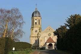 Saint-Georges' church in Hotot-en-Auge | |
 Hotot-en-Auge Location within Normandy region  Hotot-en-Auge | |
| Coordinates: 49°10′01″N 0°03′14″W / 49.1669°N 0.0539°WCoordinates: 49°10′01″N 0°03′14″W / 49.1669°N 0.0539°W | |
| Country | France |
| Region | Normandy |
| Department | Calvados |
| Arrondissement | Lisieux |
| Canton | Mézidon-Canon |
| Intercommunality | Cambremer |
| Government | |
| • Mayor (2008–2014) | Brigitte Paturel |
| Area1 | 24.05 km2 (9.29 sq mi) |
| Population (2008)2 | 300 |
| • Density | 12/km2 (32/sq mi) |
| Time zone | UTC+1 (CET) |
| • Summer (DST) | UTC+2 (CEST) |
| INSEE/Postal code | 14335 /14430 |
| Elevation |
2–35 m (6.6–114.8 ft) (avg. 28 m or 92 ft) |
|
1 French Land Register data, which excludes lakes, ponds, glaciers > 1 km2 (0.386 sq mi or 247 acres) and river estuaries. 2 Population without double counting: residents of multiple communes (e.g., students and military personnel) only counted once. | |
Hotot-en-Auge is a commune in the Calvados department in the Normandy region in northwestern France.
Demographics
In 2010, the town had 317 inhabitants. Population censuses have been conducted in the town since 1793 with some regularity as a census of municipalities with fewer than 10,000 inhabitants are held every five years.
Population
| Historical population | ||
|---|---|---|
| Year | Pop. | ±% |
| 1962 | 315 | — |
| 1968 | 345 | +9.5% |
| 1975 | 275 | −20.3% |
| 1982 | 264 | −4.0% |
| 1990 | 300 | +13.6% |
| 1999 | 281 | −6.3% |
| 2008 | 300 | +6.8% |
| 2010 | 317 | +5.7% |
See also
References
| Wikimedia Commons has media related to Hotot-en-Auge. |
This article is issued from
Wikipedia.
The text is licensed under Creative Commons - Attribution - Sharealike.
Additional terms may apply for the media files.