Parfouru-sur-Odon
| Parfouru-sur-Odon | |
|---|---|
| Commune | |
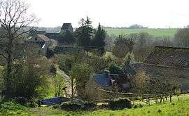 A general view of Parfouru-sur-Odon | |
 Parfouru-sur-Odon Location within Normandy region  Parfouru-sur-Odon | |
| Coordinates: 49°05′30″N 0°36′29″W / 49.0917°N 0.6081°WCoordinates: 49°05′30″N 0°36′29″W / 49.0917°N 0.6081°W | |
| Country | France |
| Region | Normandy |
| Department | Calvados |
| Arrondissement | Vire |
| Canton | Aunay-sur-Odon |
| Intercommunality | Villers-Bocage Intercom |
| Government | |
| • Mayor (2008–2014) | André Bisson |
| Area1 | 3.65 km2 (1.41 sq mi) |
| Population (2008)2 | 157 |
| • Density | 43/km2 (110/sq mi) |
| Time zone | UTC+1 (CET) |
| • Summer (DST) | UTC+2 (CEST) |
| INSEE/Postal code | 14491 /14310 |
| Elevation |
69–217 m (226–712 ft) (avg. 106 m or 348 ft) |
|
1 French Land Register data, which excludes lakes, ponds, glaciers > 1 km2 (0.386 sq mi or 247 acres) and river estuaries. 2 Population without double counting: residents of multiple communes (e.g., students and military personnel) only counted once. | |
Parfouru-sur-Odon is a commune in the Calvados department in the Normandy region in northwestern France.
Population
| Historical population | ||
|---|---|---|
| Year | Pop. | ±% |
| 1962 | 138 | — |
| 1968 | 104 | −24.6% |
| 1975 | 131 | +26.0% |
| 1982 | 150 | +14.5% |
| 1990 | 147 | −2.0% |
| 1999 | 136 | −7.5% |
| 2008 | 157 | +15.4% |
See also
References
| Wikimedia Commons has media related to Parfouru-sur-Odon. |
This article is issued from
Wikipedia.
The text is licensed under Creative Commons - Attribution - Sharealike.
Additional terms may apply for the media files.