Ifs, Calvados
| Ifs | |
|---|---|
| Commune | |
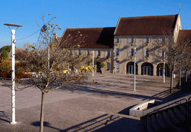 Town hall | |
 Ifs Location within Normandy region  Ifs | |
| Coordinates: 49°08′20″N 0°21′07″W / 49.1389°N 0.3519°WCoordinates: 49°08′20″N 0°21′07″W / 49.1389°N 0.3519°W | |
| Country | France |
| Region | Normandy |
| Department | Calvados |
| Arrondissement | Caen |
| Canton | Ifs |
| Intercommunality | Caen la Mer |
| Government | |
| • Mayor (2014–2020) | Michel Patard-Legendre (LR) |
| Area1 | 9.06 km2 (3.50 sq mi) |
| Population (2015)2 | 11,562 |
| • Density | 1,300/km2 (3,300/sq mi) |
| Time zone | UTC+1 (CET) |
| • Summer (DST) | UTC+2 (CEST) |
| INSEE/Postal code | 14341 /14123 |
| Elevation |
19–61 m (62–200 ft) (avg. 50 m or 160 ft) |
|
1 French Land Register data, which excludes lakes, ponds, glaciers > 1 km2 (0.386 sq mi or 247 acres) and river estuaries. 2 Population without double counting: residents of multiple communes (e.g., students and military personnel) only counted once. | |
Ifs ([if]) is a commune in the Calvados department in the Normandy region in northwestern France.
Population
| Historical population | ||
|---|---|---|
| Year | Pop. | ±% |
| 1793 | 719 | — |
| 1800 | 536 | −25.5% |
| 1806 | 703 | +31.2% |
| 1821 | 706 | +0.4% |
| 1831 | 719 | +1.8% |
| 1836 | 741 | +3.1% |
| 1841 | 772 | +4.2% |
| 1846 | 748 | −3.1% |
| 1851 | 761 | +1.7% |
| 1856 | 750 | −1.4% |
| 1861 | 736 | −1.9% |
| 1866 | 794 | +7.9% |
| 1872 | 697 | −12.2% |
| 1876 | 682 | −2.2% |
| 1881 | 617 | −9.5% |
| 1886 | 606 | −1.8% |
| 1891 | 556 | −8.3% |
| 1896 | 599 | +7.7% |
| 1901 | 566 | −5.5% |
| 1906 | 561 | −0.9% |
| 1911 | 560 | −0.2% |
| 1921 | 626 | +11.8% |
| 1926 | 634 | +1.3% |
| 1931 | 705 | +11.2% |
| 1936 | 803 | +13.9% |
| 1946 | 770 | −4.1% |
| 1954 | 1,263 | +64.0% |
| 1962 | 1,791 | +41.8% |
| 1968 | 2,681 | +49.7% |
| 1975 | 4,574 | +70.6% |
| 1982 | 5,635 | +23.2% |
| 1990 | 6,974 | +23.8% |
| 1999 | 9,207 | +32.0% |
| 2008 | 10,822 | +17.5% |
| 2015 | 11,562 | +6.8% |
Administration
Mayors of Ifs
| From | To | Name | Party |
|---|---|---|---|
| Raymond Slama | Socialist Party | ||
| Jean-Paul Gauchard | DVG | ||
| Michel Patard-Legendre | The Republicans |
International relations
Ifs is twinned with:
Notable people
- Robert Tournières (1668-1752), portrait painter, pupil of Hyacinthe Rigaud
- Sabine Devieilhe (b. 1985), operatic soprano
See also
References
External links
| Wikimedia Commons has media related to Ifs. |
- Ifs website
- Quid entry (in French)
This article is issued from
Wikipedia.
The text is licensed under Creative Commons - Attribution - Sharealike.
Additional terms may apply for the media files.