Morteaux-Coulibœuf
| Morteaux-Coulibœuf | ||
|---|---|---|
| Commune | ||
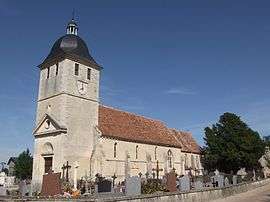 The church in Morteaux | ||
| ||
 Morteaux-Coulibœuf Location within Normandy region  Morteaux-Coulibœuf | ||
| Coordinates: 48°55′30″N 0°04′27″W / 48.925°N 0.0742°WCoordinates: 48°55′30″N 0°04′27″W / 48.925°N 0.0742°W | ||
| Country | France | |
| Region | Normandy | |
| Department | Calvados | |
| Arrondissement | Caen | |
| Canton | Falaise | |
| Intercommunality | Pays de Falaise | |
| Government | ||
| • Mayor (2008–2014) | Christian Bacheley | |
| Area1 | 11.76 km2 (4.54 sq mi) | |
| Population (2008)2 | 524 | |
| • Density | 45/km2 (120/sq mi) | |
| Time zone | UTC+1 (CET) | |
| • Summer (DST) | UTC+2 (CEST) | |
| INSEE/Postal code | 14452 /14620 | |
| Elevation |
41–106 m (135–348 ft) (avg. 64 m or 210 ft) | |
|
1 French Land Register data, which excludes lakes, ponds, glaciers > 1 km2 (0.386 sq mi or 247 acres) and river estuaries. 2 Population without double counting: residents of multiple communes (e.g., students and military personnel) only counted once. | ||

Morteaux-Coulibœuf is a commune in the Calvados department in the Normandy region in northwestern France.
Population
| Historical population | ||
|---|---|---|
| Year | Pop. | ±% |
| 1962 | 590 | — |
| 1968 | 620 | +5.1% |
| 1975 | 542 | −12.6% |
| 1982 | 505 | −6.8% |
| 1990 | 517 | +2.4% |
| 1999 | 514 | −0.6% |
| 2008 | 524 | +1.9% |
See also
References
| Wikimedia Commons has media related to Morteaux-Coulibœuf. |
This article is issued from
Wikipedia.
The text is licensed under Creative Commons - Attribution - Sharealike.
Additional terms may apply for the media files.