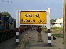
Budaun
| Budaun City Of Saints | |
|---|---|
| City | |
 Budaun Location in Uttar Pradesh, India | |
| Coordinates: 28°03′N 79°07′E / 28.05°N 79.12°ECoordinates: 28°03′N 79°07′E / 28.05°N 79.12°E | |
| Country |
|
| State | Uttar Pradesh |
| Region | Rohilkhand |
| Division | Bareilly |
| District | Budaun |
| Settled | 905AD (Modern City), 220BC (Ancient City) |
| Government | |
| • Body | Budaun Municipal Corporation |
| • Mayor | Deepmala Goyal |
| • MP | Dharmendra Yadav |
| • MLA | Mahesh Chandra Gupta |
| Area | |
| • City | 81 km2 (31 sq mi) |
| Elevation | 164 m (538 ft) |
| Population (2011) | |
| • City | 369,221 |
| • Rank | 17 |
| • Density | 5,489/km2 (14,220/sq mi) |
| • Metro | 457,665 (Budaun Metro Area) |
| Demonym(s) | Badayuni |
| Languages | |
| • Official | Hindi, Urdu |
| Time zone | UTC+5:30 (IST) |
| PIN | 243601 |
| Telephone code | 05832 |
| ISO 3166 code | IN-UP-BD |
| Vehicle registration | UP-24 |
| Coastline | 0 kilometres (0 mi) |
| Sex ratio | 907 female/1000 male |
| Literacy | 82.0% |
| Civic agency | Budaun Development Authority |
| Governing body |
Government of UP Government of India |
| Climate | HS-TH (Köppen) |
| Precipitation | 843 millimetres (33.2 in) |
| Avg. annual temperature | 27.5 °C (81.5 °F) |
| Avg. summer temperature | 39.8 °C (103.6 °F) |
| Avg. winter temperature | 11.5 °C (52.7 °F) |
| Website | http://www.badaun.nic.in/ |
| Also known as 'City of Saints' or 'Madinat ul Awliya', famous for its Pedas, 'Mentha City' of India. | |
Budaun (also spelled as Badaun, formerly Vodamayuta) is a city and a seat of Budaun district,[1] Uttar Pradesh, India. It is located near the Ganges river.[2] in the center of Western Uttar Pradesh. It was the most important post of Northern Frontier during Mughal reign. Budaun is a big market, historically famous and religiously important city. It is the heart of Rohilkhand.[3][4] Budaun is 229 km from New Delhi and it takes 4 hours 47 mins to 7 hours to reach the city depending on mode of transport i.e. car or roadways bus service.[5] Whilst not a main tourist destination, it still attracts thousands of people annually. Every year it is estimated that 1.5 lac to 2 lac people visit the city, most people come there for Ziyarat. Budaun is famous among the Barelwi sectors of Muslims due to the presence of hundreds of martyrs (Shahid) and saints buried there. Budaun was the capital of Delhi Sultanate for four years from 1210 CE to 1214 CE during Sultan Iltutmish rule.
Etymology
Prof. Goti John referred this city was named Bedamooth in an ancient inscription based on stone scripts at the Lucknow Museum. Later this region was called Panchal. According to the lines on stone scripts there was a village Bhadaunlak near the city. The Muslim historian Roz Khan Lodhi said that at Ashoka The Great (?) built a Buddh Vihar and Quila; he named it BuddhMau (Budaun Fort). According to George Smith, Budaun was named after the Ahir prince Budh.[6][7]
History
According to tradition, Budaun was founded about 905 AD, and an inscription, probably of the 12th century, gives a list of twelve Rathor kings reigning at Budaun then called Vodamāyuta.[8] Kanauj was conquered after AD 1085 by Mahmūd, the son of the Ghaznavid Sultān, driving out the Rāshtrakūta chief. This the Rāshtrakūta chief then move their capital to Vodamāyuta, where they ruled until conquered by Qutb-ud-din Aibak.[9]
The first authentic historical event connected with it, however, was its capture by Qutb-ud-din Aibak in 1196, after which it became a very important post on the northern frontier of the Delhi empire. In 1223, a very handsome mosque of imposing size, crowned with a dome, was built. In the 13th century two of its governors, Shams-ud-din Iltutmish, the builder of the mosque referred above, and his son Rukn ud din Firuz, attained the imperial throne. In 1571 the town was burnt, and about a hundred years later, under Shah Jahan, the seat of the governorship was transferred to Sahaspur-Bilari. Budaun and its district was ceded to the British government in 1801 by the Nawab of Oudh.[8]
In 1911, Budaun was a town and district of British India, in the Rohilkhand division of the United Provinces. At the time, an American Methodist mission maintained several girls schools, and there was a high school for boys.[8]
Geography
The town is near the left bank of the river Sot.[8] Budaun has an average elevation of 169 metres (554 feet). It has normal rainfall levels. Since Budaun was settled after demolishing a large fort, the city is irregularly elevated, with Sotha and Punjabi Mohalla at the top. The Civil Lines area is much plainer.
Like most of Northern India, Badaun has four seasons; winter, summer, spring, and autumn. It is above the Tropic of Cancer and is therefore not a tropical region. In the summer, the temperature is on average about 33.7 C°. However, in the winter, the temperature is on average 15.0 C°. There is widespread greenery. The climatic conditions are suitable for agriculture; the crops production from this area is larger.
Politics
Dharmendra Yadav is the MP of the Budaun Constituency and is the nephew of Mulayam Singh Yadav. Budaun has large population of Ahirs which according to British historian Matthew Atmore Sherring came from Hansi and Hisar which is in Haryana.[10][11] Budaun city comes under mainly Budaun lok sabha seat and partly in Aonla lok sabha seat. MLA of Budaun City is Mahesh Chandra Gupta.
Demographics
As of 2011 census, Budaun City had a population of 369,221 (188,475 male 180,746 female = 1000/907), 39,613 (12.3%) of whom were aged 0–6. The adult literacy rate was 92.0. The widely spoken language in the city is Hindi and Urdu with English being used very rarely, and Punjabi is also a significant language in the city.The sex ratio of Budaun city is 907 per 1000 males. Child sex ratio of girls is 882 per 1000 boys. The area of the city is 81 square km. Budaun Metro Area have a population of around 417000 and an area of 103 km2 (40 sq mi) With Badaun City, it includes Shekhupur, Bahedi, Islamganj, Chandanpur, Salarpur, Salarpur Industrial Estate, Shekhupur Firing Range, Padauna and Khera Buzurg.%.[12][13]
In 1901, the city population was 39,031.
Transportation
Roadways
Budaun city acts as a junction for many national roads, which make the city one of the most important of the western UP. SH-33 (Bharatpur-Mathura-Bareilly) and SH-43 (Moradabad-Farrukhabad) pass through Budaun, It is also the terminal point of SH-18 (to Meerut via Bulandshahr) and SH-51 (to Delhi via Bulandshahr). Budaun Depot, with 118 buses is one of the most profitable depots of UPSRTC. Two new highways would be soon connected to Budaun city, first will connect Budaun to Etawah through Qadar Chowk, Etah and Mainpuri and the second one would connect Budaun to Shahjahanpur through Dataganj. After construction of these two roads in coming 2 years, Budaun will be an important road junction of the Western UP.
Buses are available 24x7 from Badaun to Delhi, Badaun to Agra, Badaun to Bareilly, and vice versa.
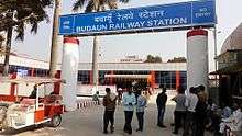
Railways
Budaun's railway station code is BEM. Budaun lies on the Mathura-Lalkuan railway which has been converted into broad gauge and was inaugurated by rail minister Suresh Prabhu on 11 August 2015. First train to run was Ramnagar Agra Fort Express. Another rail line is proposed connecting Gajraula to Mainpuri through Budaun, which would make Budaun a junction.
Intercity
Auto Rickshaws and E Rickshaws serve the city for all the day. However, you may find autos on specified points run to a limited distance (10–20 kilometres (6.2–12.4 mi) generally). Budaun is one of the less polluted cities of UP because of a lot use of AutoGas (LPG). In fact Budaun is one of the rare cities having AutoGas on petrol pumps. Many the vehicles of the city are LPG workable.
Distances
- Farrukhabad - 107 km
- Bareilly - 49 km
- Aligarh - 116.8 km
- Delhi - 216 km
- Agra - 174 km
Important Towns and other Posts
Historical and religious places
- Gurukul Sanskrit Mahavidyalaya, Suryakund, Budaun[15]
- Nagla Mandir (A Kali Devi temple in Nagla Sharki)[16]
- Jama Masjid Shamsi built by Iltutmish in 1223. This mosque is the second largest and third oldest mosque in the country.
- An immense Badaun fort (Nawab Ikhlas khan ka Makbaraa) in Jawaharpuri. It is known as Roza
- Nizamuddin Auliya's house in Syedwada where he was born.
- Remains of Sheikhupur Fort, Sheikhupur, Badaun
- Mumtaz Mahal's sister's mausoleum, Sheikhupur, Badaun
- Emperor Jahangir's foster son's mausoleum Sheikhupur, Badaun
- Shrine of Hazrat Sultanulaarfeen Khwaja Syyed Hasan Sheikh Shahi Rehmatullah Bade Sarkar
- Shrine of Hazrat Sayyed Abu Bakr Moetaab Badruddin Shah Wilayat Rehmatullah Chote Sarkar
Jama Masjid Shamsi
Jama Masjid Shamsi Mosque is in the old city area built by Iltutmish in 1223 at the time when he was the ruler of India.
This mosque reflects the Persian and Afghani Architecture, it has three Gates, Main gate is on Shakeel Road made up of Red Marble and its as high as 100 feet. Another gate is in Maulvi Tola and third one in Sotha. It has a Central Dome surrounded by two more domes, and 5 other domes too, Floor is of "SangeMarMar" or White Marble. It has a "Hauz" and three "WuzuKhana" in its premises. Two sides of mosque are occupied by residential blocks called as "Jama Masjid Quarters".
This mosque is the third oldest existing and second largest mosque of the country after Delhi's Jama Masjid, having a standard capacity of 23500. The built up part of the mosque is larger than any other mosque of the country. Before the expansion of Delhi's Jama Masjid, it was the largest and most famous mosque of the country. The Central dome of the mosque is considered to be the largest for any dome of mosque in the country.
It is also a Monument of National Importance and National Heritage Site.
Educational institutes
- Singlar Mission Girls Inter College
- Arya Kanya Inter College
- Blooming dale school
- Budaun Public School
- Christian Higher Secondary School
- De Paul School
- Draupadi Devi Swaraswati Vidya Mandir Inter-College (DDSVM)
- Florence Nightingale Higher Secondary School
- Gindo Devi Mahila Maha Vidyalaya
- Government Degree College, Avas Vikas Budaun
- Government Inter College (GIC)
- Green Wood Public School
- Government medical college
- Hafiz Siddique Islamia Inter College, Budaun
- H. P. International School, Dataganj Road, Budaun
- Holy Convent Higher Secondary School, Budaun
- Islamiah Inter College.
- Jawahar Navodaya Vidyalaya Budaun
- Kasturba Gandhi Vidyalaya
- Kavyam Teresa English School
- Kedarnath mahila College for girls
- Kendriya Vidyalaya Budaun
- Kunwar Rukum Singh Vedic Inter College
- LCRS Navyuvak Inter College Budaun
- Manglam Institute Budaun
- Global Institute of IT. & Management
- Madarsa Faiz-ul-Uloom Moh. Uperpara Budaun
- Madarsa Qadriya
- Maharishi Vidya Mandir
- Mission English School
- Mother Athena School
- Mother Teresa English School, Madhuvan Colony Budaun
- N.M.S.N.Das P.G.College
- Naqvia Girls School (Self Finance)
- Rajaram Mahila Inter College
- S.K. Inter College
- S.S.S.M.Public School Near Nagla Mandir
- Shashi Mishra Memorial Educational Institute, 32 civil lines
- Vidhyavati vedic Kanya Uchatar Madhyamik Vidyalaya
- Vivekanand College
Agriculture
Major agricultural products are wheat, rice, paddy, sugarcane, guava and menthol. Budaun is the largest producer of wheat in UP, II largest of sugarcane and potatoes. It is the leading producer of menthol in the country. The soil is very fertile due to tarai, because Budaun is on the bank of the Ganges; the Ganges flows 110 km in the district. Guava and menthol are the major exporting products. Budaun gives 40% of total menthol export of India.
Industries
Budaun City has many small scale industries and a few
- Sugar mill at Shekupur
- Rice Mills
- Many Brick Kilns
- Beedi factories at Naushera
- Menthol Producing Plants On outer SH-4
- Many automobiles parts are manufactured in Budaun.
Notable people
- Abd al-Qadir Bada'uni
- Abdul Hamid Qadri Badayuni
- Ada Jafri
- Ale Ahmad Suroor
- Alhaj Shamim Uddin
- Begum Abida Ahmed
- Bekhud Badayuni
- Dilawar Figar
- Fani Badayuni
- Feroz (actor)
- Ghulam Mustafa Khan
- Iltutmish
- Inayat Hussain Khan
- Iqbal Hussain Khan Bandanawazi
- Ismat Chughtai
- Jeelani Bano
- Moulvi Fakhrey Alam
- Nakhshabi
- Nissar Hussain Khan
- Nizamuddin Auliya - Sufi saint
- Rashid Khan
- Razia Sultana
- Rukn ud din Firuz
- Shabnam Romani
- Shakeel Badayuni
- Zamir Ali Badayuni
See also
References
- ↑ "Budaun District : Census 2011 data". Indian Census 2011. Retrieved 17 January 2014.
- ↑ http://badaun.nic.in/
- ↑ http://indiatoday.intoday.in/story/yadavs-growing-clout-resents-by-both-upper-castes-and-other-backward-castes/1/294220.html
- ↑ http://articles.timesofindia.indiatimes.com/2009-05-09/lucknow/28153545_1_sachchar-committee-salim-sherwani-mulayam-singh-yadav
- ↑ http://www.mapsofindia.com/distance/new-delhi-to-badaun.html
- ↑ George Smith (1882). The student's geography of India: the geography of British India : political and physical. John Murray. pp. 223–. Retrieved 17 February 2012.
- ↑ http://www.jagran.com/uttar-pradesh/badaun-shortage-of-milk-in-kilk-prodective-area-10672897.html
- 1 2 3 4

- ↑ Majumdar, Ramesh Chandra (1977). Ancient India. Motilal Banarsidass Publ. p. 315. ISBN 9788120804364. Retrieved May 23, 2017.
- ↑ https://books.google.co.in/books?id=8V4IAAAAQAAJ&pg=PA237&dq=Jats+Gujars+and+Ahirs&hl=en&sa=X&ei=H0m3VPf_JI2zuASO84LgBw&ved=0CCQQ6AEwAjhk#v=onepage&q=Ahirs&f=false
- ↑ Hindu Tribes and Castes, Volume 1 page 334
- ↑ "Urban Agglomerations/Cities having population 1 lakh and above" (PDF). Provisional Population Totals, Census of India 2011. Retrieved 2012-07-07.
- ↑ http://pib.nic.in/release/release.asp?relid=28770
- ↑ "Budaun City Population Census 2011". Census 2011 India. Office of the Registrar General and Census Commissioner, India. Retrieved 2015-11-29.
- ↑ "बदायूं के गुरुकुल को चाहिए पुनर्जीवन- Amarujala". Amar Ujala.
- ↑ News), Raftaar News(Latest Hindi (24 March 2017). "सात-सौ-साल-पुराना-है-नगला-शक्ति-पीठ-का-इतिहास". news.raftaar.in.
| Wikimedia Commons has media related to Budaun. |
Places adjacent to Budaun | ||||||||||
|---|---|---|---|---|---|---|---|---|---|---|
| ||||||||||