Gulbarga district
| Kalaburagi district | |
|---|---|
| district | |
| Kalaburagi district | |
 | |
 Location in Karnataka | |
| Coordinates: 17°20′N 76°50′E / 17.33°N 76.83°ECoordinates: 17°20′N 76°50′E / 17.33°N 76.83°E | |
| Country |
|
| State | Karnataka |
| Region | Hyderabad-Karnataka |
| Division | Gulbarga Division |
| Headquarters | Gulbarga |
| Government | |
| • Deputy Commissioner | Venkatesh Kumar, IAS |
| Area† | |
| • Total | 10,951 km2 (4,228 sq mi) |
| Elevation | 454 m (1,490 ft) |
| Population (2011)† | |
| • Total | 2,564,892 |
| • Density | 230/km2 (610/sq mi) |
| Language | |
| • Official | Kannada, |
| Time zone | UTC+5:30 (IST) |
| PIN | 585101 |
| Telephone code | 91 8472 |
| Vehicle registration | KA-32 |
| No. of taluks | 11 |
| Lok Sabha constituency | Gulbarga (Lok Sabha constituency) |
| Precipitation | 777 millimetres (30.6 in) |
| Avg. summer temperature | 42 °C (108 °F) |
| Avg. winter temperature | 26 °C (79 °F) |
| Website |
kalaburagi |
| '†website | |
Gulbarga district, officially known as Kalaburagi district,[1] is one of the 30 districts of Karnataka state in southern India. Gulbarga city is the administrative headquarters of the district.[2]
This district is situated in northern Karnataka between 76°.04' and 77°.42 east longitude, and 17°.12' and 17°.46' north latitude, covering an area of 10,951 km². This district is bounded on the west by Bijapur district and Solapur district of Maharashtra state, on the north by Bidar district, Osmanabad district and Latur districtof Maharashtra state, on the south by Yadgir district, and on the east by Ranga Reddy district and Medak district of Telangana state.
Economy
In 2006 the Ministry of Panchayati Raj named Gulbarga one of the country's 250 most backward districts (out of a total of 640).[3] It is one of the five districts in Karnataka currently receiving funds from the Backward Regions Grant Fund Programme (BRGF).[3]
Places of interest
Historical places
- Sannati, a small village, located on the banks of the Bhima River in Chitapur taluk is known for its Ashokan edicts, Buddhist stupa and sole surviving image of Emperor Ashoka (r. 274–232 BC) himself.[4]
- Manyakheta, a village located on the banks of the Kagina river in Sedam taluk was the Capital city of the Rashtrakuta dynasty. This village is 40 km southeast to the District Headquarters Gulbarga and 18 km west to the Taluk Headquarters Sedam.
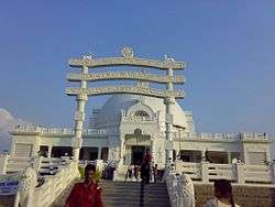
- Gulbarga Fort built in 1347 Gulbarga's old moated fort is in a much deteriorated state, but it has a number of interesting buildings inside, including the Jama Masjid, reputed to have been built by a Moorish architect during the late 14th or early 15th century who imitated the great mosque in Cordoba, Spain.[5] The mosque is unique in India, with a huge dome covering the whole area, four smaller ones at the corners, and 75 smaller still all the way around. The fort itself has 15 towers. Gulbarga also has a number of imposing tombs(Haft Gumbaz) of Bahmani kings.
Geography
Gulbarga is situated in Deccan Plateau located at 17°20′N 76°50′E / 17.33°N 76.83°E[6] and the general elevation ranges from 300 to 750 meters above mean sea level. Two main rivers, Krishna and Bhima, flow in the district. Black soil is predominant soil type in the district. The district has a large number of tanks which, in addition to the rivers, irrigate the land. The Upper Krishna Project is major irrigation venture in the district. Bajra, toor, sugarcane, groundnut, sunflower, sesame, castor bean, black gram, jowar, wheat, cotton, ragi, Bengal gram, and linseed are grown in this district.[7]
Divisions
Gulbarga district presently comprises the following 11 talukas after the separation of Yadgir district from it.[8]
Demographics
According to the 2011 census Gulbarga district has a population of 2,564,892,[10] roughly equal to the nation of Kuwait[11] or the US state of Nevada.[12] This gives it a ranking of 162nd in India (out of a total of 640).[10] The district has a population density of 233 inhabitants per square kilometre (600/sq mi).[10] Its population growth rate over the decade 2001-2011 was 17.94%.[10] Gulbarga has a sex ratio of 962 females for every 1000 males,[10] and a literacy rate of 65.65%.[10]
See also
Notes
- ↑ "Gulbarga city name changed". indiatoday.intoday.in. Retrieved 2 May 2016.
- ↑ "City of tombs and domes". The Hindu. Karnataka, India. April 4, 2011.
- 1 2 Ministry of Panchayati Raj (September 8, 2009). "A Note on the Backward Regions Grant Fund Programme" (PDF). National Institute of Rural Development. Archived from the original (PDF) on April 5, 2012. Retrieved September 27, 2011.
- ↑ "When I met Emperor Ashoka in Sannathi". Yahoo.
- ↑ "Archived copy". Archived from the original on 2010-11-20. Retrieved 2010-06-17.
- ↑ Falling Rain Genomics, Inc - Gulbarga
- ↑
- ↑ http://www.deccanherald.com/content/21801/yadgir-district-oct-31.html
- ↑ http://www.census2011.co.in/data/religion/district/256-gulbarga.html
- 1 2 3 4 5 6 "District Census 2011". Registrar General & Census Commissioner, India. 2011. Archived from the original on 23 December 2011.
- ↑ US Directorate of Intelligence. "Country Comparison:Population". Retrieved 2011-10-01.
Kuwait 2,595,62
- ↑ "2010 Resident Population Data". U. S. Census Bureau. Retrieved 2011-09-30.
Nevada 2,700,551
References
1. Gulnar K. Bosch, Islamic Art and Architecture, The New Book of Knowledge, Vol. 9P 354
2. Elisabeth Siddiqui, Islamic Art, Colorado State University.
3. Dept. of Islamic Art, The nature of Islamic art, "Intleilbrunn Timeline of Art History", The Metropolitan Museum of Art, New York, 2000.
4. Linda Komaroff Ph.D., Curator of Islamic Art, Los Angeles County Museum of Art.
5. Gulam Yazdani, Bidar its History and Monuments, published by His Exalted Highness Nizam’s Government, 1947 and reprint First Indian Edition by Motilal Banarsidass Publishers, Delhi in 1995.
6. Dr. Rehaman Patel, Bidri Art of Karnataka-A Study, Ph.D. Thesis submitted to Gulbarga University in 2009. published by Dept. of Kannada and Culture, Bangalore 2012
7. Dr. Rehaman Patel, Islamic Art of North Karnataka, Young Muslim Digest, May 2015
8. World's longest cannon lays unnoticed in Gulbarga fort, The New Indian Express, 3,12,2016
External links
| Wikivoyage has a travel guide for Gulbarga (district). |
| Wikimedia Commons has media related to Gulbarga district. |
- Gulbargians most interactive website
- Official Website of Gulbarga district
- Official Website of Gulbarga City Corporation
- Map of Gulbarga district