Mahendragarh
| Mahendragarh | |
|---|---|
| City | |
 Mahendragarh Location in Haryana, India  Mahendragarh Mahendragarh (India) | |
| Coordinates: 28°17′N 76°09′E / 28.28°N 76.15°ECoordinates: 28°17′N 76°09′E / 28.28°N 76.15°E | |
| Country |
|
| State | Haryana |
| District | Mahendragarh |
| Elevation | 262 m (860 ft) |
| Population (2011) | |
| • Total | 80,000 |
| Languages | |
| • Official | Hindi |
| • Spoken | Ahirwati |
| Time zone | UTC+5:30 (IST) |
| PIN | 123029 |
| ISO 3166 code | IN-HR |
| Vehicle registration | HR 34 and HR 66 |
| Website |
www |
Mahendragarh is a city and a municipal committee in Mahendragarh district in the north Indian state of Haryana.[1] It takes only 2 hours to reach Mahendragarh and is 100.0 km away from Gurgaon and comes under National Capital Region (India).[2]
Etymology
Earlier named kanod, in early 1860s it was renamed after Maharaja Mahendra Singh (r. 1721-1748 CE) of Patiala State who was gifted this area by the British East India Company rule for his help in crushing the Indian Rebellion of 1857.[3]
Geography
Mahendragarh is located at 28°17′N 76°09′E / 28.28°N 76.15°E.[4] It has an average elevation of 262 metres (859 feet). Mahendragarh district is bounded on the north by Bhiwani and Rohtak districts, on the east by Rewari district and Alwar district of Rajasthan, on the south by Alwar, Jaipur and Sikar districts of Rajasthan, and on the west by Sikar and Jhunjhunu districts of Rajasthan. It has four tehsils of Narnaul, Kanina,Nangal choudhary And Mahendergarh.
It is situated at the bank of Dohan River (which was a seasonal river), which is at the verge of extinction.
History
Jat rule
This area which was earlier under the Jaipur state, came under the Sindhu Jat ruler Maharaja of Patiala.[3]
Nangal Sirohi havelis
Nangal Sirohi, 9 km from Narnaul and 16 km from Mahindragarh, is famous for its historic havelis built by baniyas who had migrated from Satnali 8 generations ago.[3] This area which was earlier under the Jaipur state, came under the Sindhu Jat ruler Maharaja of Patiala.[3] Lala Tek Chand was first among them to build the fortalice haveli.[3] Later in Vikram Samvat 1959 (1902 CE), Lala Deen Dayal built an ornately decorated Caravanserai in shekhavati rajput architecture.[3]
GULAWALA :-There is a very big and magnificent temple at the top of the hill of sri balaji god in gulawala village.
LOCATION :- Gulawala , 10 km from Narnaul and 15 km from Mahindragarh, is famous for its historic temples.
The village of gulawala is the last village of mahendergarh assembly.
Jai Shree Ram
Jai Balaji mharaj.🙏🙏🙏🙏
JAI GULABGARH ( GULAWALA )
Demographics
As of 2011 India census,[5] Mahendragarh had a population of 60,000. Males constitute 53% of the population and females 47%. Mahendragarh has an average literacy rate of 76, higher than the national average of 75%: male literacy is 89%, and female literacy is 67%. In Mahendragarh, 14% of the population is under 6 years of age. Hindus constitute 98% of the population.
In spite of being a district headquarters, there is no administrative office. All the relevant work is done in Narnaul. The very first guggul (Commiphora wightii) vatika (place where medicinal plants are planted) was established here.
Now many government offices have opened in Mahendragarh near Government Boys college in new Court.
Notable personalities
- Swami Ramdev - Yoga guru
- Rao Tula Ram - Freedom fighter
- Gujarmal Modi - Founder Modi Industries and Modi Nagar
References
- ↑ "Gurgaon per capita income 10 times that of Mahendragarh". Indian Express. 2013-01-19. Retrieved 2014-07-06.
- ↑ "Mahendragarh, Bhiwani included in NCR". Hindustan Times. Retrieved 2014-07-06.
- 1 2 3 4 5 6 Magnificent havelis of Nangal-Sirohi, The Tribune, 22 June 2002.
- ↑ Falling Rain Genomics, Inc - Mahendragarh
- ↑ "Census of India 2001: Data from the 2001 Census, including cities, villages and towns (Provisional)". Census Commission of India. Archived from the original on 2004-06-16. Retrieved 2008-11-01.
Mahendragarh district topics | ||
|---|---|---|
| History | 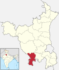 | |
| Cities and towns | ||
| Education | ||
| Lok Sabha constituencies | ||
Villages of Mahendragarh District | ||
|---|---|---|
| Villages in Satnali Block Mahendragarh |
| |
| Villages in Nizampur Block Mahendragarh |
| |
| Villages in Sihma Block Mahendragarh |
| |
| Villages in Mahendragarh Block Mahendragarh |
| |
| Villages in Kanina Block Mahendragarh |
| |
| Villages in Ateli Nangal Block Mahendragarh |
| |
| Villages in Nangal Chaudhry Block Mahendragarh |
Ishmilpur | |
| Villages in Narnaul Block Mahendragarh |
| |