Hapur district
| Hapur district | |
|---|---|
| District of Uttar Pradesh | |
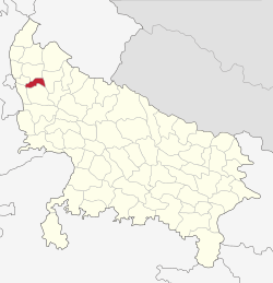 Location of Hapur district in Uttar Pradesh | |
| Country | India |
| State | Uttar Pradesh |
| Administrative division | Meerut |
| Headquarters | Hapur |
| Tehsils | Hapur, Garhmukteshwar, Dhaulana |
| Area | |
| • Total | 660 km2 (250 sq mi) |
| Population (2011) | |
| • Total | 1,338,211 |
| • Density | 2,000/km2 (5,300/sq mi) |
| Website | Official website |
Hapur district is a district of Uttar Pradesh state of India. This district on the Ganges river is 60 kilometres (37 mi) from New Delhi.[1]
History
The new district Panchsheel Nagar, was created from the tehsils of Hapur, Garhmukteshwar and Dhaulana previously of Ghaziabad district as one of three new districts of Uttar Pradesh on 28 September 2011. U.P. Chief Minister Mayawati justified the decision by declaring that Ghaziabad district was "far too big for administrative efficiency", and that creating smaller districts conformed to the ideas proposed by social reformers B. R. Ambedkar and Jyotirao Phule.[2]
The district was renamed from Panchsheel Nagar to Hapur district on 23 July 2012.[3] Hapur district is a part of Meerut division.
Government
It falls within the National Capital Region (India).[4][5]
Administrative divisions
Hapur district contains three Tehsils: Hapur, Garhmukteshwar and Dhaulana.[5]
Demographics
The district population as the 2011 census was 1.3 million, which was split into 30% urban, 70% rural.[5]
Economy
Major industries in the district are papadum, paper, textiles and steel tube production.[5]
References
- ↑ "Welcome to Official Website, Hapur U.P." hapur.nic.in.
- ↑ "UP gets three new districts: Prabuddhanagar, Panchsheel Nagar, Bhimnagar". The Indian Express. 29 September 2011. Retrieved 15 May 2014.
- ↑ "Important Cabinet Decisions". Lucknow: Information and Public Relations Department. Archived from the original on 24 October 2014. Retrieved 17 January 2013.
- ↑ "Constituent Area of NCR". Town Planning Department. Government of Rajasthan.
- 1 2 3 4 "District Industrial Profile of Hapur District (U.P.) 2015-16" (PDF). Development Commissioner (MSME), Ministry of Micro, Small & Medium Enterprises. Government of India. 8 July 2016.