Henry County, Illinois
| Henry County, Illinois | |
|---|---|
.jpg) | |
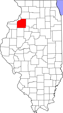 Location in the U.S. state of Illinois | |
 Illinois's location in the U.S. | |
| Founded | January 13, 1825 |
| Named for | Patrick Henry |
| Seat | Cambridge |
| Largest city | Kewanee |
| Area | |
| • Total | 826 sq mi (2,139 km2) |
| • Land | 823 sq mi (2,132 km2) |
| • Water | 2.7 sq mi (7 km2), 0.3% |
| Population | |
| • (2010) | 50,486 |
| • Density | 61/sq mi (24/km2) |
| Congressional district | 17th |
| Time zone | Central: UTC−6/−5 |
| Website |
www |
Henry County is a county located in the U.S. state of Illinois. According to the 2010 census, it has a population of 50,486.[1] Its county seat is Cambridge.[2]
Henry County is included in the Davenport-Moline-Rock Island, IA-IL Metropolitan Statistical Area.[3]
History
Henry County was formed on January 13, 1825 out of Fulton County, Illinois. It is named in honor of Patrick Henry,[4] Revolutionary War firebrand and champion of individual rights, to whom the slogan "give me liberty, or give me death" is attributed. The county was originally settled by "Yankees" (immigrants from New England and the western part of New York descended from the English Puritans whose ancestors settled New England in the colonial era). The New England settlers founded the five towns of Andover, Wethersfield, Geneseo, Morristown and La Grange.[5] Before 1843, the land where Cambridge is currently located was the private property of a man named Rev. Ithamar Pillsbury, who was very well known amongst the Yankee settlers who were moving to Henry County in large numbers at that time. Reverend Pillsbury deeded a large portion of his land to the town council and they immediately agreed it was a good place to lay out a town. Lots were sold to incoming migrants and on June 9 of 1843 (after some quarreling among the town founders about how to finance it) construction began on the town. Roads were laid out, post routes established, public buildings erected and people were invited to move there. The original settlers were entirely of New England origins or were Yankees from upstate New York whose families had moved to that place from New England only one generation earlier, in the aftermath of the Revolutionary War. This resulted in Henry County being culturally very contiguous with early New England culture.[6][7]
 Henry County from the time of its creation to 1827
 The county between 1827 and 1831
 Henry between 1831 and 1836
 Henry in 1836, when the creation of Whiteside County reduced it to its current size
Geography
According to the U.S. Census Bureau, the county has a total area of 826 square miles (2,140 km2), of which 823 square miles (2,130 km2) is land and 2.7 square miles (7.0 km2) (0.3%) is water.[8] It is the 29th largest of Illinois' 102 counties. The area is fairly flat, with elevations ranging from 650 feet above sea level in the northwest to 850 in the southeast. The land is mostly used for agriculture, about 456,596 acres (1,847.78 km2) or 86.7% of the county's land area. .
Climate and weather
| Cambridge, Illinois | ||||||||||||||||||||||||||||||||||||||||||||||||||||||||||||
|---|---|---|---|---|---|---|---|---|---|---|---|---|---|---|---|---|---|---|---|---|---|---|---|---|---|---|---|---|---|---|---|---|---|---|---|---|---|---|---|---|---|---|---|---|---|---|---|---|---|---|---|---|---|---|---|---|---|---|---|---|
| Climate chart (explanation) | ||||||||||||||||||||||||||||||||||||||||||||||||||||||||||||
| ||||||||||||||||||||||||||||||||||||||||||||||||||||||||||||
| ||||||||||||||||||||||||||||||||||||||||||||||||||||||||||||
In recent years, average temperatures in the county seat of Cambridge have ranged from a low of 13 °F (−11 °C) in January to a high of 86 °F (30 °C) in July, although a record low of −24 °F (−31 °C) was recorded in February 1996 and a record high of 103 °F (39 °C) was recorded in July 1983. Average monthly precipitation ranged from 1.52 inches (39 mm) in January to 4.32 inches (110 mm) in August.[9]
Major highways
Adjacent counties
- Whiteside County - northeast
- Bureau County - east
- Stark County - southeast
- Knox County - south
- Mercer County - west
- Rock Island County - northwest
Demographics
| Historical population | |||
|---|---|---|---|
| Census | Pop. | %± | |
| 1830 | 41 | — | |
| 1840 | 1,260 | 2,973.2% | |
| 1850 | 3,807 | 202.1% | |
| 1860 | 20,660 | 442.7% | |
| 1870 | 35,506 | 71.9% | |
| 1880 | 36,597 | 3.1% | |
| 1890 | 33,338 | −8.9% | |
| 1900 | 40,049 | 20.1% | |
| 1910 | 41,736 | 4.2% | |
| 1920 | 45,162 | 8.2% | |
| 1930 | 43,851 | −2.9% | |
| 1940 | 43,798 | −0.1% | |
| 1950 | 46,492 | 6.2% | |
| 1960 | 49,317 | 6.1% | |
| 1970 | 53,217 | 7.9% | |
| 1980 | 57,968 | 8.9% | |
| 1990 | 51,159 | −11.7% | |
| 2000 | 51,020 | −0.3% | |
| 2010 | 50,486 | −1.0% | |
| Est. 2016 | 49,280 | [10] | −2.4% |
| U.S. Decennial Census[11] 1790-1960[12] 1900-1990[13] 1990-2000[14] 2010-2013[1] | |||
As of the 2010 United States Census, there were 50,486 people, 20,373 households, and 14,149 families residing in the county.[15] The population density was 61.3 inhabitants per square mile (23.7/km2). There were 22,161 housing units at an average density of 26.9 per square mile (10.4/km2).[8] The racial makeup of the county was 94.8% white, 1.6% black or African American, 0.4% Asian, 0.2% American Indian, 1.6% from other races, and 1.4% from two or more races. Those of Hispanic or Latino origin made up 4.8% of the population.[15] In terms of ancestry, 30.0% were German, 14.6% were Irish, 12.3% were Swedish, 11.5% were English, and 7.2% were American.[16]
Of the 20,373 households, 31.1% had children under the age of 18 living with them, 55.9% were married couples living together, 9.5% had a female householder with no husband present, 30.6% were non-families, and 26.1% of all households were made up of individuals. The average household size was 2.44 and the average family size was 2.92. The median age was 41.8 years.[15]
The median income for a household in the county was $49,164 and the median income for a family was $61,467. Males had a median income of $44,589 versus $30,992 for females. The per capita income for the county was $24,915. About 6.8% of families and 10.4% of the population were below the poverty line, including 16.9% of those under age 18 and 8.7% of those age 65 or over.[17]
Communities
Cities
Towns
Villages
Unincorporated communities
- Fairbank
- Green Rock
- Lynn Center
- Nekoma
- Opheim
- Osco
- Sunny Hill
- Sunny Hill Estates
- Ulah
- Warner
Townships
Henry County is divided into twenty-four townships:
Politics
| Year | Republican | Democratic | Third Parties |
|---|---|---|---|
| 2016 | 57.4% 13,985 | 36.4% 8,871 | 6.2% 1,509 |
| 2012 | 47.5% 11,583 | 50.5% 12,332 | 2.0% 490 |
| 2008 | 45.3% 11,263 | 53.0% 13,181 | 1.6% 405 |
| 2004 | 52.3% 13,212 | 47.1% 11,877 | 0.6% 152 |
| 2000 | 46.4% 10,896 | 50.8% 11,921 | 2.8% 653 |
| 1996 | 38.3% 8,393 | 51.2% 11,201 | 10.5% 2,303 |
| 1992 | 36.9% 8,989 | 45.5% 11,077 | 17.7% 4,305 |
| 1988 | 49.3% 11,358 | 50.3% 11,594 | 0.4% 96 |
| 1984 | 57.4% 14,504 | 42.3% 10,679 | 0.3% 79 |
| 1980 | 59.9% 14,506 | 33.0% 7,977 | 7.1% 1,723 |
| 1976 | 56.0% 12,849 | 42.8% 9,822 | 1.2% 263 |
| 1972 | 63.8% 14,796 | 36.1% 8,368 | 0.1% 21 |
| 1968 | 55.1% 12,524 | 37.2% 8,455 | 7.7% 1,752 |
| 1964 | 46.8% 10,644 | 53.2% 12,085 | |
| 1960 | 57.9% 14,297 | 42.0% 10,372 | 0.1% 21 |
| 1956 | 65.5% 15,896 | 34.4% 8,349 | 0.2% 39 |
| 1952 | 65.5% 16,301 | 34.4% 8,558 | 0.1% 33 |
| 1948 | 58.8% 12,363 | 40.4% 8,489 | 0.8% 159 |
| 1944 | 59.5% 13,539 | 40.1% 9,130 | 0.4% 92 |
| 1940 | 58.4% 14,971 | 40.9% 10,481 | 0.8% 196 |
| 1936 | 49.6% 11,953 | 47.7% 11,490 | 2.7% 651 |
| 1932 | 51.3% 11,376 | 45.6% 10,122 | 3.2% 701 |
| 1928 | 70.8% 14,666 | 28.3% 5,858 | 0.9% 183 |
| 1924 | 72.4% 13,159 | 10.7% 1,944 | 16.9% 3,076 |
| 1920 | 79.0% 12,379 | 16.1% 2,530 | 4.9% 768 |
| 1916 | 65.4% 11,406 | 29.9% 5,220 | 4.6% 808 |
| 1912 | 20.3% 1,859 | 24.2% 2,219 | 55.5% 5,085 |
| 1908 | 64.5% 6,387 | 25.3% 2,499 | 10.2% 1,011 |
| 1904 | 74.5% 7,331 | 14.1% 1,390 | 11.4% 1,117 |
| 1900 | 68.5% 6,892 | 27.9% 2,809 | 3.5% 354 |
| 1896 | 66.0% 6,177 | 31.8% 2,971 | 2.2% 207 |
| 1892 | 55.8% 4,265 | 35.0% 2,670 | 9.2% 705 |
Henry County’s political history is fairly typical of many Yankee-settled rural counties in Illinois. After being largely Democratic in its first few elections the county turned powerfully Republican for the 110 years following the formation of that party. The only time it did not vote Republican between 1856 and 1960 was in 1912 when the GOP was mortally divided and Progressive Theodore Roosevelt won a majority of the county’s ballots. In 1964, when the Republican Party nominated the Southern-oriented Barry Goldwater, Henry County voted Democratic for the first time since 1852, but as was typical for Yankee counties it returned to the Republicans with the selection of the more moderate Richard Nixon.
In the 1980s, the transition of the Republican Party into a party largely based around Southern Evangelicals severely alienated its historic Yankee base: Henry County turned to Democrat Michael Dukakis in 1988 and was to vote Democratic in every election between 1988 and 2012 except that of 2004 when George Bush junior carried the county by 5.1 percent. However, concern with unemployment in the “Rust Belt” resulted in a powerful swing to Republican Donald Trump in 2016 – the worst Democratic result in the county since Jimmy Carter in 1980.
See also
References
- 1 2 "State & County QuickFacts". United States Census Bureau. Archived from the original on July 11, 2011. Retrieved July 5, 2014.
- ↑ "Find a County". National Association of Counties. Archived from the original on 2011-05-31. Retrieved 2011-06-07.
- ↑ United States Office of Management and Budget. "Update of Statistical Area Definitions and Guidance on Their Uses" (PDF). pp. 5, 36. Archived from the original (PDF) on 2006-05-14. Retrieved 2006-07-21.
- ↑ Gannett, Henry (1905). The Origin of Certain Place Names in the United States. Govt. Print. Off. p. 155.
- ↑ The expansion of New England: the spread of New England settlement and institutions to the Mississippi River, 1620-1865 page 215-216
- ↑ History Henry County, Illinois H.F. Kett & Company, 1877 page 177-178
- ↑ The expansion of New England: the spread of New England settlement and institutions to the Mississippi River, 1620-1865 by Louis Kimball Matthews page 215-216
- 1 2 "Population, Housing Units, Area, and Density: 2010 - County". United States Census Bureau. Retrieved 2015-07-11.
- 1 2 "Monthly Averages for Cambridge, Illinois". The Weather Channel. Archived from the original on 2012-10-05. Retrieved 2011-01-27.
- ↑ "Population and Housing Unit Estimates". Archived from the original on May 29, 2017. Retrieved June 9, 2017.
- ↑ "U.S. Decennial Census". United States Census Bureau. Archived from the original on May 12, 2015. Retrieved July 5, 2014.
- ↑ "Historical Census Browser". University of Virginia Library. Archived from the original on August 16, 2012. Retrieved July 5, 2014.
- ↑ "Population of Counties by Decennial Census: 1900 to 1990". United States Census Bureau. Archived from the original on April 24, 2014. Retrieved July 5, 2014.
- ↑ "Census 2000 PHC-T-4. Ranking Tables for Counties: 1990 and 2000" (PDF). United States Census Bureau. Archived (PDF) from the original on December 18, 2014. Retrieved July 5, 2014.
- 1 2 3 "DP-1 Profile of General Population and Housing Characteristics: 2010 Demographic Profile Data". United States Census Bureau. Retrieved 2015-07-11.
- ↑ "DP02 SELECTED SOCIAL CHARACTERISTICS IN THE UNITED STATES – 2006-2010 American Community Survey 5-Year Estimates". United States Census Bureau. Retrieved 2015-07-11.
- ↑ "DP03 SELECTED ECONOMIC CHARACTERISTICS – 2006-2010 American Community Survey 5-Year Estimates". United States Census Bureau. Retrieved 2015-07-11.
- ↑ Leip, David. "Dave Leip's Atlas of U.S. Presidential Elections". uselectionatlas.org. Archived from the original on 23 March 2018. Retrieved 1 May 2018.
External links
- Official website
- U.S. Geological Survey Geographic Names Information System: Henry County, Illinois
- Henry County Tourism Bureau
- Illinois Ancestors Henry County
- Henry County Historical Society
Places adjacent to Henry County, Illinois | ||||||||||
|---|---|---|---|---|---|---|---|---|---|---|
| ||||||||||
Municipalities and communities of Henry County, Illinois, United States | ||
|---|---|---|
| Cities | ||
| Towns | ||
| Villages | ||
| Townships | ||
| Unincorporated communities | ||
| Footnotes | ‡This populated place also has portions in an adjacent county or counties | |

Coordinates: 41°21′11″N 90°07′53″W / 41.35306°N 90.13139°W