Illinois Route 81
| ||||
|---|---|---|---|---|
| Route information | ||||
| Maintained by IDOT | ||||
| Length | 25.78 mi[1] (41.49 km) | |||
| Existed | 1924[2] – present | |||
| Major junctions | ||||
| West end |
| |||
|
| ||||
| East end |
| |||
| Location | ||||
| Counties | Henry | |||
| Highway system | ||||
| ||||

Illinois Route 81 is an east–west state road in northwest Illinois. It runs from U.S. Route 150 by unincorporated Lynn Center to Illinois Route 78 (Main Street) in Kewanee. This is a distance of 25.78 miles (41.49 km).[1]
Route description
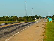
IL 81 approaching I-74 in Andover
In Kewanee, Illinois 81 is 6th Street. It is not that far away from U.S. Route 34, which is 2nd street. In addition to Kewanee, Illinois 81 also serves Andover and Cambridge.
History
SBI Route 81 was established as Lynn Center to Kewanee. The routing of Illinois 81 has not changed since it was established.
Major intersections
The entire route is in Henry County.
| Location | mi[3] | km | Destinations | Notes | |
|---|---|---|---|---|---|
| | 0.0 | 0.0 | |||
| | 2.2 | 3.5 | Exit 24 (I-74) | ||
| Cambridge | 10.6 | 17.1 | Begin/end concurrency with IL 82 | ||
| | 11.6 | 18.7 | Begin/end concurrency with IL 82 | ||
| Kewanee | 25.78 | 41.49 | |||
1.000 mi = 1.609 km; 1.000 km = 0.621 mi
| |||||
References
- 1 2 Illinois Technology Transfer Center (2006). "T2 GIS Data". Retrieved 2007-11-08.
- ↑ Carlson, Rich. Illinois Highways Page: Routes 81 thru 100. Last updated March 15, 2005. Retrieved April 13, 2006.
- ↑ Google (February 23, 2017). "Overview Map of IL 81" (Map). Google Maps. Google. Retrieved February 23, 2017.
This article is issued from
Wikipedia.
The text is licensed under Creative Commons - Attribution - Sharealike.
Additional terms may apply for the media files.