Hailles
| Hailles | |
|---|---|
| Commune | |
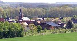 A general view of Hailles | |
 Hailles Location within Hauts-de-France region  Hailles | |
| Coordinates: 49°48′22″N 2°26′23″E / 49.8061°N 2.4397°ECoordinates: 49°48′22″N 2°26′23″E / 49.8061°N 2.4397°E | |
| Country | France |
| Region | Hauts-de-France |
| Department | Somme |
| Arrondissement | Montdidier |
| Canton | Moreuil |
| Intercommunality | CC Avre Luce Noye |
| Government | |
| • Mayor (2001–2008) | Jacques Van-Oostende |
| Area1 | 5.07 km2 (1.96 sq mi) |
| Population (2006)2 | 385 |
| • Density | 76/km2 (200/sq mi) |
| Time zone | UTC+1 (CET) |
| • Summer (DST) | UTC+2 (CEST) |
| INSEE/Postal code | 80405 /80440 |
| Elevation |
32–110 m (105–361 ft) (avg. 35 m or 115 ft) |
|
1 French Land Register data, which excludes lakes, ponds, glaciers > 1 km2 (0.386 sq mi or 247 acres) and river estuaries. 2 Population without double counting: residents of multiple communes (e.g., students and military personnel) only counted once. | |
Hailles is a commune in the Somme department in Hauts-de-France in northern France.
Geography
Hailles is situated on the banks of the river Avre and by the D90e road, some 10 miles (16 km) southeast of Amiens.
History
The name probably comes from ‘haie’ (eng: hedge), and has been variously written as Haies or Heilles. During the Franco-Prussian War of 1870, some francs-tireurs, hidden behind the town fired 60 times on a Prussian officer. All missed, he wasn’t even scratched. The German troops threatened to burn down the town.
Population
| Year | 1840 | 1874 | 1896 | 1962 | 1968 | 1975 | 1982 | 1990 | 1999 | 2006 |
|---|---|---|---|---|---|---|---|---|---|---|
| Population | 500 | 375 | 325 | 226 | 236 | 219 | 263 | 319 | 332 | 385 |
| From the year 1962 on: No double counting—residents of multiple communes (e.g. students and military personnel) are counted only once. | ||||||||||
See also
References
External links
| Wikimedia Commons has media related to Hailles. |
- Hailles on the Quid website (in French)
This article is issued from
Wikipedia.
The text is licensed under Creative Commons - Attribution - Sharealike.
Additional terms may apply for the media files.