Occoches
| Occoches | ||
|---|---|---|
| Commune | ||
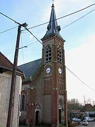 The church in Occoches | ||
| ||
 Occoches Location within Hauts-de-France region  Occoches | ||
| Coordinates: 50°10′30″N 2°16′18″E / 50.175°N 2.2717°ECoordinates: 50°10′30″N 2°16′18″E / 50.175°N 2.2717°E | ||
| Country | France | |
| Region | Hauts-de-France | |
| Department | Somme | |
| Arrondissement | Amiens | |
| Canton | Doullens | |
| Intercommunality | CC Territoire Nord Picardie | |
| Government | ||
| • Mayor (2001–2008) | Joël Patte | |
| Area1 | 7.09 km2 (2.74 sq mi) | |
| Population (2006)2 | 129 | |
| • Density | 18/km2 (47/sq mi) | |
| Time zone | UTC+1 (CET) | |
| • Summer (DST) | UTC+2 (CEST) | |
| INSEE/Postal code | 80602 /80600 | |
| Elevation |
45–136 m (148–446 ft) (avg. 70 m or 230 ft) | |
|
1 French Land Register data, which excludes lakes, ponds, glaciers > 1 km2 (0.386 sq mi or 247 acres) and river estuaries. 2 Population without double counting: residents of multiple communes (e.g., students and military personnel) only counted once. | ||

Occoches is a commune in the Somme department in Hauts-de-France in northern France.
Geography
Occoches is situated on the D938 road, some 20 miles (32 km) east-northeast of Abbeville, by the banks of the river Authie, on the border with the Pas-de-Calais département.
Population
| 1962 | 1968 | 1975 | 1982 | 1990 | 1999 | 2006 |
|---|---|---|---|---|---|---|
| 120 | 142 | 135 | 133 | 137 | 121 | 130 |
| Starting in 1962: Population without duplicates | ||||||
See also
References
External links
| Wikimedia Commons has media related to Occoches. |
- Occoches on the Quid website (in French)
- Occoches on the website of the Communauté de Communes du Doullennais (in French)
- Website of the Syndicat Mixte des Vals d'Authie, Nièvre et Somme (in French)
This article is issued from
Wikipedia.
The text is licensed under Creative Commons - Attribution - Sharealike.
Additional terms may apply for the media files.