Rollot
| Rollot | ||
|---|---|---|
| Commune | ||
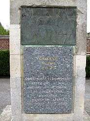
 Monument to Antoine Galland | ||
| ||
 Rollot Location within Hauts-de-France region  Rollot | ||
| Coordinates: 49°35′23″N 2°39′16″E / 49.5897°N 2.6544°ECoordinates: 49°35′23″N 2°39′16″E / 49.5897°N 2.6544°E | ||
| Country | France | |
| Region | Hauts-de-France | |
| Department | Somme | |
| Arrondissement | Montdidier | |
| Canton | Roye | |
| Intercommunality | CC Grand Roye | |
| Government | ||
| • Mayor (1995–2008) | Pierre Levier | |
| Area1 | 12.00 km2 (4.63 sq mi) | |
| Population (2006)2 | 689 | |
| • Density | 57/km2 (150/sq mi) | |
| Time zone | UTC+1 (CET) | |
| • Summer (DST) | UTC+2 (CEST) | |
| INSEE/Postal code | 80678 /80500 | |
| Elevation |
82–126 m (269–413 ft) (avg. 100 m or 330 ft) | |
|
1 French Land Register data, which excludes lakes, ponds, glaciers > 1 km2 (0.386 sq mi or 247 acres) and river estuaries. 2 Population without double counting: residents of multiple communes (e.g., students and military personnel) only counted once. | ||
Rollot is a commune in the Somme department in Hauts-de-France in northern France.
Geography
Rollot is situated 25 miles (40 km) southeast of Amiens, on the D 935 road. It is the most southerly commune in the département, just a few hundred yards from the département of Oise.
History
Rollot is well known throughout France, thanks in part to the locally-made cheese of the same name, since the 18th century.
Population
| 1926 | 1931 | 1936 | 1946 | 1954 | 1962 | 1968 | 1975 | 1982 | 1990 | 1999 | 2006 |
|---|---|---|---|---|---|---|---|---|---|---|---|
| 626 | 651 | 607 | 648 | 590 | 584 | 607 | 561 | 540 | 575 | 631 | 689 |
| Starting in 1962: Population without duplicates | |||||||||||
Places of interest
- Saint Nicolas' church
- Saint Germain's church
- Statue of Antoine Galland
- Feudal motte with a 12th-century cave (private property)
- War memorial
Personalities
Antoine Galland
- Antoine Galland, born in 1646 at Rollot. Famous orientalist and archaeologist, best remembered as the first European translator of The Thousand and One Nights.
See also
References
External links
| Wikimedia Commons has media related to Rollot (Somme). |
- History of the commune of Rollot (in French)
- Rollot on the Quid website (in French)
This article is issued from
Wikipedia.
The text is licensed under Creative Commons - Attribution - Sharealike.
Additional terms may apply for the media files.
