Coigneux
| Coigneux | |
|---|---|
| Commune | |
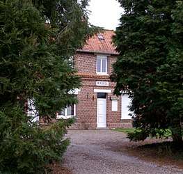 The town hall in Coigneux | |
 Coigneux Location within Hauts-de-France region  Coigneux | |
| Coordinates: 50°07′50″N 2°33′09″E / 50.1306°N 2.5525°ECoordinates: 50°07′50″N 2°33′09″E / 50.1306°N 2.5525°E | |
| Country | France |
| Region | Hauts-de-France |
| Department | Somme |
| Arrondissement | Péronne |
| Canton | Albert |
| Intercommunality | Pays du Coquelicot |
| Government | |
| • Mayor (2014–2020) | Maurice Deruit |
| Area1 | 2.88 km2 (1.11 sq mi) |
| Population (2014)2 | 50 |
| • Density | 17/km2 (45/sq mi) |
| Time zone | UTC+1 (CET) |
| • Summer (DST) | UTC+2 (CEST) |
| INSEE/Postal code | 80201 /80560 |
| Elevation |
100–150 m (330–490 ft) (avg. 107 m or 351 ft) |
|
1 French Land Register data, which excludes lakes, ponds, glaciers > 1 km2 (0.386 sq mi or 247 acres) and river estuaries. 2 Population without double counting: residents of multiple communes (e.g., students and military personnel) only counted once. | |
Coigneux is a commune in the Somme department and Hauts-de-France region of northern France.
Geography
Coigneux is situated on the D176 road, some 22 miles (35 km) northeast of Amiens. The source of the Authie river is found here.
Population
| Year | 1962 | 1968 | 1975 | 1982 | 1990 | 1999 | 2006 | 2014 |
|---|---|---|---|---|---|---|---|---|
| Population | 81 | 86 | 71 | 64 | 56 | 50 | 48 | 50 |
| From the year 1962 on: No double counting—residents of multiple communes (e.g. students and military personnel) are counted only once. | ||||||||
See also
References
External links
| Wikimedia Commons has media related to Coigneux. |
- Coigneux on the Quid website (in French)
This article is issued from
Wikipedia.
The text is licensed under Creative Commons - Attribution - Sharealike.
Additional terms may apply for the media files.