Le Quesnel
| Le Quesnel | |
|---|---|
| Commune | |
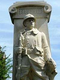 The war memorial in Le Quesnel | |
 Le Quesnel Location within Hauts-de-France region  Le Quesnel | |
| Coordinates: 49°46′33″N 2°37′32″E / 49.7759°N 2.6256°ECoordinates: 49°46′33″N 2°37′32″E / 49.7759°N 2.6256°E | |
| Country | France |
| Region | Hauts-de-France |
| Department | Somme |
| Arrondissement | Montdidier |
| Canton | Moreuil |
| Intercommunality | CC Avre Luce Noye |
| Government | |
| • Mayor (2001–2008) | Jean-Marie Pautre |
| Area1 | 11.38 km2 (4.39 sq mi) |
| Population (2006)2 | 672 |
| • Density | 59/km2 (150/sq mi) |
| Time zone | UTC+1 (CET) |
| • Summer (DST) | UTC+2 (CEST) |
| INSEE/Postal code | 80652 /80118 |
| Elevation |
72–104 m (236–341 ft) (avg. 97 m or 318 ft) |
|
1 French Land Register data, which excludes lakes, ponds, glaciers > 1 km2 (0.386 sq mi or 247 acres) and river estuaries. 2 Population without double counting: residents of multiple communes (e.g., students and military personnel) only counted once. | |
Le Quesnel is a commune in the Somme department in Hauts-de-France in northern France.
Geography
The commune is situated at the D161 and D41 crossroads, some 20 miles (32 km) southeast of Amiens.
Population
| Year | 1962 | 1968 | 1975 | 1982 | 1990 | 1999 | 2006 |
|---|---|---|---|---|---|---|---|
| Population | 555 | 562 | 480 | 409 | 436 | 540 | 672 |
| From the year 1962 on: No double counting—residents of multiple communes (e.g. students and military personnel) are counted only once. | |||||||
Places of interest
- Church of Saint Leger, known as the Cathedral of the Santerre" as it’s the biggest church in the region, with a 50m high tower.
- The Le Quesnel Canadian Battlefield Memorial and Commemorative park.
See also
References
External links
| Wikimedia Commons has media related to Le Quesnel. |
This article is issued from
Wikipedia.
The text is licensed under Creative Commons - Attribution - Sharealike.
Additional terms may apply for the media files.