Vergies
| Vergies | |
|---|---|
| Commune | |
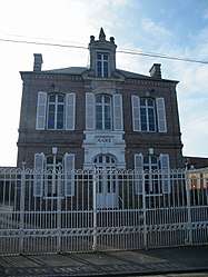 The town hall in Vergies | |
 Vergies Location within Hauts-de-France region  Vergies | |
| Coordinates: 49°56′03″N 1°50′53″E / 49.9342°N 1.8481°ECoordinates: 49°56′03″N 1°50′53″E / 49.9342°N 1.8481°E | |
| Country | France |
| Region | Hauts-de-France |
| Department | Somme |
| Arrondissement | Amiens |
| Canton | Poix-de-Picardie |
| Intercommunality | CC Somme Sud-Ouest |
| Government | |
| • Mayor (2014–2020) | Xavier Lenglet |
| Area1 | 8 km2 (3 sq mi) |
| Population (2006)2 | 192 |
| • Density | 24/km2 (62/sq mi) |
| Time zone | UTC+1 (CET) |
| • Summer (DST) | UTC+2 (CEST) |
| INSEE/Postal code | 80788 /80270 |
| Elevation |
58–129 m (190–423 ft) (avg. 128 m or 420 ft) |
|
1 French Land Register data, which excludes lakes, ponds, glaciers > 1 km2 (0.386 sq mi or 247 acres) and river estuaries. 2 Population without double counting: residents of multiple communes (e.g., students and military personnel) only counted once. | |
Vergies is a commune in the Somme department in Hauts-de-France in northern France.
Geography
Vergies is situated 17 miles (27 km) west of Amiens, on the D298 road
Population
| Year | 1962 | 1968 | 1975 | 1982 | 1990 | 1999 | 2006 |
|---|---|---|---|---|---|---|---|
| Population | 213 | 203 | 199 | 192 | 153 | 151 | 192 |
| From the year 1962 on: No double counting—residents of multiple communes (e.g. students and military personnel) are counted only once. | |||||||
See also
References
External links
| Wikimedia Commons has media related to Vergies. |
- Vergies on the Quid website (in French)
This article is issued from
Wikipedia.
The text is licensed under Creative Commons - Attribution - Sharealike.
Additional terms may apply for the media files.