La Chaussée-Tirancourt
| La Chaussée-Tirancourt | |
|---|---|
| Commune | |
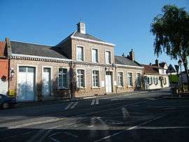 The town hall and school in La Chaussée | |
 La Chaussée-Tirancourt Location within Hauts-de-France region  La Chaussée-Tirancourt | |
| Coordinates: 49°57′15″N 2°08′58″E / 49.9542°N 2.1494°ECoordinates: 49°57′15″N 2°08′58″E / 49.9542°N 2.1494°E | |
| Country | France |
| Region | Hauts-de-France |
| Department | Somme |
| Arrondissement | Amiens |
| Canton | Ailly-sur-Somme |
| Intercommunality | CC Nièvre et Somme |
| Government | |
| • Mayor (2001–2008) | Philippe Francois |
| Area1 | 12.52 km2 (4.83 sq mi) |
| Population (2006)2 | 670 |
| • Density | 54/km2 (140/sq mi) |
| Time zone | UTC+1 (CET) |
| • Summer (DST) | UTC+2 (CEST) |
| INSEE/Postal code | 80187 /80310 |
| Elevation |
12–97 m (39–318 ft) (avg. 17 m or 56 ft) |
|
1 French Land Register data, which excludes lakes, ponds, glaciers > 1 km2 (0.386 sq mi or 247 acres) and river estuaries. 2 Population without double counting: residents of multiple communes (e.g., students and military personnel) only counted once. | |
La Chaussée-Tirancourt is a commune in the Somme department in Hauts-de-France in northern France.
Geography
The commune is situated on the N235 road, on the banks of the river Somme some 8 miles (13 km) northwest of Amiens.
Population
| Year | 1962 | 1968 | 1975 | 1982 | 1990 | 1999 | 2006 |
|---|---|---|---|---|---|---|---|
| Population | 397 | 480 | 581 | 645 | 673 | 687 | 670 |
| From the year 1962 on: No double counting—residents of multiple communes (e.g. students and military personnel) are counted only once. | |||||||
Points of interest
- Samara historical park, recreating ancient civilization and habitation based on local archaeology, from paleolithic to Gallo-Roman times, including reconstructions of homes and other buildings set within the area's marshes. Includes the Arboretum de Samara.
See also
References
External links
| Wikimedia Commons has media related to La Chaussée-Tirancourt. |
- La Chaussée-Tirancourt on the Quid website (in French)
This article is issued from
Wikipedia.
The text is licensed under Creative Commons - Attribution - Sharealike.
Additional terms may apply for the media files.