Bernaville
| Bernaville | ||
|---|---|---|
| Commune | ||
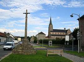 The cross and church in Bernaville | ||
| ||
 Bernaville Location within Hauts-de-France region  Bernaville | ||
| Coordinates: 50°07′55″N 2°09′50″E / 50.132°N 2.164°ECoordinates: 50°07′55″N 2°09′50″E / 50.132°N 2.164°E | ||
| Country | France | |
| Region | Hauts-de-France | |
| Department | Somme | |
| Arrondissement | Amiens | |
| Canton | Doullens | |
| Intercommunality | CC Territoire Nord Picardie | |
| Government | ||
| • Mayor (2001–2008) | Laurent Somon | |
| Area1 | 17.34 km2 (6.70 sq mi) | |
| Population (2006)2 | 998 | |
| • Density | 58/km2 (150/sq mi) | |
| Time zone | UTC+1 (CET) | |
| • Summer (DST) | UTC+2 (CEST) | |
| INSEE/Postal code | 80086 /80370 | |
| Elevation |
94–158 m (308–518 ft) (avg. 152 m or 499 ft) | |
|
1 French Land Register data, which excludes lakes, ponds, glaciers > 1 km2 (0.386 sq mi or 247 acres) and river estuaries. 2 Population without double counting: residents of multiple communes (e.g., students and military personnel) only counted once. | ||

Bernaville is a commune in the Somme department in Hauts-de-France in northern France.
Geography
Bernaville is situated on the D925 road, some 18 miles (29 km) east of Abbeville.
Its surrounded by the communes Domesmont, Beaumetz and Gorges, Bernaville is located 24 km north-east of Abbeville's largest city nearby.[1]
Population
| Year | 1962 | 1968 | 1975 | 1982 | 1990 | 1999 | 2006 |
|---|---|---|---|---|---|---|---|
| Population | 862 | 871 | 960 | 951 | 910 | 996 | 998 |
| From the year 1962 on: No double counting—residents of multiple communes (e.g. students and military personnel) are counted only once. | |||||||
See also
References
External links
| Wikimedia Commons has media related to Bernaville. |
- Bernaville on the Quid site (French)
- Bernaville on the France (French)
- Vals d'Authie, Nièvre, and Somme (French)
This article is issued from
Wikipedia.
The text is licensed under Creative Commons - Attribution - Sharealike.
Additional terms may apply for the media files.