Namps-Maisnil
| Namps-Maisnil | |
|---|---|
| Commune | |
_1.jpg) The church in Taisnil | |
 Namps-Maisnil Location within Hauts-de-France region  Namps-Maisnil | |
| Coordinates: 49°48′13″N 2°06′28″E / 49.8036°N 2.1078°ECoordinates: 49°48′13″N 2°06′28″E / 49.8036°N 2.1078°E | |
| Country | France |
| Region | Hauts-de-France |
| Department | Somme |
| Arrondissement | Amiens |
| Canton | Ailly-sur-Noye |
| Intercommunality | CC Somme Sud-Ouest |
| Government | |
| • Mayor (2001–2008) | Michel Delamare |
| Area1 | 21.96 km2 (8.48 sq mi) |
| Population (2006)2 | 1,036 |
| • Density | 47/km2 (120/sq mi) |
| Time zone | UTC+1 (CET) |
| • Summer (DST) | UTC+2 (CEST) |
| INSEE/Postal code | 80582 /80290 |
| Elevation |
55–149 m (180–489 ft) (avg. 87 m or 285 ft) |
|
1 French Land Register data, which excludes lakes, ponds, glaciers > 1 km2 (0.386 sq mi or 247 acres) and river estuaries. 2 Population without double counting: residents of multiple communes (e.g., students and military personnel) only counted once. | |
Namps-Maisnil is a commune in the Somme department in Hauts-de-France in northern France.
Geography
A commune created by the amalgamation, in 1972, of the four old communes of Namps-au-Mont, Namps-au-Val, Rumaisnil and Taisnil. The commune is surrounded by forests and situated at the junction of the D169, D61 and D38 roads, some 9 miles (14 km) southwest of Amiens.
Population
| 1962 | 1968 | 1975 | 1982 | 1990 | 1999 | 2006 |
|---|---|---|---|---|---|---|
| 766 | 818 | 836 | 890 | 970 | 1002 | 1036 |
| Starting in 1962: Population without duplicates | ||||||
Places of interest
- The war memorial at Taisnil
- The church at Namps-au-Val
- The Château of Namps-au-Mont
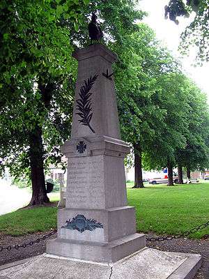
Taisnil war memorial
See also
References
External links
| Wikimedia Commons has media related to Namps-Maisnil. |
- Namps-Maisnil on the Quid website (in French)
This article is issued from
Wikipedia.
The text is licensed under Creative Commons - Attribution - Sharealike.
Additional terms may apply for the media files.