Liéramont
| Liéramont | |
|---|---|
| Commune | |
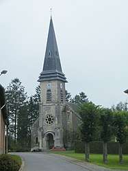 The church in Liéramont | |
 Liéramont Location within Hauts-de-France region  Liéramont | |
| Coordinates: 49°59′41″N 3°03′01″E / 49.9947°N 3.0503°E / 49.9947; 3.0503Coordinates: 49°59′41″N 3°03′01″E / 49.9947°N 3.0503°E / 49.9947; 3.0503 | |
| Country | France |
| Region | Hauts-de-France |
| Department | Somme |
| Arrondissement | Péronne |
| Canton | Péronne |
| Intercommunality | Haute Somme |
| Government | |
| • Mayor (2001–2008) | Régis Douay |
| Area1 | 7.29 km2 (2.81 sq mi) |
| Population (2006)2 | 199 |
| • Density | 27/km2 (71/sq mi) |
| Time zone | UTC+1 (CET) |
| • Summer (DST) | UTC+2 (CEST) |
| INSEE/Postal code | 80475 /80240 |
| Elevation |
113–152 m (371–499 ft) (avg. 150 m or 490 ft) |
|
1 French Land Register data, which excludes lakes, ponds, glaciers > 1 km2 (0.386 sq mi or 247 acres) and river estuaries. 2 Population without double counting: residents of multiple communes (e.g., students and military personnel) only counted once. | |
Liéramont is a commune in the Somme department in Hauts-de-France in northern France.
Geography
The commune is situated on the D22 and D72 crossroads, some 20 miles (32 km) northwest of Saint Quentin.
Population
| 1962 | 1968 | 1975 | 1982 | 1990 | 1999 | 2006 |
|---|---|---|---|---|---|---|
| 231 | 265 | 215 | 197 | 164 | 182 | 199 |
| Starting in 1962: Population without duplicates | ||||||
See also
References
External links
| Wikimedia Commons has media related to Liéramont. |
- Liéramont on the Quid website (in French)
This article is issued from
Wikipedia.
The text is licensed under Creative Commons - Attribution - Sharealike.
Additional terms may apply for the media files.