Mons-Boubert
| Mons-Boubert | |
|---|---|
| Commune | |
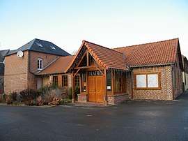 The town hall in Mons-Boubert | |
 Mons-Boubert Location within Hauts-de-France region  Mons-Boubert | |
| Coordinates: 50°07′47″N 1°39′43″E / 50.1297°N 1.6619°ECoordinates: 50°07′47″N 1°39′43″E / 50.1297°N 1.6619°E | |
| Country | France |
| Region | Hauts-de-France |
| Department | Somme |
| Arrondissement | Abbeville |
| Canton | Abbeville-2 |
| Intercommunality | CA Baie de Somme |
| Government | |
| • Mayor (2001–2020) | Emmanuel Delahaye |
| Area1 | 9.53 km2 (3.68 sq mi) |
| Population (2006)2 | 531 |
| • Density | 56/km2 (140/sq mi) |
| Time zone | UTC+1 (CET) |
| • Summer (DST) | UTC+2 (CEST) |
| INSEE/Postal code | 80556 /80210 |
| Elevation |
5–71 m (16–233 ft) (avg. 20 m or 66 ft) |
|
1 French Land Register data, which excludes lakes, ponds, glaciers > 1 km2 (0.386 sq mi or 247 acres) and river estuaries. 2 Population without double counting: residents of multiple communes (e.g., students and military personnel) only counted once. | |
Mons-Boubert is a commune in the Somme department in Hauts-de-France in northern France.
Geography
The commune is situated on the D403 road, some 7 miles (11 km) west of Abbeville.
Population
| 1962 | 1968 | 1975 | 1982 | 1990 | 1999 | 2006 |
|---|---|---|---|---|---|---|
| 509 | 567 | 519 | 508 | 506 | 483 | 531 |
| Starting in 1962: Population without duplicates | ||||||
See also
References
External links
| Wikimedia Commons has media related to Mons-Boubert. |
- Mons-Boubert on the Quid website (in French)
| Authority control |
|---|
This article is issued from
Wikipedia.
The text is licensed under Creative Commons - Attribution - Sharealike.
Additional terms may apply for the media files.