Harbonnières
| Harbonnières | ||
|---|---|---|
| Commune | ||
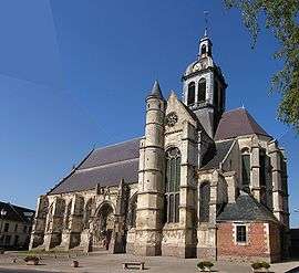 The church in Harbonnières | ||
| ||
 Harbonnières Location within Hauts-de-France region  Harbonnières | ||
| Coordinates: 49°50′58″N 2°40′14″E / 49.8494°N 2.6706°ECoordinates: 49°50′58″N 2°40′14″E / 49.8494°N 2.6706°E | ||
| Country | France | |
| Region | Hauts-de-France | |
| Department | Somme | |
| Arrondissement | Péronne | |
| Canton | Moreuil | |
| Intercommunality | CC Terre de Picardie | |
| Government | ||
| • Mayor (2006–2008) | Régis Ventelon | |
| Area1 | 15.37 km2 (5.93 sq mi) | |
| Population (2006)2 | 1,450 | |
| • Density | 94/km2 (240/sq mi) | |
| Time zone | UTC+1 (CET) | |
| • Summer (DST) | UTC+2 (CEST) | |
| INSEE/Postal code | 80417 /80131 | |
| Elevation |
60–94 m (197–308 ft) (avg. 91 m or 299 ft) | |
|
1 French Land Register data, which excludes lakes, ponds, glaciers > 1 km2 (0.386 sq mi or 247 acres) and river estuaries. 2 Population without double counting: residents of multiple communes (e.g., students and military personnel) only counted once. | ||

Harbonnières is a commune in the Somme department in Hauts-de-France in northern France.
Geography
The commune is situated on the D337 road, 34 kilometres (21 mi) east of Amiens.
Population
| Year | 1962 | 1968 | 1975 | 1982 | 1990 | 1999 | 2006 |
|---|---|---|---|---|---|---|---|
| Population | 1405 | 1426 | 1559 | 1371 | 1286 | 1305 | 1450 |
| From the year 1962 on: No double counting—residents of multiple communes (e.g. students and military personnel) are counted only once. | |||||||
Places of interest
- Saint Martin's church at Harbonnières. A large 15th-century building with a tower topped by a dome. A sundial is visible on the façade.
- Heath Cemetery, a World War I cemetery operated by the Commonwealth War Graves Commission.
See also
References
External links
| Wikimedia Commons has media related to Harbonnières. |
- Harbonnières on the Quid website (in French)
This article is issued from
Wikipedia.
The text is licensed under Creative Commons - Attribution - Sharealike.
Additional terms may apply for the media files.