Aubigny, Somme
| Aubigny | ||
|---|---|---|
| Commune | ||
 The town hall and school | ||
| ||
 Aubigny Location within Hauts-de-France region  Aubigny | ||
| Coordinates: 49°54′04″N 2°28′59″E / 49.9011°N 2.4831°ECoordinates: 49°54′04″N 2°28′59″E / 49.9011°N 2.4831°E | ||
| Country | France | |
| Region | Hauts-de-France | |
| Department | Somme | |
| Arrondissement | Amiens | |
| Canton | Amiens-3 | |
| Intercommunality | CC Val Somme | |
| Government | ||
| • Mayor (2014–2020) | Georges Leclercq | |
| Area1 | 9.75 km2 (3.76 sq mi) | |
| Population (2015)2 | 455 | |
| • Density | 47/km2 (120/sq mi) | |
| Time zone | UTC+1 (CET) | |
| • Summer (DST) | UTC+2 (CEST) | |
| INSEE/Postal code | 80036 /80800 | |
| Elevation |
22–90 m (72–295 ft) (avg. 34 m or 112 ft) | |
|
1 French Land Register data, which excludes lakes, ponds, glaciers > 1 km2 (0.386 sq mi or 247 acres) and river estuaries. 2 Population without double counting: residents of multiple communes (e.g., students and military personnel) only counted once. | ||

Aubigny is a commune in the Somme department in Hauts-de-France in northern France.
Demography
| Historical population | ||||||||||||||||||||||||||||||||||||||||||||||||
|---|---|---|---|---|---|---|---|---|---|---|---|---|---|---|---|---|---|---|---|---|---|---|---|---|---|---|---|---|---|---|---|---|---|---|---|---|---|---|---|---|---|---|---|---|---|---|---|---|
|
|
|
| |||||||||||||||||||||||||||||||||||||||||||||
Places and monuments
- Church Sainte-Colombe (1821).
- British Cemetery [1]
.JPG) Church Sainte-Colombe.
Church Sainte-Colombe..JPG) Cemetery entrance.
Cemetery entrance.
sport and leisure
In Aubigny, teams are playing balle à la main witch is a traditional sport in Picardy.
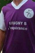
shirt of the team of Aubigny
See also
References
| Wikimedia Commons has media related to Aubigny (Somme). |
This article is issued from
Wikipedia.
The text is licensed under Creative Commons - Attribution - Sharealike.
Additional terms may apply for the media files.