Lamotte-Brebière
| Lamotte-Brebière | |
|---|---|
| Commune | |
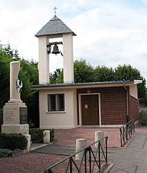 The church in Lamotte-Brebière | |
 Lamotte-Brebière Location within Hauts-de-France region  Lamotte-Brebière | |
| Coordinates: 49°53′10″N 2°23′28″E / 49.8861°N 2.3911°ECoordinates: 49°53′10″N 2°23′28″E / 49.8861°N 2.3911°E | |
| Country | France |
| Region | Hauts-de-France |
| Department | Somme |
| Arrondissement | Amiens |
| Canton | Amiens-3 |
| Intercommunality | Val de Somme |
| Government | |
| • Mayor (2001–2008) | Geneviève Lojtek |
| Area1 | 4.25 km2 (1.64 sq mi) |
| Population (2006)2 | 225 |
| • Density | 53/km2 (140/sq mi) |
| Time zone | UTC+1 (CET) |
| • Summer (DST) | UTC+2 (CEST) |
| INSEE/Postal code | 80461 /80450 |
| Elevation |
22–70 m (72–230 ft) (avg. 66 m or 217 ft) |
|
1 French Land Register data, which excludes lakes, ponds, glaciers > 1 km2 (0.386 sq mi or 247 acres) and river estuaries. 2 Population without double counting: residents of multiple communes (e.g., students and military personnel) only counted once. | |
Lamotte-Brebière is a commune in the Somme department in Hauts-de-France in northern France.
Geography
The commune is situated on the D1b road, some 3 miles (5 km) east of Amiens, by the banks of the river Somme.
Population
| Year | 1962 | 1968 | 1975 | 1982 | 1990 | 1999 | 2006 |
|---|---|---|---|---|---|---|---|
| Population | 123 | 132 | 180 | 210 | 215 | 242 | 225 |
| From the year 1962 on: No double counting—residents of multiple communes (e.g. students and military personnel) are counted only once. | |||||||
See also
References
External links
| Wikimedia Commons has media related to Lamotte-Brebière. |
- Lamotte-Brebière on the Quid website (in French)
This article is issued from
Wikipedia.
The text is licensed under Creative Commons - Attribution - Sharealike.
Additional terms may apply for the media files.