Bernay-en-Ponthieu
| Bernay-en-Ponthieu | |
|---|---|
| Commune | |
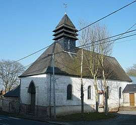 The church in Bernay | |
 Bernay-en-Ponthieu Location within Hauts-de-France region  Bernay-en-Ponthieu | |
| Coordinates: 50°16′10″N 1°44′43″E / 50.2694°N 1.7453°ECoordinates: 50°16′10″N 1°44′43″E / 50.2694°N 1.7453°E | |
| Country | France |
| Region | Hauts-de-France |
| Department | Somme |
| Arrondissement | Abbeville |
| Canton | Rue |
| Intercommunality | CC Ponthieu-Marquenterre |
| Government | |
| • Mayor (2008–2020) | Jean Boulanger |
| Area1 | 9.97 km2 (3.85 sq mi) |
| Population (2006)2 | 240 |
| • Density | 24/km2 (62/sq mi) |
| Time zone | UTC+1 (CET) |
| • Summer (DST) | UTC+2 (CEST) |
| INSEE/Postal code | 80087 /80120 |
| Elevation |
2–47 m (6.6–154.2 ft) (avg. 23 m or 75 ft) |
|
1 French Land Register data, which excludes lakes, ponds, glaciers > 1 km2 (0.386 sq mi or 247 acres) and river estuaries. 2 Population without double counting: residents of multiple communes (e.g., students and military personnel) only counted once. | |
Bernay-en-Ponthieu is a commune in the Somme department in Hauts-de-France in northern France.
Geography
The commune is situated on the N1 road, next to the A16 autoroute, some 15 miles (24 km) north of Abbeville.
Population
| Year | 1962 | 1968 | 1975 | 1982 | 1990 | 1999 | 2006 |
|---|---|---|---|---|---|---|---|
| Population | 226 | 264 | 251 | 215 | 194 | 202 | 240 |
| From the year 1962 on: No double counting—residents of multiple communes (e.g. students and military personnel) are counted only once. | |||||||
See also
References
External links
| Wikimedia Commons has media related to Bernay-en-Ponthieu. |
- Bernay-en-Ponthieu on the Quid site (French)
- Rooms in Bernay-en-Ponthieu (French)
This article is issued from
Wikipedia.
The text is licensed under Creative Commons - Attribution - Sharealike.
Additional terms may apply for the media files.