Fresnoy-au-Val
| Fresnoy-au-Val | |
|---|---|
| Commune | |
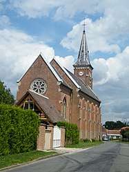 The church in Fresnoy-au-Val | |
 Fresnoy-au-Val Location within Hauts-de-France region  Fresnoy-au-Val | |
| Coordinates: 49°50′09″N 2°03′22″E / 49.8358°N 2.0561°ECoordinates: 49°50′09″N 2°03′22″E / 49.8358°N 2.0561°E | |
| Country | France |
| Region | Hauts-de-France |
| Department | Somme |
| Arrondissement | Amiens |
| Canton | Ailly-sur-Somme |
| Intercommunality | CC Somme Sud-Ouest |
| Government | |
| • Mayor (2001–2008) | Alain Desfosses |
| Area1 | 8.07 km2 (3.12 sq mi) |
| Population (2006)2 | 243 |
| • Density | 30/km2 (78/sq mi) |
| Time zone | UTC+1 (CET) |
| • Summer (DST) | UTC+2 (CEST) |
| INSEE/Postal code | 80357 /80290 |
| Elevation |
70–139 m (230–456 ft) (avg. 124 m or 407 ft) |
|
1 French Land Register data, which excludes lakes, ponds, glaciers > 1 km2 (0.386 sq mi or 247 acres) and river estuaries. 2 Population without double counting: residents of multiple communes (e.g., students and military personnel) only counted once. | |
Fresnoy-au-Val is a commune in the Somme department in Hauts-de-France in northern France.
Geography
The commune is situated 16 miles (26 km) southwest of Amiens on the D51 road half a mile from the A29 autoroute
Population
| Year | 1962 | 1968 | 1975 | 1982 | 1990 | 1999 | 2006 |
|---|---|---|---|---|---|---|---|
| Population | 211 | 216 | 197 | 181 | 218 | 225 | 243 |
| From the year 1962 on: No double counting—residents of multiple communes (e.g. students and military personnel) are counted only once. | |||||||
See also
References
External links
| Wikimedia Commons has media related to Fresnoy-au-Val. |
- Fresnoy-au-Val on the Quid website (in French)
This article is issued from
Wikipedia.
The text is licensed under Creative Commons - Attribution - Sharealike.
Additional terms may apply for the media files.