Liancourt-Fosse
| Liancourt-Fosse | ||
|---|---|---|
| Commune | ||
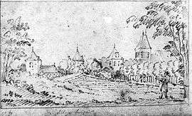 The chateau in Liancourt-Fosse | ||
| ||
 Liancourt-Fosse Location within Hauts-de-France region  Liancourt-Fosse | ||
| Coordinates: 49°45′21″N 2°48′59″E / 49.7558°N 2.8164°ECoordinates: 49°45′21″N 2°48′59″E / 49.7558°N 2.8164°E | ||
| Country | France | |
| Region | Hauts-de-France | |
| Department | Somme | |
| Arrondissement | Montdidier | |
| Canton | Roye | |
| Intercommunality | CC Grand Roye | |
| Government | ||
| • Mayor (2001–2008) | Pierre Remy | |
| Area1 | 6.44 km2 (2.49 sq mi) | |
| Population (2006)2 | 243 | |
| • Density | 38/km2 (98/sq mi) | |
| Time zone | UTC+1 (CET) | |
| • Summer (DST) | UTC+2 (CEST) | |
| INSEE/Postal code | 80473 /80700 | |
| Elevation |
71–96 m (233–315 ft) (avg. 82 m or 269 ft) | |
|
1 French Land Register data, which excludes lakes, ponds, glaciers > 1 km2 (0.386 sq mi or 247 acres) and river estuaries. 2 Population without double counting: residents of multiple communes (e.g., students and military personnel) only counted once. | ||
.svg.png)
Liancourt-Fosse is a commune in the Somme department in Hauts-de-France in northern France.
Geography
The commune is situated at the junction of the D227 and N17 roads, half a mile from the A1 autoroute and some 30 miles (48 km) southeast of Amiens.
Population
| 1962 | 1968 | 1975 | 1982 | 1990 | 1999 | 2006 |
|---|---|---|---|---|---|---|
| 172 | 220 | 226 | 221 | 226 | 231 | 243 |
| Starting in 1962: Population without duplicates | ||||||
See also
References
External links
| Wikimedia Commons has media related to Liancourt-Fosse. |
- Liancourt-Fosse on the Quid website (in French)
This article is issued from
Wikipedia.
The text is licensed under Creative Commons - Attribution - Sharealike.
Additional terms may apply for the media files.