Ville-le-Marclet
| Ville-le-Marclet | |
|---|---|
| Commune | |
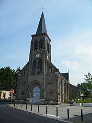 The church in Ville-le-Marclet | |
 Ville-le-Marclet Location within Hauts-de-France region  Ville-le-Marclet | |
| Coordinates: 50°01′24″N 2°05′22″E / 50.0233°N 2.0894°ECoordinates: 50°01′24″N 2°05′22″E / 50.0233°N 2.0894°E | |
| Country | France |
| Region | Hauts-de-France |
| Department | Somme |
| Arrondissement | Amiens |
| Canton | Flixecourt |
| Intercommunality | CC Nièvre et Somme |
| Government | |
| • Mayor (2001–2008) | Bernard Defrancois |
| Area1 | 8.93 km2 (3.45 sq mi) |
| Population (2006)2 | 514 |
| • Density | 58/km2 (150/sq mi) |
| Time zone | UTC+1 (CET) |
| • Summer (DST) | UTC+2 (CEST) |
| INSEE/Postal code | 80795 /80420 |
| Elevation |
17–113 m (56–371 ft) (avg. 26 m or 85 ft) |
|
1 French Land Register data, which excludes lakes, ponds, glaciers > 1 km2 (0.386 sq mi or 247 acres) and river estuaries. 2 Population without double counting: residents of multiple communes (e.g., students and military personnel) only counted once. | |
Ville-le-Marclet is a commune in the Somme department in Hauts-de-France in northern France.
Geography
The commune is situated 24 km (15 miles) northwest of Amiens, on the D159 road and 1 mile(1.6 km) from a junction with the A16 autoroute.
Population
| Year | 1962 | 1968 | 1975 | 1982 | 1990 | 1999 | 2006 |
|---|---|---|---|---|---|---|---|
| Population | 472 | 485 | 556 | 512 | 508 | 511 | 514 |
| From the year 1962 on: No double counting—residents of multiple communes (e.g. students and military personnel) are counted only once. | |||||||
See also
References
External links
| Wikimedia Commons has media related to Ville-le-Marclet. |
- Ville-le-Marclet on the Quid website (in French)
This article is issued from
Wikipedia.
The text is licensed under Creative Commons - Attribution - Sharealike.
Additional terms may apply for the media files.