Vercourt
| Vercourt | |
|---|---|
| Commune | |
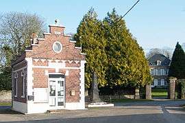 The main square in Vercourt, with the town hall, chateau and war memorial | |
 Vercourt Location within Hauts-de-France region  Vercourt | |
| Coordinates: 50°18′03″N 1°42′07″E / 50.3008°N 1.7019°ECoordinates: 50°18′03″N 1°42′07″E / 50.3008°N 1.7019°E | |
| Country | France |
| Region | Hauts-de-France |
| Department | Somme |
| Arrondissement | Abbeville |
| Canton | Rue |
| Intercommunality | CC Ponthieu-Marquenterre |
| Government | |
| • Mayor (2001–2008) | Robert Demanet |
| Area1 | 4.67 km2 (1.80 sq mi) |
| Population (2006)2 | 111 |
| • Density | 24/km2 (62/sq mi) |
| Time zone | UTC+1 (CET) |
| • Summer (DST) | UTC+2 (CEST) |
| INSEE/Postal code | 80787 /80120 |
| Elevation |
3–31 m (9.8–101.7 ft) (avg. 4 m or 13 ft) |
|
1 French Land Register data, which excludes lakes, ponds, glaciers > 1 km2 (0.386 sq mi or 247 acres) and river estuaries. 2 Population without double counting: residents of multiple communes (e.g., students and military personnel) only counted once. | |
Vercourt is a commune in the Somme department in Hauts-de-France in northern France.
Geography
Vercourt is situated 15 miles (24 km) north of Abbeville, on the D175 road
Population
| Year | 1962 | 1968 | 1975 | 1982 | 1990 | 1999 | 2006 |
|---|---|---|---|---|---|---|---|
| Population | 96 | 119 | 108 | 90 | 82 | 85 | 111 |
| From the year 1962 on: No double counting—residents of multiple communes (e.g. students and military personnel) are counted only once. | |||||||
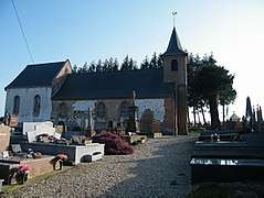 Church Saint-Saturnin.
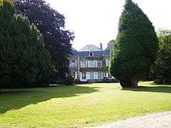 Castle.
.JPG) Church.
Church.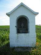 Notre-Dame de joie, towards Cantereine.
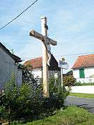
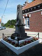 Monument aux morts.
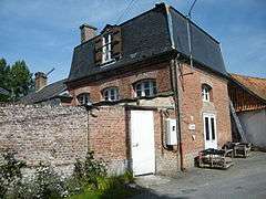 Old school.
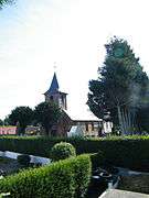 Church.
See also
References
External links
| Wikimedia Commons has media related to Vercourt. |
- Vercourt on the Quid website (in French)
This article is issued from
Wikipedia.
The text is licensed under Creative Commons - Attribution - Sharealike.
Additional terms may apply for the media files.