Aral, Xinjiang
Aral[1][2] is a sub-prefecture-level city surrounded by Aksu Prefecture in Xinjiang Uyghur Autonomous Region, China. Aral means "island" in Uyghur.[3] The city's name is also often written as Alar.[4]
Aral 阿拉尔市 ئارال شەھىرى | |
|---|---|
County-level & Sub-prefectural city | |
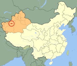 Aral (red) in Xinjiang Province (orange) and China | |
| Coordinates (Aral municipal government): 40°32′53″N 81°16′52″E | |
| Country | People's Republic of China |
| Autonomous region | Xinjiang |
| Area | |
| • Total | 5,258.739 km2 (2,030.410 sq mi) |
| Population (2010 Census) | |
| • Total | 166,205 |
| • Density | 32/km2 (82/sq mi) |
| Time zone | UTC+8 (China Standard) |
| Aral, Xinjiang | |||||||||||
|---|---|---|---|---|---|---|---|---|---|---|---|
| Chinese name | |||||||||||
| Simplified Chinese | 阿拉尔 | ||||||||||
| Traditional Chinese | 阿拉爾 | ||||||||||
| |||||||||||
| Uyghur name | |||||||||||
| Uyghur | ئارال | ||||||||||
| |||||||||||
History
Aral was created by the Xinjiang Production and Construction Corps to facilitate Han Chinese immigration to the region. It became a city in 2002 and its population increased to 166,205 in 2010.
On January 23, 2013, 474.208 km2 (183.093 sq mi) of territory was transferred from Awat County (Awati) to Aral city[5] and 802.733 km2 (309.937 sq mi) of territory was transferred from Aksu city (Akesu) to Aral city.[6]
Geography
The city has an administrative area of 5,258.739 km2 (2,030.410 sq mi). It is bordered by mountainous regions to the north and northwest and the Taklamakan Desert to the east and south.
Demographics
As of 2015, 167,697 of the 179,214 residents of the county were Han Chinese, 6,036 were Uyghur and 5,481 were from other ethnic groups.[7]
Education
Tarim University is located in Aral.
References
- The official spelling according to Zhōngguó dìmínglù, 中国地名录 (Beijing, SinoMaps Press 中国地图出版社 1997); ISBN 7-5031-1718-4
- The official spelling is Aral, according to the Zhōngguó dìmínglù, 中国地名录 (Beijing, SinoMaps Press 1997); ISBN 7-5031-1718-4; p. 1, 299.
- "Archived copy". Archived from the original on 2015-10-18. Retrieved 2014-05-03.CS1 maint: archived copy as title (link)
- Sharma, Yojana (18 July 2014). "Government rushes through Kashgar university plan". University World News. Retrieved 14 January 2020.
- 阿瓦提县历史沿革 [Awat County Historical Development] (in Chinese). XZQH.org. 30 January 2015. Retrieved 14 May 2019.
2013年1月23日,自治区政府(新政函[2013]17号)批复同意将阿瓦提县474.208平方千米区域划归阿拉尔市管辖。
- 阿克苏市历史沿革 [Aksu City Historical Development] (in Chinese). XZQH.org. 30 January 2015. Retrieved 18 May 2019.
- 3-7 各地、州、市、县(市)分民族人口数 (in Chinese). شىنجاڭ ئۇيغۇر ئاپتونوم رايونى 新疆维吾尔自治区统计局 Statistic Bureau of Xinjiang Uygur Autonomous Region. 15 March 2017. Archived from the original on 11 October 2017. Retrieved 3 September 2017.