Xuchang
Xuchang (Chinese: 许昌; postal: Hsuchang) is a prefecture-level city in central Henan province in Central China. It borders the provincial capital of Zhengzhou to the northwest, Kaifeng to the northeast, Zhoukou to the east, Luohe to the southeast, and Pingdingshan to the southwest.
Xuchang 许昌市 Hsuchang | |
|---|---|
 | |
 Location of Xuchang City jurisdiction in Henan | |
| Coordinates (Xuchang municipal government): 34°02′13″N 113°51′07″E | |
| Country | People's Republic of China |
| Province | Henan |
| Municipal seat | Weidu District |
| Area | |
| • Prefecture-level city | 4,978.36 km2 (1,922.16 sq mi) |
| • Urban | 1,088.2 km2 (420.2 sq mi) |
| • Metro | 1,724 km2 (666 sq mi) |
| Elevation | 71 m (234 ft) |
| Highest elevation | 1,150.6 m (3,774.9 ft) |
| Lowest elevation | 50.4 m (165.4 ft) |
| Population | |
| • Prefecture-level city | 4,307,488 |
| • Density | 870/km2 (2,200/sq mi) |
| • Urban | 1,265,536 |
| • Urban density | 1,200/km2 (3,000/sq mi) |
| • Metro | 1,952,666 |
| • Metro density | 1,100/km2 (2,900/sq mi) |
| Time zone | UTC+8 (China Standard) |
| Area code(s) | 374 |
| ISO 3166 code | CN-HA-10 |
| GDP | ¥54,522 per capita (2016) |
| Major Nationalities | Han |
| County-level divisions | 6 |
| License plate prefixes | 豫K |
| Website | xuchang |
| Xuchang | |||||||||||||||||||||||
|---|---|---|---|---|---|---|---|---|---|---|---|---|---|---|---|---|---|---|---|---|---|---|---|
| Traditional Chinese | 許昌 | ||||||||||||||||||||||
| Simplified Chinese | 许昌 | ||||||||||||||||||||||
| |||||||||||||||||||||||
Its population was 4,307,488 inhabitants at the final 2010 census, of whom 1,952,666 lived in the built-up (or "metro") area made up of Weidu and Jian'an districts, Xuchang county and Changge City largely being urbanized.[2] In 2007, the city was named as one of China's top ten livable cities by Chinese Cities Brand Value Report, which was released at 2007 Beijing Summit of China Cities Forum.[3]
Administration
The prefecture-level city of Xuchang administers 2 district, 2 county-level cities and 2 counties.
- Weidu District (魏都区)
- Jian'an District (建安区)
- Yuzhou City (禹州市)
- Changge City (长葛市)
- Yanling County (鄢陵县)
- Xiangcheng County (襄城县)
| Map |
|---|

History
According to tradition, the city was named after Xu, an ancient state led by tribal leader Xuyou during the Spring and Autumn period of the Zhou Dynasty. In ancient times, the city occupied a strategic location in central China. It may have been the origin of the surname Xǔ (許/许).
Xuchang served as the warlord Cao Cao's de facto capital during the late Eastern Han Dynasty. After finding the old capital Luoyang ravaged by war, Cao moved the imperial court and Emperor Xian to what is now Xuchang in 196.
In 220, Cao Cao's son and successor Cao Pi officially declared the city as the capital of the newly established state of Cao Wei. The city was renamed "Xuchang" taken to mean "Xu Rising". The Wei emperors held court at Xuchang until the capital was moved to Luoyang in the 220s.
Geography and climate
Xuchang ranges in latitude from 33° 16' to 34° 24' N and in longitude from 113° 03' to 114° 190' E.
Xuchang has a monsoon-influenced humid subtropical climate (Köppen Cwa), with four distinct seasons. Winters are cool and dry, summers hot and humid, spring begins early and is warm, and autumn is mild and provides a reasonable transition. Rain mainly falls from May to September, as more than 70% of the annual precipitation occurs then. The city has an annual mean temperature of at 14.5 °C (58.1 °F), and its highest average monthly temperature is 27.1 °C (80.8 °F) in July and the lowest is 0.7 °C (33.3 °F) in January. Just over 700 millimetres (28 in) of precipitation falls each year, and there is on average 217 frost-free days and 2280 hours of sunshine per year.
| Climate data for Xuchang (1971−2000) | |||||||||||||
|---|---|---|---|---|---|---|---|---|---|---|---|---|---|
| Month | Jan | Feb | Mar | Apr | May | Jun | Jul | Aug | Sep | Oct | Nov | Dec | Year |
| Record high °C (°F) | 20.2 (68.4) |
23.5 (74.3) |
28.3 (82.9) |
34.2 (93.6) |
38.9 (102.0) |
41.9 (107.4) |
39.2 (102.6) |
38.9 (102.0) |
37.2 (99.0) |
35.1 (95.2) |
27.0 (80.6) |
21.4 (70.5) |
41.9 (107.4) |
| Average high °C (°F) | 6.1 (43.0) |
8.9 (48.0) |
13.9 (57.0) |
21.3 (70.3) |
26.8 (80.2) |
31.8 (89.2) |
32.0 (89.6) |
30.7 (87.3) |
27.0 (80.6) |
21.7 (71.1) |
14.4 (57.9) |
8.2 (46.8) |
20.2 (68.4) |
| Daily mean °C (°F) | 0.7 (33.3) |
3.1 (37.6) |
8.1 (46.6) |
15.2 (59.4) |
20.6 (69.1) |
25.7 (78.3) |
27.1 (80.8) |
25.8 (78.4) |
21.1 (70.0) |
15.4 (59.7) |
8.5 (47.3) |
2.7 (36.9) |
14.5 (58.1) |
| Average low °C (°F) | −3.6 (25.5) |
−1.4 (29.5) |
3.0 (37.4) |
9.4 (48.9) |
14.8 (58.6) |
20.0 (68.0) |
23.1 (73.6) |
22.0 (71.6) |
16.6 (61.9) |
10.5 (50.9) |
3.7 (38.7) |
−1.7 (28.9) |
9.7 (49.5) |
| Record low °C (°F) | −16.4 (2.5) |
−19.6 (−3.3) |
−11.5 (11.3) |
−2.9 (26.8) |
3.2 (37.8) |
11.6 (52.9) |
16.4 (61.5) |
13.8 (56.8) |
6.3 (43.3) |
−0.9 (30.4) |
−13.1 (8.4) |
−14.0 (6.8) |
−19.6 (−3.3) |
| Average precipitation mm (inches) | 12.0 (0.47) |
14.9 (0.59) |
33.7 (1.33) |
43.5 (1.71) |
72.8 (2.87) |
83.5 (3.29) |
163.3 (6.43) |
121.7 (4.79) |
71.4 (2.81) |
50.7 (2.00) |
26.0 (1.02) |
12.1 (0.48) |
705.6 (27.79) |
| Average precipitation days (≥ 0.1 mm) | 3.5 | 5.0 | 7.0 | 6.9 | 7.9 | 8.4 | 11.7 | 10.6 | 8.3 | 7.7 | 5.4 | 3.8 | 86.2 |
| Source: Weather China[1] | |||||||||||||
Economy
Xuchang is an important center of the Chinese tobacco industry.
The manufacturing industry the city is best known for is wigs and hair extensions with exports worth about $1 billion in 2016. The industry started around 1900 when German merchants purchased hair from the local area. It was revived in the 1980s and in 1990 a local entrepreneur Zheng Youquan merged a number of smaller hair manufacturing workshops into Rebecca Hair Products, a larger entity that quickly expanded to international markets and became the largest wig maker in the world.[4]
Education
Xuchang University is in the city.
Tourism
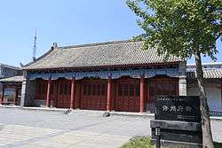
Famous tourist attractions include Baling Bridge and Chunqiu Tower.
Sister city
On 18 December 2006, the Oromia Region government in Ethiopia signed an agreement with Henan Province to establish a sister city program with Ambo.[5] Bolingbrook, Illinois is also a sister city of Xuchang.
Notes
- 许昌城市介绍 (in Chinese). Weather China. Retrieved 2011-05-29.
- "China: Hénán (Prefectures, Cities, Districts and Counties) - Population Statistics, Charts and Map". www.citypopulation.de. Retrieved 2 April 2018.
- "China's Top 10 Most Livable Cities". hnloudi.gov.cn. Hunan Loudi Official Government. 2012-03-28. Retrieved 2014-08-04.
- "China Focus: Century-old wig industry reviving under B&R initiative". Xinhua. May 10, 2017.
- "Oromia State Regional Government and the delegation of Henan Province sign an agreement on the Establishment of Friendship City Relationship" (Oromia State government website)
External links
| Wikivoyage has a travel guide for Xuchang. |
| Wikimedia Commons has media related to Xuchang. |
- Government website of Xuchang (in Simplified Chinese)
Henan topics | |
|---|---|
Zhengzhou (capital) | |
| General | |
| Geography | |
| Education | |
| Culture |
|
| Cuisine | |
| Visitor attractions | |
| |
| Authority control |
|
|---|