Qiemo County
Qiemo County (Chinese: 且末县) as the official romanized name, also transliterated from Uyghur as Qarqan County[4][5] (Uyghur: چەرچەن ناھىيىسى; Chinese: 恰尔羌县), is a county under the administration of the Bayin'gholin Mongol Autonomous Prefecture in the Xinjiang Uyghur Autonomous Region of the People's Republic of China, bordering the Tibet Autonomous Region to the south. Its area is 138,645 square kilometers (53,531 sq mi) and, according to the 2002 census, it has a population of 60,000. The county seat is at Qiemo Town.
Qiemo County چەرچەن ناھىيىسى 且末县 Qarqan, Charchan, Chiehmo, Chü-mo, Jumo | |
|---|---|
County | |
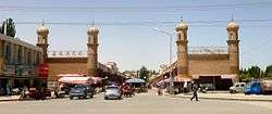 Main entrance of a bazaar in the county seat of Qiemo | |
.png) Location of Qiemo County (pink) in Bayingolin Prefecture (yellow) and Xinjiang | |
 Qiemo Location of the county seat in Xinjiang | |
| Coordinates (Qiemo County government): 38°08′46″N 85°31′48″E | |
| Country | People's Republic of China |
| Autonomous region | Xinjiang |
| Autonomous prefecture | Bayingolin |
| Area | |
| • Total | 138,680 km2 (53,540 sq mi) |
| Population (2010)[1] | |
| • Total | 65,572 |
| • Density | 0.47/km2 (1.2/sq mi) |
| Ethnic groups | |
| • Major ethnic groups | Uyghur, Han Chinese[2] |
| Time zone | UTC+8 (China Standard) |
| Postal code | 841900 |
| Website | www |
| Qiemo County | |||||||||||
|---|---|---|---|---|---|---|---|---|---|---|---|
| Uyghur name | |||||||||||
| Uyghur | قاغىلىق ناھىيىسى | ||||||||||
| |||||||||||
| Chinese name | |||||||||||
| Simplified Chinese | 且末县 | ||||||||||
| Traditional Chinese | 且末縣 | ||||||||||
| |||||||||||
| Alternative Chinese name | |||||||||||
| Simplified Chinese | 恰尔羌县 | ||||||||||
| Traditional Chinese | 恰爾羌縣 | ||||||||||
| |||||||||||
Name
"Qiemo (W-G: Ch'ieh-mo) 且末 = modern Cherchen or Charchan (Uyghur: Qarqan). There has been uncertainty about this name as Chavannes (1907), p. 156, and then Stein (1921a), Vol. I, 296 ff., gave an incorrect romanization for the first character. Chavannes, using the French EFEO romanization system, gave tsiu, and Stein used the Wade-Giles equivalent, chü. In fact, the character is correctly rendered k’ie in EFEO, ch’ieh in Wade-Giles and qie in pinyin. Nevertheless, there has never been any serious dispute about its identification with modern Cherchen."[6]
It has been suggested that the name "Cherchen" may have been derived from Shanshan, the kingdom that once ruled the area.[7] A number of different names have been used for the town, Lionel Giles has recorded the following names for Ruoqiang Town (with his Wade-Giles forms of the Chinese names converted to pinyin):
- Jumo Han
- Zuomo (左末) Song Yun
- Jumo Jun [Sui]
- Zhemotuona (折摩馱那) Xuanzang
- Boxian Zhen (播仙鎭) [Tang, after A.D. 674]
- Jurjān [Mīrzā Haidar, sixteenth century]
- Charchan [modern name][8]
It was called Calmadana in Kharoshthi documents found in the region.
History
Several mummies were found in Cherchen including the Cherchen Man.
The modern county is based on the ancient kingdom of Qiemo (且末) mentioned in the Hanshu and the Hou Hanshu. According to the Hanshu, Qiemo/Cherchen had "230 households, 1,610 individuals and 320 persons able to bear arms."[9]
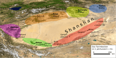
The ancient Qiemo may have been located on the east of the Cherchen (Charchan) river, across from the modern Cherchen.[10] Qiemo became part of Loulan Kingdom after it was under Chinese control during the Han dynasty and renamed Shanshan.[11] Later in 442 CE, after an attack by Juqu Anzhou, King Bilong of Shanshan fled to Qiemo together with half of his countrymen so Shanshan came to be ruled by Qiemo.[12]
The Buddhist pilgrim Xuanzang passed through this region in 644 on his return from India to China, visited a town called Nafubo (納縛波, thought to be Charklik) of Krořän (Loulan), and wrote of Ziemo (Qiemo), "A fortress exists, but not a trace of man".[13]
Marco Polo who passed through Cherchen mentioned it as a province with a town of the same name as its chief city. Its inhabitants were described as Muslims.[14]
Geography
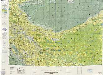
From the south to the north, the lands of the county run from the main range of the Kunlun Mountains (which forms the border with the Tibet Autonomous Region) to the middle of the Taklamakan Desert. The southernmost area of the county includes the northern side of part of the Ulugh Muztagh range (the main range of the Kunlun), and a section of the Altyn-Tagh range which runs roughly parallel to the main range of the Kunlun. Most of the county population lives in the northern foothills of the mountains, in the oases watered by snow-fed rivers.
The Qiemo River (Qarqan River) near the town of Ziemo (Qiemo) is frozen for two to three months in the winter. From the foot of the mountains to the oasis of Ziemo (Qiemo), it has a faIl of nearly 4000 feet.
Climate
| Climate data for Qiemo (1971−2000) | |||||||||||||
|---|---|---|---|---|---|---|---|---|---|---|---|---|---|
| Month | Jan | Feb | Mar | Apr | May | Jun | Jul | Aug | Sep | Oct | Nov | Dec | Year |
| Average high °C (°F) | −0.5 (31.1) |
5.3 (41.5) |
14.0 (57.2) |
23.0 (73.4) |
28.0 (82.4) |
31.1 (88.0) |
32.8 (91.0) |
32.2 (90.0) |
27.4 (81.3) |
19.6 (67.3) |
9.8 (49.6) |
1.3 (34.3) |
18.7 (65.6) |
| Average low °C (°F) | −13.8 (7.2) |
−9.3 (15.3) |
−1.7 (28.9) |
6.3 (43.3) |
11.7 (53.1) |
15.4 (59.7) |
17.4 (63.3) |
15.5 (59.9) |
9.6 (49.3) |
1.5 (34.7) |
−5.2 (22.6) |
−11.6 (11.1) |
3.0 (37.4) |
| Average precipitation mm (inches) | 0.5 (0.02) |
0.4 (0.02) |
0.7 (0.03) |
1.1 (0.04) |
1.7 (0.07) |
7.1 (0.28) |
7.3 (0.29) |
4.2 (0.17) |
0.7 (0.03) |
0.1 (0.00) |
0.0 (0.0) |
0.4 (0.02) |
24.2 (0.97) |
| Average precipitation days (≥ 0.1 mm) | 1.1 | 0.7 | 0.3 | 0.5 | 1.0 | 2.9 | 3.5 | 1.8 | 0.6 | 0.1 | 0.1 | 0.8 | 13.4 |
| Source: Weather China | |||||||||||||
Administrative divisions

Qiemo County includes five towns, eight townships and other areas:[15][16][1]
Towns (镇)
- Qiemo Town (且末镇), Tatrang (Tatirang; 塔提让镇, formerly 塔提让乡), Aqqan[17] (Aqiang, A-ch'iang; 阿羌镇, formerly 阿羌乡), Aoyiya Yilake (奥依亚依拉克镇, formerly 奥依亚依拉克乡), Tazhong (塔中镇), Aral (Arele; 阿热勒镇, formerly 阿热勒乡)
Townships (乡)
- Qiongkule Township (琼库勒乡), Tuogela Keleke Township (托格拉克勒克乡), Bage Airike Township (Bage'airike; 巴格艾日克乡), Yengiostang Township (Yingwusitang; 英吾斯塘乡), Aketi Kandun Township (Aketikandun; 阿克提坎墩乡), Kuoshi Satema Township (Kuoshisatema; 阔什萨特玛乡), Koramlik Township[17][18] (Kula Muleke, Ku-la-mu-le-k'o; 库拉木勒克乡)
County Autonomous Regions (县辖区)
- Aqiang District (阿羌区)
Others
- 农二师且末工程支队
Economy
The economy of the county is primarily based on agriculture and animal husbandry. Agricultural products of the county include wheat, corn, cotton and rapeseed. Lynx and fox hunting in the county produces valuable animal skins. Mining in the county includes coal, jade and asbestos. Industries in the county include mining, leather making, and grain and oil processing.[3]
Demographics
As of 2015, 50,754 of the 69,464 residents of the county were Uyghur, 18,365 were Han Chinese and 345 were from other ethnic groups.[19]
As of 1999, 77.5% of the population of Qarqan (Qiemo) County was Uyghur and 22.31% of the population was Han Chinese.[20]
Transportation
- Qiemo Airport
- China National Highway 315
Notable persons
Notes
- From map: "The representation of international boundaries is not necessarily authoritative."
References
- 且末县历史沿革 [Ruoqiang County Historical Development] (in Chinese). XZQH.org. 30 January 2015. Retrieved 6 December 2019.
2003年,且末县总面积138680平方千米,{...}2010年第六次人口普查,且末县常住总人口65572人,其中:且末镇18893人,阿热勒乡2304人,琼库勒乡5455人,托格拉克勒克乡8011人,巴格艾日克乡4235人,英吾斯塘乡6233人,阿克提坎墩乡4081人,阔什萨特玛乡2982人,塔提让乡4226人,阿羌乡2064人,库拉木勒克乡2008人,奥依亚依拉克乡1853人,兵团农二师且末工程支队1715人,兵团三十八团1512人。 2013年1月9日,自治区政府(新政函[2013]8号)批复同意撤销奥依亚依拉克乡,设立奥依亚依拉克镇。2014年10月20日,自治区政府(新政函[2014]178号)批复同意撤销塔提让乡,设立塔提让镇,并将县直辖的26848平方公里划归塔提让镇管辖。调整后,全县辖3个镇、9个乡:且末镇、奥依亚依拉克镇、塔提让镇、阿热勒乡、琼库勒乡、托格拉克勒克乡、巴格艾日克乡、英吾斯塘乡、阿克提坎墩乡、阔什萨特玛乡、阿羌乡、库拉木勒克乡。
- 1997年且末县行政区划. XZQH.org (in Chinese). 10 December 2010. Retrieved 28 February 2020.
面积14万平方千米,人口4.9万,有维吾尔、汉、回等民族,其中维吾尔族占82.3%,汉族占17.7%,
- 夏征农; 陈至立, eds. (September 2009). 辞海:第六版彩图本 [Cihai (Sixth Edition in Color)] (in Chinese). 上海. Shanghai: 上海辞书出版社. Shanghai Lexicographical Publishing House. p. 1173. ISBN 9787532628599.
且(jū){...}且末 县名。在新疆维吾尔自治区南部,{...}经济以农、牧业为主,农产有小麦、玉米、棉花、油菜籽。狩猎业亦盛,产猞猁、狐狸等珍贵毛皮。矿产有煤、玉石、石棉。工业有采矿、皮毛和粮油加工等。
- Ministry of Housing and Urban-Rural Development (2010). 建筑抗震设计规范 [GB50011-2010: Code for Seismic Design of Buildings] (in English and Chinese). Beijing: China Architecture & Building Press. p. 203 – via Google Books.
Qarqan County
- Ivan Watson and Ben Westcott (21 January 2019). "Uyghur refugee tells of death and fear inside China's Xinjiang camps". CNN. Retrieved 8 April 2020.
In April 2017, while in her parents' home county of Qarqan, 1,184 kilometers (735 miles) away from Urumqi, she says she was taken away from her two remaining children and placed in detention by Chinese authorities.
CS1 maint: uses authors parameter (link) - Hill (2015), Vol. I, p. 84.
- Mallory, J. P. & Mair, Victor H. (2000). The Tarim Mummies: Ancient China and the Mystery of the Earliest Peoples from the West. Thames & Hudson. London. p. 81. ISBN 0-500-05101-1.
- Giles (1930-1932), p. 846.
- Hill (2015), Vol. I, p. 85.
- Miller (1959), p. 24, n. 44.
- Hill (2015)
- Weishu Original text: 真君三年,鄯善王比龍避沮渠安周之難,率國人之半奔且末,後役屬鄯善。 Translation: In the third year of Zhenjun, the Loulan king Bilong, so as to avoid troubles from Juqu Anzhou, led half his countrymen and fled to Qiemo, which later controlled Shanshan.
- Da Tang Xiyu Ji Original text: 从此东行六百余里至折摩驮那故国。即涅末地也。城郭岿然人烟断绝。复此东北行千余里至纳缚波故国。即楼兰地也。
- J.M. Dent (1908), "Chapter 36: Of the Town of Lop Of the Desert in its Vicinity - And of the strange Noises heard by those who pass over the latter", The travels of Marco Polo the Venetian, pp. 99–101
- 且末县行政区划. 新疆且末县人民政府 (in Chinese). 新疆且末县人民政府办公室. 7 July 2019. Retrieved 6 December 2019.
且末县行政区划 乡(镇)乡镇个数(个)名称 乡 镇 国营农牧场 村 居委会 全县合计 8 5 3 4 5 且末镇 1 1 5{...}阿热勒乡 1 3{...}琼库勒乡 1 4{...}托乎拉克勒克乡 1 6{...}英吾斯塘乡 1 7{...}巴格艾日克乡 1 6{...}阿克提坎墩乡 1 4{...}阔什萨特玛乡 1 4{...}塔提让镇 1 5{...}阿羌镇 1 4{...}库拉木勒克乡 1 5{...}奥依亚伊拉克镇 1 5{...}吐拉牧场 1 昆其布拉克牧场 1 良种场 1 塔中镇 1
- 2018年统计用区划代码和城乡划分代码:且末县 [2018 Statistical Area Numbers and Rural-Urban Area Numbers: Qiemo County] (in Chinese). National Bureau of Statistics of the People's Republic of China. 2018. Retrieved 6 December 2019.
统计用区划代码 名称 652825100000 且末镇 652825101000 奥依亚依拉克镇 652825102000 塔提让镇 652825103000 塔中镇 652825104000 阿羌镇 652825105000 阿热勒镇 652825201000 琼库勒乡 652825202000 托格拉克勒克乡 652825203000 巴格艾日克乡 652825204000 英吾斯塘乡 652825205000 阿克提坎墩乡 652825206000 阔什萨特玛乡 652825209000 库拉木勒克乡 652825501000 兵团三十七团 652825502000 兵团三十八团
- Collins World Atlas Illustrated Edition (3rd ed.). HarperCollins. 2007. p. 82. ISBN 978-0-00-723168-3 – via Internet Archive.
Koramlik{...}Aqqan
- World Atlas Trade & Logistics Edition. World Trade Press. 2008. p. 86. ISBN 978-1-885073-44-0 – via Internet Archive.
Koramlik
- 3-7 各地、州、市、县(市)分民族人口数 (in Chinese). شىنجاڭ ئۇيغۇر ئاپتونوم رايونى 新疆维吾尔自治区统计局 Statistic Bureau of Xinjiang Uygur Autonomous Region. 15 March 2017. Archived from the original on 11 October 2017. Retrieved 3 September 2017.
- Morris Rossabi, ed. (2004). Governing China’s Multiethnic Frontiers (PDF). University of Washington Press. p. 178. ISBN 0-295-98390-6.
- Giles, Lionel (1930–1932). "A Chinese Geographical Text of the Ninth Century." BSOS VI, pp. 825–846.
- Hill, John E. (2015). Through the Jade Gate - China to Rome: A Study of the Silk Routes 1st to 2nd Centuries CE. Second Edition. Vols. I-II. CreateSpace. North Charleston, South Carolina.
- Miller, Roy Andrew (1959). Accounts of Western Nations in the History of the Northern Chou Dynasty. University of California Press.

External links

- A tourism guide to Cherchen / Qiemo
- Tourism helps ancient Xinjiang village shake off poverty (tourism in Kulamulak)
| Wikimedia Commons has media related to Qiemo County. |