Luntai County
Luntai County as the official romanized name, also transliterated from Mongolian as Bügür County, is a county in central Xinjiang Uyghur Autonomous Region and is under the administration of the Bayin'gholin Mongol Autonomous Prefecture. It contains an area of 14,189 km2 (5,478 sq mi). According to the 2002 census, it has a population of 90,000.
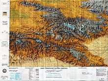
Map including northern part of the county (ATC, 1972)
Luntai County 轮台县 بۈگۈر ناھىيىسى | |
|---|---|
.png) Location of Luntai County (red) within Bayingolin Prefecture (yellow) and Xinjiang | |
 Luntai Location of the seat in Xinjiang | |
| Coordinates: 41°46′N 84°10′E | |
| Country | People's Republic of China |
| Autonomous region | Xinjiang |
| Autonomous prefecture | Bayingolin |
| Time zone | UTC+8 (China Standard) |
| Luntai County | |||||||||||
|---|---|---|---|---|---|---|---|---|---|---|---|
| Chinese name | |||||||||||
| Simplified Chinese | 轮台县 | ||||||||||
| Traditional Chinese | 輪台縣 | ||||||||||
| |||||||||||
| Alternative Chinese name | |||||||||||
| Simplified Chinese | 布古尔县 | ||||||||||
| Traditional Chinese | 布古爾縣 | ||||||||||
| |||||||||||
| Mongolian name | |||||||||||
| Mongolian script | ᠪᠦᠭᠦᠷ ᠱᠢᠨᠢ | ||||||||||
| Uyghur name | |||||||||||
| Uyghur | بۈگۈر ناھىيىسى | ||||||||||
| |||||||||||
Luntai has a long history associated with China. When the city refused aid to Li Guangli's Fergana campaign (c. 101 BC), the inhabitants were slaughtered. Around 80 BC, a Han military colony was established on the site.[1]
References
- Loewe, Michael (1979). "Introduction". In Hulsewé, Anthony François Paulus (ed.). China in Central Asia: The Early Stage: 125 BC – AD 23. Brill. pp. 1–70. ISBN 978-90-04-05884-2. Pages 43, 46.
Further Readings
- Yap, Joseph P, (2019). The Western Regions, Xiongnu and Han, from the Shiji, Hanshu and Hou Hanshu. ISBN 978-1792829154
This article is issued from Wikipedia. The text is licensed under Creative Commons - Attribution - Sharealike. Additional terms may apply for the media files.