Danjiangkou
Danjiangkou (Chinese: 丹江口; pinyin: Dānjiāngkǒu) is a county-level city of northwestern Hubei Province, People's Republic of China, bordering Henan province to the northeast. It has a population of more than 150,000 and is under the administration of Shiyan City.
Danjiangkou 丹江口市 | |
|---|---|
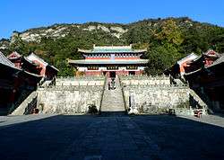 Zixiao Palace | |
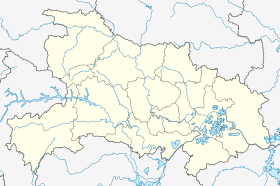 Danjiangkou Location in Hubei | |
| Coordinates: 32°34′N 111°29′E | |
| Country | People's Republic of China |
| Province | Hubei |
| Prefecture-level city | Shiyan |
| Area | |
| • County-level city | 3,121 km2 (1,205 sq mi) |
| • Urban | 214.94 km2 (82.99 sq mi) |
| Population (2010)[1] | |
| • County-level city | 443,755 |
| • Estimate (2017) | 478,000 |
| • Density | 140/km2 (370/sq mi) |
| • Urban | 209,300 |
| Time zone | UTC+8 (CST) |
| Website | djk |
Administrative Divisions
- Junzhou Road Subdistrict (均州路街道), Daba Road/Daba Subdistrict (大坝路街道/大坝街道), Danzhao Road Subdistrict (丹赵路街道), Sanguandian Subdistrict (三官殿街道)
Towns:
- Tuguanya (土关垭镇), Langhe (浪河镇), Dingjiaying (丁家营镇), Liuliping (六里坪镇), Yanchihe (盐池河镇), Junxian (均县镇), Xijiadian (习家店镇), Haoping (蒿坪镇), Shigu (石鼓镇), Liangshuihe (凉水河镇), Guanshan (官山镇), Longshan (龙山镇)
(Formerly included Tutai Township (土台乡))
Other areas:
Geography
Danjiangkou is located on the Hanshui River. As the city name indicates (Danjiangkou = "the mouth of the Danjiang"), it is located near the mouth of the Dan River (Danjiang).
The city proper is situated near the Danjiangkou Dam on this river.
Transport
Danjiangkou is the northwest terminus of the Hankou–Danjiangkou Railway.
External links
References
- 丹江口市历史沿革 [Danjiangkou City Historical Development]. 行政区划网 [www.xzqh.org] (in Chinese). 6 August 2014. Retrieved 11 December 2018.
1996年,丹江口市面积3121平方千米,{...}2010年第六次人口普查,丹江口市常住总人口443755人,其中:均州路街道55248人,大坝路街道48225人,丹赵路街道39091人,三宫[sic]殿街道21346人,土关垭镇10408人,浪河镇14147人,丁家营镇13530人,六里坪镇47148人,盐池河镇6552人,均县镇19916人,习家店镇29896人,蒿坪镇9067人,石鼓镇9049人,凉水河镇19547人,官山镇10693人,土台乡9176人,新港经济开发管理处12876人,牛河林业开发管理区5624人,白杨坪林业开发管理区1909人,大沟林业开发管理区5136人,武当山特区55171人。 全市辖5个街道、12个镇:均州路街道、大坝街道、丹赵路街道、三官殿街道、武当山街道(实际由武当山特区管理)、土关垭镇、浪河镇、丁家营镇、六里坪镇、盐池河镇、均县镇、习家店镇、蒿坪镇、石鼓镇、凉水河镇、官山镇、龙山镇。
- Ministry of Housing and Urban-Rural Development, ed. (2019). China Urban Construction Statistical Yearbook 2017. Beijing: China Statistics Press. p. 66. Retrieved 11 January 2020.
- 区划人口 [Administrative Divisions & Population]. 丹江口市人民政府 [Danjiangkou City People's Government] (in Chinese). 30 September 2018. Retrieved 11 December 2018.
【区划】截至2016年,丹江口市下辖4个街道办事处,12个镇,及武当山旅游经济特区(即湖北省武当山风景区),共有41个社区(居委会)、223个村。即习家店镇、蒿坪镇、均县镇、六里坪镇、土关垭镇、凉水河镇、石鼓镇、浪河镇、丁家营镇、盐池河镇、官山镇、龙山镇、三官殿办事处、丹赵路办事处、大坝办事处、均州路办事处、大沟林业开发管理区、牛河林业开发管理区、白杨坪林业开发管理区、新港经济开发管理处、武当山旅游经济特区。
- 2017年统计用区划代码和城乡划分代码:丹江口市 [2017 Statistical Area Numbers and Rural-Urban Area Numbers: Danjiangkou City] (in Chinese). National Bureau of Statistics of the People's Republic of China. 2017. Retrieved 11 December 2018.
统计用区划代码 名称 420381001000 均州路街道办事处 420381002000 大坝路街道办事处 420381003000 丹赵路街道办事处 420381005000 三官殿街道办事处 420381100000 土关垭镇 420381101000 浪河镇 420381102000 丁家营镇 420381103000 六里坪镇 420381104000 盐池河镇 420381105000 均县镇 420381106000 习家店镇 420381107000 蒿坪镇 420381108000 石鼓镇 420381109000 凉水河镇 420381110000 官山镇 420381111000 龙山镇 420381400000 新港经济开发管理处 420381401000 牛河林业开发管理区 420381402000 白杨坪林业开发管理区 420381403000 大沟林业开发管理区 420381450000 武当山特区
This article is issued from Wikipedia. The text is licensed under Creative Commons - Attribution - Sharealike. Additional terms may apply for the media files.