Hoboksar Mongol Autonomous County
Hoboksar (Chinese: 和布克赛尔蒙古自治县; pinyin: Hébùkèsàiěr Měnggǔ Zìzhìxiàn; refers to the historic name of Hefeng County, 和丰县; Héfēng Xiàn) is an autonomous county for Mongol people in the middle north of Xinjiang Uyghur Autonomous Region, Western China, it is under administration of Tacheng Prefecture. The county has an area of 28,784 km2 (11,114 sq mi) with a population of 62,100 (as of 2010 Census).[1] It has eight towns and townships and seven farms, Hoboksar Town is its county seat.[2]
Hoboksar County 和布克赛尔县 قوبۇقسار ناھىيىسى | |
|---|---|
Hoboksar Mongol Autonomous County ᠬᠣᠪᠣᠭᠰᠠᠶᠢᠷ ᠮᠣᠩᠭᠣᠯ ᠥᠪᠡᠷᠲᠡᠭᠡᠨ ᠵᠠᠰᠠᠬᠤ ᠰᠢᠶᠠᠨ和布克赛尔蒙古自治县 قوبۇقسار موڭغۇل ئاپتونوم ناھىيىسى قوبىقسارى موڭعۇل اۆتونوميالى اۋدانى | |
.png) | |
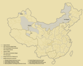
 Hoboksar Location in Xinjiang | |
| Coordinates: 46°47′N 85°43′E | |
| Country | People's Republic of China |
| Autonomous region | Xinjiang |
| Prefecture | Tacheng |
| Township-level divisions | 2 towns and 5 townships |
| County seat | Hoboksar Town |
| Area | |
| • Total | 28,784 km2 (11,114 sq mi) |
| Population | |
| • Total | 50,000 |
| • Density | 1.7/km2 (4.5/sq mi) |
| Time zone | UTC+8 (China Standard) |
| Postal code | 834400 |
| Area code(s) | 0901 |
| Hoboksar Mongol Autonomous County | |||||||||
|---|---|---|---|---|---|---|---|---|---|
| Chinese name | |||||||||
| Simplified Chinese | 和布克赛尔蒙古自治县 | ||||||||
| Traditional Chinese | 和布克賽爾蒙古自治縣 | ||||||||
| |||||||||
| Alternative Chinese name | |||||||||
| Simplified Chinese | 和丰县 | ||||||||
| Traditional Chinese | 和豐縣 | ||||||||
| |||||||||
| Mongolian name | |||||||||
| Mongolian Cyrillic | Ховогсайр | ||||||||
| Mongolian script | ᠬᠣᠪᠣᠭᠰᠠᠶᠢᠷ ᠮᠣᠩᠭᠣᠯ ᠥᠪᠡᠷᠲᠡᠭᠡᠨ ᠵᠠᠰᠠᠬᠤ ᠰᠢᠶᠠᠨ | ||||||||
| |||||||||
| Uyghur name | |||||||||
| Uyghur | قوبۇقسار | ||||||||
| |||||||||
| Kazakh name | |||||||||
| Kazakh | قوبىقسارى موڭعۇل اۆتونوميالى اۋدانى Qobyqsary Mońǵul avtonomıaly aýdany Қобықсары Моңғұл автономйалы ауданы | ||||||||
Name
The name of Hoboksar (和布克赛尔) was individually referred to as "Hobok" (和布克) and "Sar" (赛尔) from the Mongolian language. Hobok is Hobok River (和布克河), it means "sika deer" (梅花鹿), the river was named after its river basin within huge amount of sika deer in the past. Sar is the Salair Mountains and it means horseback (马背), the mountain was named after its shape like a horseback.[1]
History
At the latest starting from the Qin dynasty, the Saka people appeared in the place of present Hoboksar area. This was followed by the Usans and Xiongnu people.
The place was part of Usan Sate in the Western Han period. It was merged to the Later Cheshi Kingdom (车师后国) in the Eastern Han and Three Kingdoms periods. It was part of Xianbei during the Jin period, part of Rouran Khaganate, followed by the First Turkic Khaganate, Western Turkic Khaganate in the period of Northern and Southern dynasties. It was under the administration of Kunling Commandery (昆陵都护府) of the Tang dynasty in 657, ruled by Karluks (葛逻禄) in 789, Uyghur Khaganate (回纥汗国) in 808, Kyrgyz Khaganate (黠戛斯汗国) in 840 and Qara Khitai (西辽) in 1127, it was merged to the Yuan dynasty in 1218, became the dominion of Ögedei Khan (窝阔台汗) in 1225, then after that, the territory of Bechbaliq Province (Beiting, 别失八里行省) and Almaliq Province (阿力麻里行省) in 1280, it was merged to Chagatai Khanate (察合台汗国) during 1324 - 1328.
It was part of Bechbaliq Khaganate (别失八里汗国) in 1370, the herd land of the Oirats tribe in the 5th century. After Batur's (巴图尔) succession to Khong Tayiji (浑台吉, the chieftain) in 1636, he quickly unified the Oirats tribes (卫拉特各部) in the North Xinjiang, with Hoboksar (霍博克赛里) as the base camp. The Khong Tayiji of Batur (巴图尔浑台吉) built a castle five kilometers away southeast of the present county seat of Hoboksar Town between 1639 - 1643.
The place of Hoboksar was under jurisdiction of Counsellor of Tarbaghatay (塔尔巴哈台参赞大臣, under leadship of the General of Ili; "Tarbaghatay", the prensent Tacheng Prefecture) in 1758. The Torghut Tribe back far away from the south side of Russian Ezil River (额济勒河, the present Volga River), immigrated to Hoboksar (霍博克赛里) in 1771.[1]
Hoxtolgay Xianzuo (和什托洛盖县佐, similar to a division under vice county magistrate; in the present Hoxtolgay Town) under jurisdiction of Shawan County, was formed in 1915 and it was transferred to Tacheng Circuit (塔城道) in 1916. Hoxtolgay Xianzuo was changed to Hoxtolgay Division (和什托洛盖设治局) and the Hefeng Division (和丰设治局) was formed in 1941. Hefeng County (和丰县) was organized in 1944 and its county seat is in the present Hoboksar Town. Hefeng County was renamed to Hoboksar Mongol Autonomous County on September 10, 1954.[3]
Geography
Hoboksar County is located south of the Tarbagatai-Saur mountain range, and its northern part, where most of the county's population lives, receives some water from streams (such as the Baiyang River) flowing from the snow-capped mountains. The southeastern part of the county is in Gurbantünggüt Desert.
Historically, the large Alan Nur and Manas Lake were located in the desert southwestern part of the county; they received water, at least intermittently, both from the streams flowing across the desert from the north and from the south (via the Manas River). Due to the increasing water diversion for irrigation and other human needs, as well as geological processes, the Alan Nur has fully dried out, and the Manas Lake is in a fairly precarious situation as well.[4]
The Irtysh–Karamay Canal, constructed around the turn of the 21st century, crosses the county's southeastern part; the canal's Fengcheng Reservoir is located on the county's border with Karamay City's Urho District.
A point situated some 30 miles ESE of Hoxtolgay Town is listed as the farthest point from the sea (at 46°16.8′N 86°40.2′E) by the Guinness Book of World Records. It is roughly 2646 kilometres away from the Arctic Ocean and a similar distance from the Bay of Bengal and the Arabian Sea (see Continental Pole of Inaccessibility for other candidates).
The "record-setting" location of the county attracted the attention of advertisers for the Corona beer brand, who staged and documented a trip of a few residents of the village of Bulin (布林, 46°43′13″N 86°7′59″E), in Hoboksar County's Chagankulei Township (Chinese: 查干库勒乡; pinyin: Chágànkùlei xiāng) to the sea coast in Hainan Island.[5]
Administrative divisions
Town (镇)
- Hoboksar Town (和布克赛尔镇), Hebutuoluogai (和什托洛盖镇)
Township (乡)
- Xiazigai Township (夏孜盖乡), Tiebukenwusan Township (铁布肯乌散乡), Chagankule Township (查干库勒乡), Bayinaopao Township (巴音敖包乡), Motege Township (莫特格乡)
Others
- Yikewutubulage Ranch (伊克乌图布拉格牧场), Nareheuke Ranch (那仁和布克牧场), Bagawutubulage Ranch (巴嘎乌图布拉格牧场), Busitunge Ranch (布斯屯格牧场), XPCC No. 184 (兵团184团), Shajihai Mine (砂吉海矿区)
Climate
| Climate data for Hoboksar County (1971−2000) | |||||||||||||
|---|---|---|---|---|---|---|---|---|---|---|---|---|---|
| Month | Jan | Feb | Mar | Apr | May | Jun | Jul | Aug | Sep | Oct | Nov | Dec | Year |
| Average high °C (°F) | −6.1 (21.0) |
−3.9 (25.0) |
2.0 (35.6) |
12.2 (54.0) |
19.0 (66.2) |
23.9 (75.0) |
25.6 (78.1) |
24.3 (75.7) |
18.5 (65.3) |
10.0 (50.0) |
0.8 (33.4) |
−4.4 (24.1) |
10.2 (50.3) |
| Average low °C (°F) | −16.8 (1.8) |
−15.1 (4.8) |
−9.2 (15.4) |
−0.3 (31.5) |
6.1 (43.0) |
11.4 (52.5) |
13.4 (56.1) |
11.5 (52.7) |
6.0 (42.8) |
−1.5 (29.3) |
−9.3 (15.3) |
−14.3 (6.3) |
−1.5 (29.3) |
| Average precipitation mm (inches) | 2.6 (0.10) |
2.3 (0.09) |
5.0 (0.20) |
8.0 (0.31) |
12.5 (0.49) |
25.1 (0.99) |
34.2 (1.35) |
21.0 (0.83) |
10.9 (0.43) |
5.3 (0.21) |
5.4 (0.21) |
4.1 (0.16) |
136.4 (5.37) |
| Average precipitation days (≥ 0.1 mm) | 4.1 | 3.8 | 5.6 | 5.3 | 7.2 | 9.4 | 11.0 | 8.6 | 5.7 | 4.1 | 5.1 | 5.3 | 75.2 |
| Average relative humidity (%) | 65 | 61 | 58 | 46 | 42 | 44 | 47 | 46 | 46 | 55 | 63 | 67 | 53 |
| Mean monthly sunshine hours | 181.5 | 198.0 | 253.1 | 273.6 | 297.7 | 291.4 | 300.2 | 299.1 | 271.3 | 226.3 | 170.6 | 155.1 | 2,917.9 |
| Percent possible sunshine | 66 | 69 | 69 | 68 | 64 | 62 | 63 | 68 | 72 | 67 | 61 | 58 | 66 |
| Source: China Meteorological Administration | |||||||||||||
Demographics
The Chinese Mongols that live in Bayingolin and Hoboksar come from varied origins. A majority are Torghuts, who speak the Oirat language. Chahar Mongols who immigrated from Inner Mongolia also live in Hoboksar and Bayingolin, and there are also Uriankhai Mongols, who are considered Mongols in China but Tuvans to some outside observers. A fair number of Daur people and Dongxiang people live in Hoboksar especially, and they speak Mongolic languages.[6]
Culture
Hoboksar is traditionally considered the place of origin of the Epic of Jangar. The Jangar Culture and Art Palace (江格尔文化艺术宫) was opened in the county in 2014.[7][8]
Transportation
China National Highway 217 and the new Kuytun–Beitun Railway both cross Hoboksar county along the same north–south corridor. There is daily passenger service at the Hoxtolgay station.
References
- 和布克赛尔县历史沿革. xzqh.org. 2014-12-04. Retrieved 2019-08-27.
- 和布克赛尔县概况. xzqh.org. 2014-12-04. Retrieved 2019-08-27.
- 和布克赛尔概况. Hoboksar.gov.cn. Retrieved 2019-08-27.
- Yao, Yonghui; Li, Huiguo (2010), "Tectonic geomorphological characteristics for evolution of the Manas Lake", Journal of Arid Land, 2 (3): 167–173, doi:10.3724/SP.J.1227.2010.00167
- Daniel Gilroy, Corona Extra: A Journey From ‘The Pole Of naccessibility’. Here's the campaign's web site: http://www.coronaextra.eu/china/#/
- Benson, Linda K.; Svanberg, Ingvar (1998). China's Last Nomads: The History and Culture of China's Kazaks. M.E. Sharpe. p. 25.
- Jangar Palace Opens in Xinjiang’s Hoboksar Archived 2014-02-04 at the Wayback Machine
- 世界最大的江格尔文化艺术宫建成投用
External links
- County government - official site (in Chinese)
| Regions |
|  | |||||||
|---|---|---|---|---|---|---|---|---|---|
| Prefectures and counties |
| ||||||||
| |||||||||
| Authority control |
|
|---|