Yima, Henan
Yima (simplified Chinese: 义马; traditional Chinese: 義馬; pinyin: Yìmǎ) is a county-level city in Henan, China. It is under the administration of Sanmenxia. Yima is located in the western part of Henan province. It is located in the Xiaoshan Old Tracks, with Yangshao Peak to the north and Balcony Loewe to the south. Since ancient times, it was a key point between Luoyang and Changan. It has great strategic importance, being often a battlefield or a place for merchants to trade. Yima was founded two years before the Qin Dynasty established the new county system (it took 81 years to build the city). After the People's Republic of China was founded, Yima reached county-level status in Henan Province in 1981. It was originally under the administration of Luoyang. However, since 1986, it has been under the administration of Sanmenxia. Currently, it is one of the forty-eight counties in Henan Province trying to expand. It is also one of China's top hundred counties, as well as the smallest city in China (112 square kilometers with a population of about 160,000). Yima has the advantage of being self-sustaining, allowing for massive redevelopment of its industry and increased economic growth. In 2010, the city's per capita GDP was over seventy thousand RMB, which is about ten thousand US dollars. It ranks alongside moderately developed countries. In 2010, it was ranked first economically in Henan Province (perennial top five). The city is also known as "The Home of Martial Arts".
Yima 义马市 | |
|---|---|
 | |
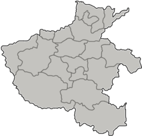 Yima Location in Henan | |
| Coordinates: 34°44′49″N 111°52′30″E | |
| Country | People's Republic of China |
| Province | Henan |
| Prefecture-level city | Sanmenxia |
| Population (2007) | 141,532 |
| Time zone | UTC+8 (China Standard) |
| Postal code | 472300 |
| Website | www |
Location
Yima is in the western part of Henan. It has a north latitude of 34°42′–34°46′, and an east longitude of 111°50′47″–111°50′49. It is 183 km (114 mi) away from Zhengzhou in the east, and 65 km (40 mi) away from Sanmenxia City in the west. The southern, western, northern, and northeastern parts are near Mianchi county's towns. Such towns include Xiaopotou, Zhangdachi, Duncungou, Tani, Zhanggou, Cuimen, Chiwu, Meiyaogou, Duancun, Fakeling, Xuzhuang, Yichang, Baohou, Hukang, Wuzhuang, Chenzhuang, etc. On the southeast corner, there are neighboring villages, such as Xin'an county's iron gates and Yiyang county's salt towns. In the east, there is Huanglian Slope. In the west, there is East Thani Creek. The length between them is 14 km (8.7 mi). In the south, there is a new district doing business in the southern ridge. In the north, there is a mesa. The width is 9 km (5.6 mi). The total area is 112 km2 (43 sq mi).[1]
Climate
Yima is located in a warm temperate zone, on the southern edge of the North Subtropics. There are four distinct seasons and abundant sunshine. The average annual temperature is 12.4 °C. During July, the hottest month of the year, the annual temperature is 25.5 °C. In the coldest months, the average temperature is -2.1 °C. The average annual amount of sunshine is 2250.4 hours, with an average annual sunshine rate of 51%. In the spring and summer months, there are northwest winds. In the autumn and winter months, there are southeast winds. There are rich animal and plant resources, with a rainfall of 666.9 mm.
Traffic
Yima City is 50 km (31 mi) long. To its east is Zhengzhou, Luoyang, which is 180 km (110 mi) away. To its west is Sanmenxia, which is 60 km (37 mi) away via Xi'an Longhai Railway. Lianhuo (Lianyungang, Huoerguosi) highway, labeled as National Highway 310, is 290 km (180 mi) long. The highway passes through towns and intersections in a criss-cross across the Octagon channel. Transportation is very convenient.
Cultural History
Yima has a long and magnificent history and culture, being one of the cradles of ancient China. It has many territorial and historical sites, along with a famous ancient culture.
- Chu Pit Site
Xiang Yu killed 200,000 Qin prisoners and threw their corpses into a hole. It is located twenty villages west of LiXingWan village. It is commonly known as a mass grave. In 206 BC, Xiang Yu massacred 200,000 prisoners right at this spot. In "History - Xiang Yu's notes", it says that "at night, the Chu army (led by Xiang Yu) killed 200,000 Qin soldiers in southern Xin'an (新安)", which is in present-day Yima. The site is in the shape of a pit, with an area of around 70-80 Mu (a Mu is an ancient unit for area, 1 Mu = 667 sq. m.). To the south, there was the river Jian; to the north, there was Tuling village. In the east and west, there was only flat plains. The hole's north was along LiXingWan Village. To the right, there was White Dragon Temple. In 1913, the Longhai Railway was built to run through the hole. Thus, the original shape no longer exists.[1]
- Empress' Palace
- The Old City of Qin Xin'an
- Yima's Ginkgo Fossils
In recent years, archaeologists discovered the site, which contains the world's oldest Gingkofossils. One of those fossils was dated to be from 1.8 million years ago, whose date was confirmed in the International Organization of Palaeobotany's sixth and seventh conference.
References
- 义马市人民政府网关于城市地理面积、历史文化的介绍. Yima People's Government.