Barkam
Barkam or Markang or Muerkvua is a county-level city in Ngawa Tibetan and Qiang Autonomous Prefecture, in the northwest of Sichuan province, People's Republic of China. The city seat is the town of Barkam.
Barkam 马尔康市 · འབར་ཁམས་གྲོང་ཁྱེར། · Muerkvua shi | |
|---|---|
 Overview of the city of Barkam | |
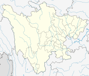
.png) Barkam City (red) in Ngawa Prefecture (yellow) and Sichuan | |
 Barkam Location of the seat in Sichuan | |
| Coordinates (Barkam municipal government): 31°54′21″N 102°12′23″E | |
| Country | People's Republic of China |
| Province | Sichuan |
| Autonomous prefecture | Ngawa |
| Township-level divisions | 3 towns 11 townships |
| Seat | Barkam Town |
| Area | |
| • Total | 6,639 km2 (2,563 sq mi) |
| Elevation | 2,615 m (8,579 ft) |
| Population (1999) | |
| • Total | 54,735 |
| • Density | 8.2/km2 (21/sq mi) |
| Postal code | 624000 |
| Area code(s) | 0837 |
| Website | maerkang.gov.cn |
| Barkam | |||||||
|---|---|---|---|---|---|---|---|
| Chinese name | |||||||
| Simplified Chinese | 马尔康 | ||||||
| Traditional Chinese | 馬爾康 | ||||||
| Hanyu Pinyin | Mǎ'ěrkāng | ||||||
| |||||||
| Tibetan name | |||||||
| Tibetan | འབར་ཁམས། | ||||||
| |||||||
Administrative divisions
Barkam has four towns and 10 townships:[1]
Towns: Barkam (马尔康镇), Zhuokeji (卓克基镇), Songgang (松岗镇), Sha'erzong (沙尔宗镇).
Townships: Suomo (梭磨乡), Baiwan (白湾乡), Dangba (党坝乡), Mu'erzong (木尔宗乡), Jiaomuzu (脚木足乡), Longerjia (龙尔甲乡), Dazang (大藏乡), Kangshan (康山乡), Caodeng (草登乡), Ribu (日部乡).
Transport
Climate
Due to its elevation, Barkam lies in the transition between a subtropical highland climate (Köppen Cwb) and humid continental climate (Köppen Dwb), with strong monsoonal influences; winters are frosty and summers warm with frequent rain. The monthly 24-hour average temperature ranges from −0.5 °C (31.1 °F) in December and January to 16.4 °C (61.5 °F) in July, while the annual mean is 8.75 °C (47.7 °F). Nearly two-thirds of the annual precipitation of 784 mm (30.9 in) occurs from June to September. With monthly percent possible sunshine ranging from 36% in June to 65% in December, the town receives 2,133 hours of bright sunshine annually. Diurnal temperature variation is large, averaging 16.0 °C (28.8 °F) annually.
| Climate data for Barkam (1981−2010 normals) | |||||||||||||
|---|---|---|---|---|---|---|---|---|---|---|---|---|---|
| Month | Jan | Feb | Mar | Apr | May | Jun | Jul | Aug | Sep | Oct | Nov | Dec | Year |
| Record high °C (°F) | 22.1 (71.8) |
24.8 (76.6) |
26.8 (80.2) |
31.3 (88.3) |
34.7 (94.5) |
34.5 (94.1) |
34.6 (94.3) |
34.6 (94.3) |
32.4 (90.3) |
30.6 (87.1) |
23.3 (73.9) |
19.3 (66.7) |
34.7 (94.5) |
| Average high °C (°F) | 10.8 (51.4) |
13.7 (56.7) |
16.6 (61.9) |
19.6 (67.3) |
22.2 (72.0) |
23.6 (74.5) |
25.2 (77.4) |
25.0 (77.0) |
22.3 (72.1) |
18.7 (65.7) |
14.9 (58.8) |
10.7 (51.3) |
18.6 (65.5) |
| Daily mean °C (°F) | −0.3 (31.5) |
3.1 (37.6) |
6.6 (43.9) |
9.9 (49.8) |
12.8 (55.0) |
15.0 (59.0) |
16.4 (61.5) |
15.9 (60.6) |
13.2 (55.8) |
9.1 (48.4) |
3.8 (38.8) |
−0.5 (31.1) |
8.8 (47.8) |
| Average low °C (°F) | −7.4 (18.7) |
−4.2 (24.4) |
−0.5 (31.1) |
3.0 (37.4) |
6.4 (43.5) |
9.7 (49.5) |
11.1 (52.0) |
10.6 (51.1) |
8.3 (46.9) |
4.0 (39.2) |
−2.7 (27.1) |
−7.2 (19.0) |
2.6 (36.7) |
| Record low °C (°F) | −16.0 (3.2) |
−13.1 (8.4) |
−12.6 (9.3) |
−4.2 (24.4) |
−2.2 (28.0) |
1.5 (34.7) |
2.2 (36.0) |
1.5 (34.7) |
−0.5 (31.1) |
−5.6 (21.9) |
−10.7 (12.7) |
−16.6 (2.1) |
−16.6 (2.1) |
| Average precipitation mm (inches) | 2.9 (0.11) |
8.1 (0.32) |
24.8 (0.98) |
53.9 (2.12) |
106.2 (4.18) |
150.9 (5.94) |
130.5 (5.14) |
112.5 (4.43) |
121.3 (4.78) |
61.3 (2.41) |
8.7 (0.34) |
2.8 (0.11) |
783.9 (30.86) |
| Average precipitation days (≥ 0.1 mm) | 2.8 | 4.9 | 10.1 | 14.9 | 20.0 | 22.4 | 20.5 | 18.0 | 19.8 | 15.3 | 4.7 | 2.1 | 155.5 |
| Average relative humidity (%) | 44 | 44 | 50 | 55 | 63 | 73 | 75 | 75 | 77 | 73 | 57 | 48 | 61 |
| Mean monthly sunshine hours | 200.8 | 178.4 | 187.3 | 189.3 | 184.2 | 153.4 | 161.1 | 177.3 | 142.0 | 164.3 | 193.8 | 201.4 | 2,133.3 |
| Percent possible sunshine | 63 | 57 | 51 | 49 | 43 | 36 | 37 | 43 | 38 | 47 | 61 | 65 | 48 |
| Source: China Meteorological Administration (precipitation days and sunshine 1971–2000)[2][3] | |||||||||||||
Demographics
The city had a population of 54,735 in 1999.[4] The area is traditionally inhabited by a branch of Rgyalrong people who speak the Situ language.[5]
Notes
- (in Chinese) National Bureau of Statistics - Barkam City.
- 中国气象数据网 - WeatherBk Data (in Chinese). China Meteorological Administration. Retrieved 2020-04-15.
- 中国地面国际交换站气候标准值月值数据集(1971-2000年). China Meteorological Administration. Archived from the original on 2013-09-21. Retrieved 2010-05-25.
- National Population Statistics Materials by County and City - 1999 Period, in China County & City Population 1999, Harvard China Historical GIS
- "Rgyalrong Culture" 嘉绒人文. Ma'erkang City Government website. Archived from the original on 2019-03-28. Retrieved 2019-09-19.
External links
- (in Chinese) Maerkang County Government site - Google translation
- (in Chinese) Maerkang - bashu.net - Google translation