Yining
Yining[4] (Chinese: 伊宁), also known as Ghulja (Uyghur: غۇلجا ) or Qulja (Kazakh: قۇلجا, Qulja)[lower-alpha 2] and formerly Ningyuan (寧遠), is a county-level city in Northwestern Xinjiang, People's Republic of China and the seat of the Ili Kazakh Autonomous Prefecture. Historically, Yining is the successor to the ruined city of Almaliq in neighbouring Huocheng County. Yining is the third largest city in Xinjiang after Ürümqi and Korla.
Yining Kuldja; Ining | |
|---|---|
| Yining City | |
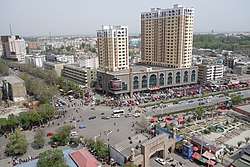 Cityscape of Yining | |
 Yining Location in Xinjiang | |
| Coordinates (Yining municipal government): 43°54′29″N 81°16′40″E | |
| Country | People's Republic of China |
| Autonomous region | Xinjiang |
| Autonomous prefecture | Ili |
| Area | |
| • County-level city | 629 km2 (243 sq mi) |
| • Urban (2018)[1] | 49 km2 (19 sq mi) |
| Population (2015)[2] | |
| • County-level city | 542,507 |
| • Density | 860/km2 (2,200/sq mi) |
| • Urban (2018)[3] | 345,000 |
| • Urban density | 7,000/km2 (18,000/sq mi) |
| Time zone | UTC+8 (China Standard[lower-alpha 1]) |
| Postal code | 835000 |
| Area code(s) | 0999 |
| Website | Official website |
| Yining | |||||||||||
|---|---|---|---|---|---|---|---|---|---|---|---|
| Chinese name | |||||||||||
| Simplified Chinese | 伊宁 | ||||||||||
| Traditional Chinese | 伊寧 | ||||||||||
| |||||||||||
| Alternative Chinese name | |||||||||||
| Chinese | 固勒扎 | ||||||||||
| |||||||||||
| Tibetan name | |||||||||||
| Tibetan | གུལ་ཅ | ||||||||||
| |||||||||||
| Mongolian name | |||||||||||
| Mongolian Cyrillic | Хулж | ||||||||||
| Mongolian script | ᠬᠤᠯᠵᠠ | ||||||||||
| Uyghur name | |||||||||||
| Uyghur | غۇلجا | ||||||||||
| |||||||||||
| Manchu name | |||||||||||
| Manchu script | ᡤᡡᠯᠵᠠ | ||||||||||
| Abkai | Gvlja | ||||||||||
| Möllendorff | Gūlja | ||||||||||
| Russian name | |||||||||||
| Russian | Кульджа | ||||||||||
| Romanization | Kuldzha | ||||||||||
| Kazak(h) name | |||||||||||
| Kazak(h) | قۇلجا Qulja Құлжа | ||||||||||
| Oirat name | |||||||||||
| Oirat | ᡎᡇᠯᠴᠠ | ||||||||||
| Chagatai name | |||||||||||
| Chagatai | غولجا | ||||||||||
Area and population
The city of Yining is a county-level administrative unit located along Ili River. As of 2015, it has an estimated population of 542,507, with a total land area of 629 km2 (243 sq mi).[5] It is the most populous city in the Ili Kazakh Autonomous Prefecture.
The land area and population of the City of Yining saw an increase in 2003; the increase resulted from the transfer of two villages with some 100 km2 (39 sq mi) of land from the adjacent Yining County, which is a separate administrative unit from the city.
History
Note on historical place names
From 13-15th century it was under the control of Chagatai Khanate. Another Mongol empire—the Zunghar Khanate—established around Ili area. In the 19th and early 20th century, the word Kuldja or Ghulja was often used in Russia and in the West as the name for the entire Chinese part of the Ili River basin as well as for its two main cities. The usage of 1911 Encyclopædia Britannica is fairly characteristic: it defines Kulja as a "territory in north-west China" bounded by the Russian border and the mountains that surround the Ili basin, and it talks about two major cities of the region:[6]
- Kulja (i.e. today's Yining), or more specifically Old Kulja (elsewhere, also called Taranchi Kulja), which was the commercial center of the region.
- Suidun (i.e. Suiding, now called Shuiding), or more specifically New Kulja, Manchu Kulja, or Ili (elsewhere, also Chinese Kulja), the Chinese fortress and the regional capital.
Until the 1860s Huiyuan to the south of Suiding was the regional capital.
Qing dynasty
The fort of Ningyuan (寧遠城) was built in 1762 to accommodate new settlers from southern Xinjiang. The forts of Huining (惠寧城) and Xichun (熙春城) built later in 1765 and 1780 were also located within the modern Yining City.
The Sino-Russian Treaty of Kulja 1851 opened the area for trade.
In 1864-66, the city suffered severely from fighting during the Dungan Revolt. The city and the rest of the Ili River basin were seized by the Russians in 1871 during Yakub Beg's independent rule of Kashgaria. It was restored to the Chinese under the terms of the Treaty of Saint Petersburg (1881). In 1888 the Ningyuan County was established.
The Geographical Magazine in 1875 by Sir Clements Robert Markham stated:
What little industry Kulja possesses is all due to the Chinese, who transplanted the taste for art, assiduity and skilfulness of their pigtailed race, even to these western outskirts of "the celestial flowery dominion of the Middle." Had the Taranjis and Kalmuks been left to themselves, or had they remained in a preponderating majority, Kulja would not be a bit farther advanced than either Yarkand or Aksu. The principal trades are the following:— founders, manufacturing kettles, plates, and other implements of a very primitive form; paper-makers, whose productions do not seem to be superior to the paper manufactured at the present time after Chinese patterns at Khokand and Samarkand. There are, moreover, some confectionaries in which cakes of all shapes are baked of rice and millet, overlaid with sugar; also maccaroni-makers, the Taranjis being notoriously very fond of dried farinaceous food. In Eastern Turkistan there still exist many similar trades, and although their products are not equal to European articles of the same kind—I mean here the fabrics of the formerly western Chinese provinces— they are still said to be profitable. Finally among the tradesmen we may mention millers, vinegar manufacturers and potters. The number of factories amount to-day at Kulja to 38, wherein over 131 hands are occupied. To this of course other tradespeople have to be added, such as 169 boot-makers, 50 blacksmiths, 48 carpenters, 11 brass-founders, 3 silversmiths, 26 stone-cutters, and 2 tailors.[7]
Republic of China
In 1914 the Ningyuan County was renamed Yining County to avoid confusion with other places in China named Ningyuan.
People's Republic
Yining became a separate city from Yining County in 1952. In 1962, major Sino-Soviet clashes took place along the Ili River.
In 1997, in what came to be known as the Gulja Incident or massacre, the city was rocked by two days of demonstrations or riots[8] followed by a government crack down resulting in at least 9 deaths following the execution of 30 Uighur activists.[9]
Geography

| Yining (Gulja) | ||||||||||||||||||||||||||||||||||||||||||||||||||||||||||||
|---|---|---|---|---|---|---|---|---|---|---|---|---|---|---|---|---|---|---|---|---|---|---|---|---|---|---|---|---|---|---|---|---|---|---|---|---|---|---|---|---|---|---|---|---|---|---|---|---|---|---|---|---|---|---|---|---|---|---|---|---|
| Climate chart (explanation) | ||||||||||||||||||||||||||||||||||||||||||||||||||||||||||||
| ||||||||||||||||||||||||||||||||||||||||||||||||||||||||||||
| ||||||||||||||||||||||||||||||||||||||||||||||||||||||||||||
Yining is located on the northern side of the Ili River in the Dzungarian basin, about 70 km (43 mi) east of the border with Kazakhstan, and about 710 km (440 mi) west of Ürümqi. The Ili River valley is far wetter than most of Xinjiang and has rich grazing land.
The City of Yining borders on Huocheng County in the west and the Yining County in the east; across the river in the south is Qapqal Xibe Autonomous County.
Climate
Yining (Gulja) has a semi-arid climate (Köppen BSk), without the strong variation in seasonal precipitation seen across most of China. Dry and sunny weather dominates year-round. Winters are cold, with a January average of −8.8 °C (16.2 °F). Yet the influence of the Dzungarian Altau to the northwest and Boroboro Mountains to the northeast helps keep the city warmer than more easterly locales on a similar latitude. Summers are hot, with a July average of 23.1 °C (73.6 °F). Diurnal temperature ranges tend to be large from April to October. The annual mean temperature is 8.98 °C (48.2 °F). With monthly percent possible sunshine ranging from 53% in December to 73% in August and September, sunshine is abundant and the city receives 2,834 hours of bright sunshine annually.
| Climate data for Yining (Gulja) (1971–2000) | |||||||||||||
|---|---|---|---|---|---|---|---|---|---|---|---|---|---|
| Month | Jan | Feb | Mar | Apr | May | Jun | Jul | Aug | Sep | Oct | Nov | Dec | Year |
| Average high °C (°F) | −2.1 (28.2) |
0.2 (32.4) |
9.0 (48.2) |
20.4 (68.7) |
24.8 (76.6) |
28.5 (83.3) |
31.0 (87.8) |
30.4 (86.7) |
25.8 (78.4) |
18.0 (64.4) |
8.7 (47.7) |
1.3 (34.3) |
16.3 (61.4) |
| Average low °C (°F) | −15.0 (5.0) |
−12.2 (10.0) |
−2.5 (27.5) |
5.8 (42.4) |
10.2 (50.4) |
14.0 (57.2) |
15.8 (60.4) |
14.1 (57.4) |
9.3 (48.7) |
2.9 (37.2) |
−2.8 (27.0) |
−9.5 (14.9) |
2.5 (36.5) |
| Average precipitation mm (inches) | 17.9 (0.70) |
19.1 (0.75) |
20.2 (0.80) |
28.0 (1.10) |
27.2 (1.07) |
28.5 (1.12) |
20.2 (0.80) |
14.2 (0.56) |
14.6 (0.57) |
26.1 (1.03) |
27.8 (1.09) |
25.0 (0.98) |
268.8 (10.57) |
| Average precipitation days (≥ 0.1 mm) | 8.1 | 7.6 | 8.1 | 7.6 | 8.6 | 9.1 | 8.1 | 6.2 | 4.4 | 6.7 | 7.4 | 8.3 | 90.2 |
| Average relative humidity (%) | 78 | 78 | 70 | 55 | 58 | 59 | 56 | 54 | 57 | 66 | 74 | 78 | 65 |
| Mean monthly sunshine hours | 159.7 | 170.9 | 213.8 | 252.2 | 291.5 | 299.6 | 327.4 | 316.0 | 274.8 | 213.8 | 168.6 | 145.7 | 2,834 |
| Percent possible sunshine | 56 | 58 | 58 | 63 | 64 | 65 | 70 | 73 | 73 | 68 | 58 | 53 | 64 |
| Source: China Meteorological Administration [10] | |||||||||||||
Administrative divisions
The administrative divisions of Yining include eight subdistricts, two towns, and seven townships (the below names are pinyin transcriptions may not necessarily be the official names):[11]
| Name | Simplified Chinese | Hanyu Pinyin | Uyghur (UEY) | Uyghur Latin (ULY) | Population
(thousand) |
Area
km2 |
Number of communities |
|---|---|---|---|---|---|---|---|
| Subdistricts | |||||||
| Sayibuyi Subdistrict | 萨依布依街道 | Sàyībùyī Jiēdào | سايبويى كوچا باشقارمىسى | Sayboyi
Kocha Bashqarmisi |
57.7 | 13 | |
| Dunmaili Subdistrict | 墩买里街道 | Dūnmǎilǐ Jiēdào | دۆڭمەھەللە كوچا باشقارمىسى | Döngmehelle
Kocha Bashqarmisi |
30 | 7 | |
| Yilihe Lu Subdistrict | 伊犁河路街道 | Yīlí Hé Lù Jiēdào | ئىلى دەرياسى يولى كوچا باشقارمىسى | Ili Deryasi Yoli
Kocha Bashqarmisi |
21.7 | 6 | |
| Kazanqi Subdistrict | 喀赞其街道 | Kāzànqí Jiēdào | قازانچى كوچا باشقارمىسى | Qazanchi
Kocha Bashqarmisi |
28 | 8 | |
| Doulaitibage Subdistrict | 都来提巴格街道 | Dōuláitíbāgé Jiēdào | دۆلەتباغ كوچا باشقارمىسى | Döletbagh
Kocha Bashqarmisi |
21.3 | 9 | |
| Qiongkeruike Subdistrict | 琼科瑞克街道 | Qióngkēruìkè Jiēdào | چوڭ كۆۋرۈك كوچا باشقارمىسى | Chong Köwrük
Kocha Bashqarmisi |
43.6 | 14 | |
| Ailanmubage Subdistrict | 艾兰木巴格街道 | Àilánmùbāgé Jiēdào | ھەرەمباغ كوچا باشقارمىسى | Herembagh
Kocha Bashqarmisi |
66.1 | 15 | |
| Jiefang Lu Subdistrict | 解放路街道 | Jiěfàng Lù Jiēdào | ئازادلىق يولى كوچا باشقارمىسى | Azatliq Yoli
Kocha Bashqarmisi |
42 | 10 | |
| Towns | |||||||
| Bayandai Town | 巴彦岱镇 | Bāyàndài Zhèn | بايانداي بازىرى | Bayanday Baziri | 31 | 262.36 | 8 |
| Panjin Town | 潘津镇 | Pānjīn Zhèn | پەنجىم بازىرى | Penjim Baziri | 25.3 | 105.5 | 7 |
| Townships | |||||||
| Yingye'er Township | 英也尔乡 | Yīngyě'ěr Xiāng | يېڭىيەر يېزىسى | Yéngiyer Yézisi | 16.5 | 100 | 5 |
| Hanbin Township | 汉宾乡 | Hànbīn Xiāng | خەنبىڭ يېزىسى | Xenbing Yézisi | 14 | 18.7 | 4 |
| Tashekeruike Township | 塔什科瑞克乡 | Tǎshékēruìkè Xiāng | تاش كۆۋرۈك يېزىسى | Tash Kowruk Yézisi | 12.9 | 10.9 | 6 |
| Ka'erdun Township | 喀尔墩乡 | Kā'ěrdūn Xiāng | قارادۆڭ يېزىسى | Qaradöng Yézisi | 10.2 | 26.7 | 5 |
| Tuogelake Township | 托格拉克乡 | Tuōgélākè Xiāng | توغراق يېزىسى | Toghraq Yézisi | 9.1 | 26 | 4 |
| Kebokeweizi Township | 克伯克圩孜乡 | Kèbókèwéizī Xiāng | كېپەكيۈزى يېزىسى | Képekyüzi Yézisi | 7 | 16 | 3 |
| Dadamutu Township | 达达木图乡 | Dádámùtú Xiāng | دادامتۇ يېزىسى | Dadamtu Yézisi | 25.2 | 57.5 | 6 |
| Other | |||||||
| Yining Border Economic Cooperation Zone | 伊宁边境经济合作区 | Yīníng Biānjìng Jīngjì Hézuò Qū | |||||
| Ili Agricultural Stock Breeding Center | 伊犁州农业良种繁育中心 | Yīlí Zhōu Nóngyè Liángzhǒng Fányù Zhōngxīn | |||||
| Yining City Gardening Zone and Yili Prefecture Milk Farm | 伊宁市园艺场和伊犁州奶牛场 | Yīníng Shì Yuányìchǎng hé Yīlí Zhōu Nǎiniúchǎng | |||||
Economy
The city's nominal GDP was approximately 20.9 billion RMB (US$3.1 billion) as of 2015 with an annual increase of 7.6%.The nominal GDP per capita was approximately 38,805 RMB(US$5976).[12] Yining is the chief city and the agricultural and commercial center of the Ili valley. It is an old commercial center trading in tea and cattle, and it is still an agricultural area with extensive livestock raising. It has fruit orchards. Iron, coal, and uranium are mined nearby.
Transportation
- Regular bus service is available to other cities in the region, and taxis are available locally.
- Yining Airport is located several kilometers north of the city.
- The Jinghe-Yining-Horgos Railway, an electrified railway from Ürümqi to Yining to Khorgos on the China-Kazakhstan border was finished in the late 2009.[13] Daily passenger service - an overnight Ürümqi-Yining train service began on July 1, 2010.[14][15]
- China National Highway 218
- China National Highway 312
Culture
Ili Kazak Autonomous Prefecture Museum, opened in Yining in 2004, is one of Xinjiang's most important museums. In fact, at the time it opened it became, in the words of a Western scholar, the "only modern museum" in Xinjiang. (Xinjiang of course also has the provincial museum in Ürümqi; but at that time point, its old building had been demolished, while its replacement was still under construction). The museum houses archaeological and ethnological artefacts from throughout the prefecture.[16]
Notes
- Locals in Xinjiang frequently observe UTC+6, 2 hours behind Beijing.
- Alternate spellings: Ĝulja, Gulja, Kuldja and Kulja.
References
- Cox, W (2018). Demographia World Urban Areas. 14th Annual Edition (PDF). St. Louis: Demographia. p. 88.
- "National Data". Retrieved 20 April 2016.
- Cox, W (2018). Demographia World Urban Areas. 14th Annual Edition (PDF). St. Louis: Demographia. p. 88.
- The official spelling according to 中国地名录. Beijing: SinoMaps Press (中国地图出版社). 1997. ISBN 7-5031-1718-4.
- "Yining: Bulletin for economical and social development in 2015". Retrieved 20 April 2016.
- "Kulja" in Encyclopædia Britannica 1911, e.g
- Sir Clements Robert Markham (1875). The Geographical Magazine. Trübner & Company. pp. 176–.
- "Xinjiang to intensify crackdown on separatists", China Daily, 10/25/2001
- 1997 Channel 4 UK report which can be seen here
- 中国地面国际交换站气候标准值月值数据集(1971-2000年). China Meteorological Administration. Retrieved 2010-05-23.
- http://www.stats.gov.cn/tjsj/tjbz/tjyqhdmhcxhfdm/2016/65/40/654002.html
- "Bulletin for the economy and society development in 2015". Retrieved May 6, 2010.
- Xingjiang’s first electrified railway rails laid 2009-09-17
- Tickets of train from Urumqi to Yining put on sale (2010-06-22)
- Xinjiang's first electrified railway passenger train (2010-07-07)
- A TALE OF TWO CITIES: NEW MUSEUMS FOR YINING AND URUMQI. CHINA HERITAGE NEWSLETTER, No. 3, September 2005
External links
| Wikimedia Commons has media related to Yining. |
- Yining City Government (in Chinese)
- Map of the City of Yining (Borders shown as they were before the annexation of the villages of Dadamutu (达达木图乡 on the map) and Panjin (潘津村 on the map) in 2004) (in Chinese)