Xingtai
Xingtai (simplified Chinese: 邢台; traditional Chinese: 邢臺 or 邢台; pinyin: Xíngtái; Wade–Giles: Hsing2-tʻai2), formerly known as Xingzhou and Shunde, is a prefecture-level city in southern Hebei province, People's Republic of China. It has a total area of 12,486 square kilometres (4,821 sq mi) and administers 2 districts, 2 county-level cities and 15 counties. At the 2010 census, its population was 7,104,103 inhabitants whom 1,461,809 lived in the built-up (or metro) area made of 2 urban districts and Xingtai and Nanhe Counties largely being conurbated now. It borders Shijiazhuang and Hengshui in the north, Handan in the south, and the provinces of Shandong and Shanxi in the east and west respectively.
Xingtai 邢台市 Hsingtai, Shunteh | |
|---|---|
 Clockwise from top: Xingtai Liberation Monument, sculpture of Lying Bull, Xingtai Telegraph Building, city wall ruins and Huoshen Temple, Zhongxing West Street, Dakaiyuan Temple, Qingfeng Tower, statue of Guo Shoujing | |
| Nickname(s): City of Lying Bull (卧牛城) | |
| |
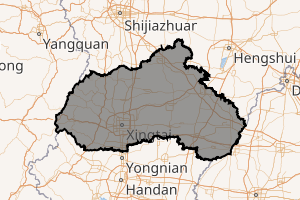
.png) Location of Xingtai City jurisdiction in Hebei | |
 Xingtai Location of the city centre in Hebei 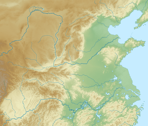 Xingtai Xingtai (North China Plain) 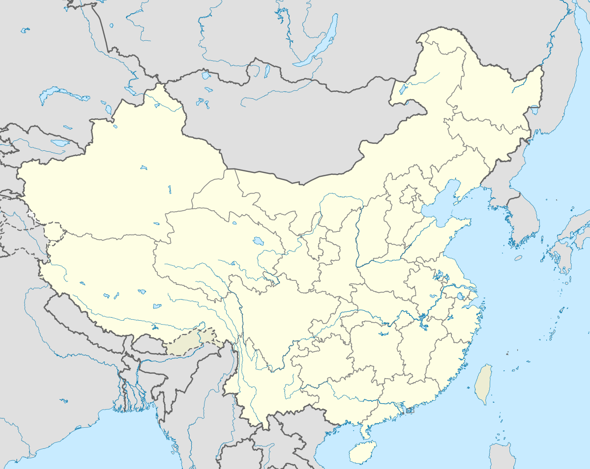 Xingtai Xingtai (China) | |
| Coordinates (Xingtai municipal government): 37°04′18″N 114°30′17″E | |
| Country | People's Republic of China |
| Province | Hebei |
| Settled | 3500 BC |
| Established | November 15, 1983 |
| Area | |
| • Prefecture-level city | 12,432 km2 (4,800 sq mi) |
| • Urban | 114.80 km2 (44.32 sq mi) |
| • Districts[1] | 132.3 km2 (51.1 sq mi) |
| Population | |
| • Prefecture-level city | 7,884,000 (2,016) |
| • Urban | 971,300 |
| • Urban density | 8,500/km2 (22,000/sq mi) |
| • Districts[1] | 971,000 |
| Time zone | UTC+8 (China Standard) |
| Postal code | 054000 |
| Area code(s) | 0319 |
| ISO 3166 code | CN-HE-05 |
| Licence plate prefixes | 冀E |
| Website | www |
| Xingtai | |||||||||
|---|---|---|---|---|---|---|---|---|---|
| Simplified Chinese | 邢台 | ||||||||
| Traditional Chinese | 邢臺 | ||||||||
| Postal | Hsingtai | ||||||||
| Literal meaning | "temple of Xing" | ||||||||
| |||||||||
History
Xingtai is the oldest city in North China. The history of Xingtai can be traced back 3500 years ago. During the Shang Dynasty, Xingtai functioned as a capital city. During the Zhou Dynasty, the State of Xing – from which the present name derives – was founded in the city. During the Warring States period, the state of Zhao made Xingtai its provisional capital. The city was known as Xindu for most of the Qin Dynasty, but after the 207 BC Battle of Julu (within present-day Pingxiang County, not today's Julu County), it became known as Xiangguo. During the Sixteen Kingdoms Period, when the Later Zhao was founded by Shi Le of the Jie, the capital was again at Xiangguo. During the Sui and Tang dynasties, the city was known as Xingzhou.
Sui, Tang and Song times saw the zenith of ceramics production in what was the most prolific ceramics center of northern China (rivaling the Yue ware from the South). The white ware and new technologies developed in the Xing Kiln mark the transition from proto-porcelain to proper porcelain.[2] More than thirty kiln site have been excavated in different subdivisions of today's Xingtai City and a large high-tech museum have been established in Neiqiu County in 2017.[3][4][5]
During the Yuan Dynasty, Ming, and Qing dynasties, Xingtai was called Shunteh (Shundefu) and functioned as a prefecture in China.
Geography and climate
Xingtai has a continental, monsoon-influenced semi-arid climate (Köppen BSk),[6] characterised by hot, humid summers due to the East Asian monsoon, and generally cold, windy, very dry winters that reflect the influence of the vast Siberian anticyclone. Spring can bear witness to sandstorms blowing in from the Mongolian steppe, accompanied by rapidly warming, but generally dry, conditions. Autumn is similar to spring in temperature and lack of rainfall. The annual rainfall, more than half of which falls in July and August alone, is highly variable and not reliable. In the city itself, this amount has averaged to a meagre 493 millimetres (19.4 in) per annum.
| Climate data for Xingtai (1971−2000) | |||||||||||||
|---|---|---|---|---|---|---|---|---|---|---|---|---|---|
| Month | Jan | Feb | Mar | Apr | May | Jun | Jul | Aug | Sep | Oct | Nov | Dec | Year |
| Record high °C (°F) | 20.9 (69.6) |
27.4 (81.3) |
30.2 (86.4) |
35.2 (95.4) |
39.7 (103.5) |
41.1 (106.0) |
40.6 (105.1) |
38.7 (101.7) |
39.0 (102.2) |
37.0 (98.6) |
27.8 (82.0) |
27.6 (81.7) |
41.1 (106.0) |
| Average high °C (°F) | 3.9 (39.0) |
7.3 (45.1) |
13.6 (56.5) |
21.9 (71.4) |
27.5 (81.5) |
32.1 (89.8) |
31.9 (89.4) |
30.3 (86.5) |
26.9 (80.4) |
21.1 (70.0) |
12.4 (54.3) |
5.9 (42.6) |
19.6 (67.2) |
| Daily mean °C (°F) | −1.6 (29.1) |
1.5 (34.7) |
7.9 (46.2) |
15.7 (60.3) |
21.4 (70.5) |
26.0 (78.8) |
27.0 (80.6) |
25.6 (78.1) |
21.0 (69.8) |
14.7 (58.5) |
6.5 (43.7) |
0.4 (32.7) |
13.8 (56.8) |
| Average low °C (°F) | −6.1 (21.0) |
−3.1 (26.4) |
2.5 (36.5) |
9.8 (49.6) |
15.1 (59.2) |
20.2 (68.4) |
22.6 (72.7) |
21.6 (70.9) |
16.1 (61.0) |
9.4 (48.9) |
1.8 (35.2) |
−3.8 (25.2) |
8.8 (47.9) |
| Record low °C (°F) | −20.2 (−4.4) |
−15.6 (3.9) |
−10.9 (12.4) |
−4.9 (23.2) |
5.0 (41.0) |
9.9 (49.8) |
15.7 (60.3) |
13.2 (55.8) |
5.6 (42.1) |
−1.7 (28.9) |
−9.2 (15.4) |
−17.4 (0.7) |
−20.2 (−4.4) |
| Average precipitation mm (inches) | 3.6 (0.14) |
7.0 (0.28) |
13.0 (0.51) |
18.2 (0.72) |
30.8 (1.21) |
53.3 (2.10) |
151.9 (5.98) |
120.2 (4.73) |
49.5 (1.95) |
29.6 (1.17) |
12.2 (0.48) |
4.1 (0.16) |
493.4 (19.43) |
| Average precipitation days (≥ 0.1 mm) | 2.3 | 2.9 | 3.8 | 4.0 | 6.1 | 8.0 | 12.9 | 11.1 | 7.3 | 5.3 | 3.9 | 2.1 | 69.7 |
| Source: Weather China | |||||||||||||
Air pollution
As air pollution in China is at an all-time high, several Hebei cities are among the most polluted cities and has one of the worst air quality in China. Reporting on China's airpocalypse has been accompanied by what seems like a monochromatic slideshow of the country's several cities smothered in thick smog. According to a survey made by "Global voices China" in February 2013, 7 cities in Hebei including Xingtai, Shijiazhuang, Baoding, Handan, Langfang, Hengshui and Tangshan, are among China's 10 most polluted cities. Xingtai ranked 1st in the list and is referred to has the worst air quality in all Chinese cities.[7]
Xingtai earthquake
A major earthquake, known as the Xingtai earthquake, with magnitude 6.8 on the Richter scale and epicenter in Longyao County occurred in the early morning of March 8, 1966. It was followed by 5 earthquakes above magnitude 6 on the Richter scale that lasted until March 29, 1966. The strongest of these quakes had a magnitude of 7.2 and took place in the southeastern part of Ningjin County on March 22. The earthquake damage included 8,064 dead, 38,000 injured and more than 5 million destroyed houses.[8]
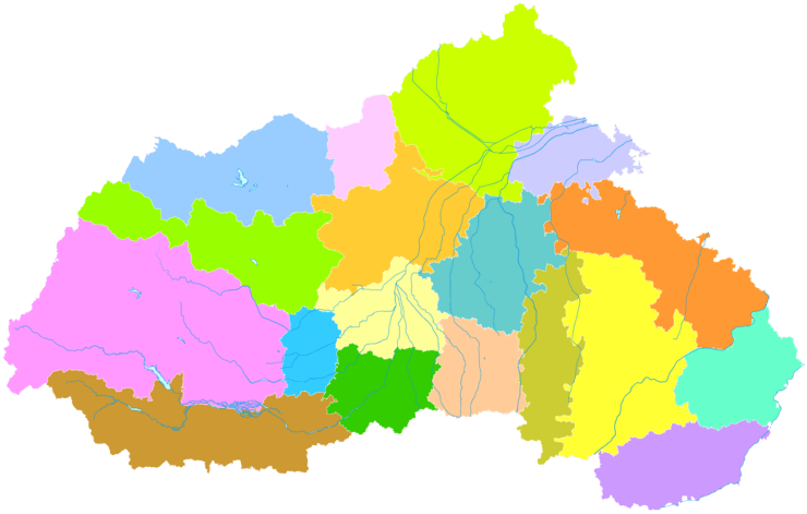
Administrative divisions

| Map | ||||||
|---|---|---|---|---|---|---|
| Name | Chinese | Pinyin | Population (2004 est.) | Area (km²) | Density (/km²) | |
| Xindu District | 信都区 | Xìndū Qū | 230,000 | 37 | 6,216 | |
| Xiangdu District | 襄都区 | Xiāngdū Qū | 780,000 | 2,079 | 375 | |
| Renze District | 任泽区 | Rènzé Qū | 320,000 | 431 | 742 | |
| Nanhe District | 南和区 | Nánhé Qū | 320,000 | 418 | 766 | |
| Nangong City | 南宫市 | Nángōng Shì | 450,000 | 854 | 527 | |
| Shahe City | 沙河市 | Shāhé Shì | 470,000 | 999 | 470 | |
| Lincheng County | 临城县 | Línchéng Xiàn | 190,000 | 797 | 238 | |
| Neiqiu County | 内丘县 | Nèiqiū Xiàn | 260,000 | 775 | 335 | |
| Baixiang County | 柏乡县 | Bǎixiāng Xiàn | 180,000 | 268 | 672 | |
| Longyao County | 隆尧县 | Lóngyáo Xiàn | 490,000 | 749 | 654 | |
| Ningjin County | 宁晋县 | Níngjìn Xiàn | 730,000 | 1,107 | 659 | |
| Julu County | 巨鹿县 | Jùlù Xiàn | 360,000 | 623 | 578 | |
| Xinhe County | 新河县 | Xīnhé Xiàn | 160,000 | 366 | 437 | |
| Guangzong County | 广宗县 | Guǎngzōng Xiàn | 270,000 | 493 | 548 | |
| Pingxiang County | 平乡县 | Píngxiāng Xiàn | 280,000 | 406 | 670 | |
| Wei County | 威县 | Wēi Xiàn | 540,000 | 994 | 543 | |
| Qinghe County | 清河县 | Qīnghé Xiàn | 360,000 | 501 | 719 | |
| Linxi County | 临西县 | Línxī Xiàn | 330,000 | 542 | 609 | |
- Xingtai County - defunct
Economy
Xingtai is the most important base for natural resources in North China, producing 20 million metric tonnes of coal annually. It also features the largest power plant in the southern part of this region of China, with an output of 2.06 GW.[9]
Transport
Located on the Beijing−Guangzhou and the Beijing−Kowloon Railways, as well as the Beijing−Shenzhen, Qingdao−Yinchuan (, and Xingtai−Linqing Expressways, Xingtai is a transport hub connecting the Eastern, Northern, and Central China.
Notable persons
- Ren Xuefeng
- Pangzai
See also
References
- Ministry of Housing and Urban-Rural Development, ed. (2019). China Urban Construction Statistical Yearbook 2017. Beijing: China Statistics Press. p. 46. Retrieved 11 January 2020.
- Song, Xiaoyan (October 11, 2018). "The Most Ancient White Porcelain in China". China Today. Retrieved 3 March 2020.
- Song, Xiaoyan (April 12, 2013). "Significant Results from the Excavation of Xing Kiln Site in 2012". Chinese Archaeology. Retrieved 3 March 2020.
- "Chinese Xingyao Museum". Shijiazhuang Municipality Official Website. Retrieved 3 March 2020.
- "Xing Kiln Museum / YCA". ArchDaily. May 29, 2019. Retrieved 3 March 2020.
- Peel, M. C. and Finlayson, B. L. and McMahon, T. A. (2007). "Updated world map of the Köppen-Geiger climate classification". Hydrol. Earth Syst. Sci. 11: 1633-1644. ISSN 1027-5606.
- Bildner, Eli (27 February 2013). "Interactive Maps of China's Most–and Least–Polluted Places". Global Voices China. http://newsmotion.org. Archived from the original on 3 September 2014. Retrieved 1 September 2014.
- "Major earthquakes on Chinese mainland since 1966" by the Consulate General of the People's Republic of China in Houston
- 邢台市情介绍 (in Chinese). Xingtai People's Government. Retrieved 2011-05-20.
External links
| Wikimedia Commons has media related to Xingtai. |
Hebei topics | |
|---|---|
Shijiazhuang (capital) | |
| General | |
| Geography |
|
| Education |
|
| Culture | |
| Visitor attractions |
|
| |
| Authority control |
|
|---|