Yangzhong
Yangzhong (simplified Chinese: 扬中; traditional Chinese: 揚中; pinyin: Yángzhōng; lit.: 'Yang[tze] middle') is a county-level city under the administration of Zhenjiang, Jiangsu province, China. It is the easternmost county-level division of Zhenjiang City.
Yangzhong 扬中市 | |
|---|---|
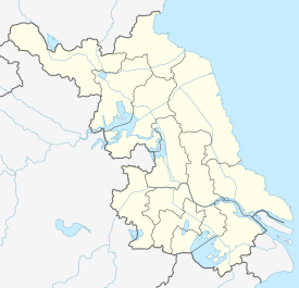 Yangzhong Location in Jiangsu | |
| Coordinates: 32°14′13″N 119°48′54″E[1] | |
| Country | People's Republic of China |
| Province | Jiangsu |
| Prefecture-level city | Zhenjiang |
| Population | |
| • Total | 131,431 |
| Time zone | UTC+8 (China Standard) |
| Postal code | 2122XX |
History
There were only several smaller shoals in the area of present-day Yangzhong during the Eastern Jin. As time went on, they enlarged and merged into an elongated shoal by Tang dynasty, which was called Xiaozhou (小洲; literally: "Small shoal") in Song dynasty. It was renamed Xinzhou (新洲) and then Ximinzhou (細民洲) during Ming dynasty, and was designated Taipingzhou (太平洲) in Qing dynasty.
In 1904, the imperial court decided to establish a subprefecture named after Taiping. In 1911, it was promoted to a county. Since there is a namesake in Anhui. The county was renamed Yangzhong, the abbreviation of "揚子江中" which means "(the shoal is) in the Yangtze River".
Overview
- In 1938, the Japanese army captured the county, then it was governed by the pro-Japanese collaborators.
- In 1939, the Jiangnan Counter-Japanese Volunteers' Army attacked the county, then the Nationalist Government controlled it.
- In 1940, the Japanese army recaptured the county.
- In July 1945, the force of CPC overthrew the puppet county government, but the Nationalist Government controlled the county in December.
- On 22 April 1949, the PLA captured the county.
- In 1994, the county was turn into a county-level city.
Geography
| Climate data for Yangzhong (normal temperatures and precipitations: 1959−1985, extremes: 1959−1992) | |||||||||||||
|---|---|---|---|---|---|---|---|---|---|---|---|---|---|
| Month | Jan | Feb | Mar | Apr | May | Jun | Jul | Aug | Sep | Oct | Nov | Dec | Year |
| Record high °C (°F) | 19.9 (67.8) |
22.9 (73.2) |
29.7 (85.5) |
33.4 (92.1) |
34.7 (94.5) |
35.9 (96.6) |
37.6 (99.7) |
39.2 (102.6) |
36.8 (98.2) |
31.5 (88.7) |
27.6 (81.7) |
20.3 (68.5) |
39.2 (102.6) |
| Average high °C (°F) | 6.3 (43.3) |
7.9 (46.2) |
12.8 (55.0) |
19.0 (66.2) |
24.4 (75.9) |
28.2 (82.8) |
31.3 (88.3) |
31.4 (88.5) |
26.6 (79.9) |
21.7 (71.1) |
15.3 (59.5) |
8.9 (48.0) |
19.5 (67.1) |
| Daily mean °C (°F) | 2.0 (35.6) |
3.5 (38.3) |
8.1 (46.6) |
14.1 (57.4) |
19.4 (66.9) |
23.9 (75.0) |
27.6 (81.7) |
27.4 (81.3) |
25.8 (78.4) |
16.9 (62.4) |
10.7 (51.3) |
4.3 (39.7) |
15.3 (59.6) |
| Average low °C (°F) | −1.3 (29.7) |
0.1 (32.2) |
4.1 (39.4) |
9.7 (49.5) |
15.1 (59.2) |
20.2 (68.4) |
24.3 (75.7) |
19.4 (66.9) |
23.0 (73.4) |
12.9 (55.2) |
6.9 (44.4) |
0.7 (33.3) |
11.3 (52.3) |
| Record low °C (°F) | −11.8 (10.8) |
−10.7 (12.7) |
−4.2 (24.4) |
−1.6 (29.1) |
3.7 (38.7) |
11.4 (52.5) |
15.1 (59.2) |
16.6 (61.9) |
8.9 (48.0) |
1.4 (34.5) |
−4.7 (23.5) |
−9.2 (15.4) |
−11.8 (10.8) |
| Average precipitation mm (inches) | 29.1 (1.15) |
42.2 (1.66) |
64.4 (2.54) |
89.7 (3.53) |
92.3 (3.63) |
169.2 (6.66) |
192.8 (7.59) |
113.7 (4.48) |
120.6 (4.75) |
58.2 (2.29) |
60.5 (2.38) |
28.9 (1.14) |
1,061.6 (41.8) |
| Source: Yangzhong County Chorography | |||||||||||||
References
- Google (2014-07-02). "Yangzhong" (Map). Google Maps. Google. Retrieved 2014-07-02.
- "About Yangzhong". Archived from the original on 2007-12-17. Retrieved 2007-11-17.
External links
- Yangzhong City English guide (Jiangsu.NET)
Jiangsu topics | |
|---|---|
Nanjing (capital) | |
| General | |
| Geography |
|
| Education | |
| Culture |
|
| Visitor attractions |
|
| |