Xinyang
Xinyang (simplified Chinese: 信阳; traditional Chinese: 信陽; pinyin: Xìnyáng; postal: Sinyang) is a prefecture-level city in southeastern Henan province, People's Republic of China, the southernmost administrative division in the province. Its population was 6,109,106 according to the 2010 census, and 1,230,042 of them lived in 2 urban districts, Pingqiao and Shihe.
Xinyang 信阳市 Sinyang | |
|---|---|
 View of Xinyang | |
 Location of Xinyang City jurisdiction in Henan | |
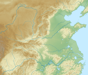 Xinyang Location on the North China Plain 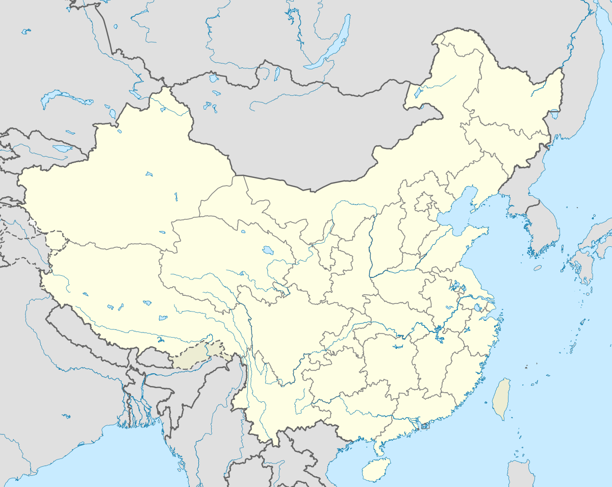 Xinyang Xinyang (China) | |
| Coordinates (Xinyang municipal government): 32°08′56″N 114°05′28″E | |
| Country | People's Republic of China |
| Province | Henan |
| Municipal seat | Pingqiao District |
| Area | |
| • Prefecture-level city | 18,908.27 km2 (7,300.52 sq mi) |
| • Urban | 75 km2 (29 sq mi) |
| • Metro | 3,665.9 km2 (1,415.4 sq mi) |
| Population (2010 Census) | |
| • Prefecture-level city | 6,109,106 |
| • Density | 320/km2 (840/sq mi) |
| • Urban (2018)[2] | 600,000 |
| • Urban density | 8,000/km2 (21,000/sq mi) |
| • Metro | 1,230,042 |
| • Metro density | 340/km2 (870/sq mi) |
| Time zone | UTC+8 (China Standard) |
| Area code(s) | 0376 |
| ISO 3166 code | CN-HA-15 |
| GDP 2010 | 109.2 |
| Major Nationalities | Han |
| License plate prefixes | 豫S |
| Website | www |
Geography
The prefecture-level city of Xinyang has a total land area of 18,819 square kilometres (7,266 sq mi). The city is located in the southernmost part of Henan Province, on the south bank of the Huai River. It borders the cities Zhumadian to the north and Nanyang to the northwest, and the provinces of Anhui and Hubei to the east and south respectively. The region where Xinyang is located is considered a subtropical area and the Dabie Mountains cover most of its territory.
Climate
Xinyang has a monsoon-influenced, four-season humid subtropical climate (Köppen Cfa), with cold, damp winters, and hot, humid summers. The months of April through June here are slightly cooler than much of the rest of the province. The monthly 24-hour average temperature ranges from 2.4 °C (36.3 °F) in January to 27.3 °C (81.1 °F) in July; the annual mean is 15.54 °C (60.0 °F). The annual precipitation is just above 1,100 millimetres (43 in), and close to two-thirds of it occurs from May to September. With monthly percent possible sunshine ranging from 38% in March to 47% in four months, the city receives 1,974 hours of bright sunshine annually; January through March are the cloudiest months.
| Climate data for Xinyang (1981–2010 normals) | |||||||||||||
|---|---|---|---|---|---|---|---|---|---|---|---|---|---|
| Month | Jan | Feb | Mar | Apr | May | Jun | Jul | Aug | Sep | Oct | Nov | Dec | Year |
| Record high °C (°F) | 20.6 (69.1) |
26.5 (79.7) |
30.7 (87.3) |
34.3 (93.7) |
36.3 (97.3) |
38.7 (101.7) |
40.1 (104.2) |
40.9 (105.6) |
37.3 (99.1) |
34.2 (93.6) |
30.0 (86.0) |
21.7 (71.1) |
40.9 (105.6) |
| Average high °C (°F) | 6.8 (44.2) |
9.6 (49.3) |
14.7 (58.5) |
21.7 (71.1) |
26.4 (79.5) |
29.7 (85.5) |
31.5 (88.7) |
30.5 (86.9) |
26.7 (80.1) |
21.8 (71.2) |
15.6 (60.1) |
9.4 (48.9) |
20.4 (68.7) |
| Daily mean °C (°F) | 2.4 (36.3) |
4.9 (40.8) |
9.7 (49.5) |
16.4 (61.5) |
21.4 (70.5) |
25.0 (77.0) |
27.3 (81.1) |
26.2 (79.2) |
21.8 (71.2) |
16.4 (61.5) |
10.3 (50.5) |
4.7 (40.5) |
15.5 (60.0) |
| Average low °C (°F) | −1.1 (30.0) |
1.2 (34.2) |
5.7 (42.3) |
12.0 (53.6) |
17.0 (62.6) |
21.0 (69.8) |
24.1 (75.4) |
22.9 (73.2) |
18.0 (64.4) |
12.4 (54.3) |
6.3 (43.3) |
1.0 (33.8) |
11.7 (53.1) |
| Record low °C (°F) | −20.0 (−4.0) |
−16.0 (3.2) |
−6.6 (20.1) |
−0.6 (30.9) |
5.0 (41.0) |
11.9 (53.4) |
17.0 (62.6) |
14.1 (57.4) |
7.9 (46.2) |
−0.4 (31.3) |
−6.4 (20.5) |
−12.4 (9.7) |
−20.0 (−4.0) |
| Average precipitation mm (inches) | 30.1 (1.19) |
41.7 (1.64) |
69.3 (2.73) |
77.0 (3.03) |
116.9 (4.60) |
136.5 (5.37) |
224.9 (8.85) |
174.6 (6.87) |
88.6 (3.49) |
74.2 (2.92) |
49.0 (1.93) |
23.4 (0.92) |
1,106.2 (43.54) |
| Average precipitation days (≥ 0.1 mm) | 7.2 | 7.9 | 10.7 | 9.9 | 11.5 | 11.0 | 12.6 | 11.9 | 10.5 | 10.2 | 7.6 | 6.2 | 117.2 |
| Average relative humidity (%) | 71 | 71 | 70 | 69 | 71 | 76 | 81 | 83 | 79 | 76 | 72 | 69 | 74 |
| Mean monthly sunshine hours | 127.0 | 121.7 | 139.3 | 175.6 | 196.1 | 197.4 | 205.7 | 194.8 | 160.2 | 162.2 | 149.9 | 143.8 | 1,973.7 |
| Percent possible sunshine | 40 | 39 | 38 | 45 | 46 | 47 | 47 | 47 | 43 | 46 | 47 | 46 | 44.5 |
| Source: China Meteorological Administration (precipitation days and sunshine 1971–2000)[3][4] | |||||||||||||
Administration
The Xinyang City is divided into two districts and eight counties.
| Map | ||||||
|---|---|---|---|---|---|---|
| English Name | Simplified | Traditional | Pinyin | Area | Population | Density |
| Shihe District | 浉河区 | 浉河區 | Shīhé Qū | 1,782.51 | 594,391 | 333 |
| Pingqiao District | 平桥区 | 平橋區 | Píngqiáo Qū | 1,883.42 | 635,651 | 337 |
| Huangchuan County | 潢川县 | 潢川縣 | Huángchuān Xiàn | 1,638 | 630,333 | 385 |
| Huaibin County | 淮滨县 | 淮濱縣 | Huáibīn Xiàn | 1,208 | 570,156 | 472 |
| Xi County | 息县 | 息縣 | Xī Xiàn | 1,835 | 793,746 | 433 |
| Xin County | 新县 | 新縣 | Xīn Xiàn | 1,612 | 275,285 | 171 |
| Shangcheng County | 商城县 | 商城縣 | Shāngchéng Xiàn | 2,130 | 495,491 | 233 |
| Gushi County | 固始县 | 固始縣 | Gùshǐ Xiàn | 2,946 | 1,023,857 | 348 |
| Luoshan County | 罗山县 | 羅山縣 | Luóshān Xiàn | 2,065 | 504,542 | 244 |
| Guangshan County | 光山县 | 光山縣 | Guāngshān Xiàn | 1,835 | 275,282 | 150 |

Demographics
According to the 2010 Census, the population of Xinyang is of 6,109,106 inhabitants, 6.39% less than the population marked on the last census of 2000, when there were 6,527,368 inhabitants in the city.[5]
Its built up area is home to 1,230,042 inhabitants spread out on 2 urban districts and 3,665.9 square kilometres (1,415.4 sq mi).
Culture
Xinyang Tea Culture Festival is held during April, 28th and 30th every year.
Transportation
- Highway system
- Railway system
- Jingguang Railway
- Jingjiu Railway
- Ningxi Railway
- Beijing–Guangzhou–Shenzhen–Hong Kong High-Speed Railway
Education
- Higher Education
- Secondary Education
Recreation
Twin towns
- Niimi, Okayama, Japan
- Ashkelon, Israel
References
- Cox, W (2018). Demographia World Urban Areas. 14th Annual Edition (PDF). St. Louis: Demographia. p. 22.
- Cox, W (2018). Demographia World Urban Areas. 14th Annual Edition (PDF). St. Louis: Demographia. p. 22.
- 中国气象数据网 - WeatherBk Data (in Chinese). China Meteorological Administration. Retrieved 2020-04-15.
- 中国地面国际交换站气候标准值月值数据集(1971-2000年). China Meteorological Administration. Archived from the original on 2013-09-21. Retrieved 2010-05-25.
- (in Chinese) Compilation by LianXin website. Data from the Sixth National Population Census of the People's Republic of China Archived March 25, 2012, at the Wayback Machine
External links
Henan topics | |
|---|---|
Zhengzhou (capital) | |
| General | |
| Geography | |
| Education | |
| Culture |
|
| Cuisine | |
| Visitor attractions | |
| |