Qinggil County
Qinghe County as the official romanized name, also transliterated from Chinese to Uyghur as Qinggil County, is a county situated in northeastern Xinjiang, China, bordering Mongolia to the east and under the administration of the Altay Prefecture. It has an area of 15,722 km2 (6,070 sq mi) with a population of 60,000. Qinghe was the site of a meteorite impact in 1898 and a Mongolian–Chinese border clash in the spring of 1944.
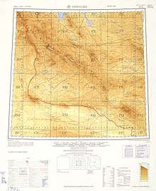
Map of Qinggil (labeled as CH'ING-HO) and surrounding region from the International Map of the World (1957)
Qinghe County 青河县 چىڭگىل ناھىيىسى | |
|---|---|
County | |
.png) Location of Qinggil County (pink) in Altay Prefecture (yellow) and Xinjiang | |
 Qinggil Location of the county town in Xinjiang | |
| Coordinates: 46°37′N 90°25′E | |
| Country | People's Republic of China |
| Region | Xinjiang |
| Prefecture | Altay |
| County seat | Qinggil (青河镇) |
| Area | |
| • Total | 15,722 km2 (6,070 sq mi) |
| Elevation | 1,220 m (4,000 ft) |
| Population | |
| • Total | 60,000 |
| • Density | 3.8/km2 (9.9/sq mi) |
| Time zone | UTC+8 (China Standard) |
| Postal code | 836200 |
| Website | xjqh |
| Qinggil County | |||||||||||
|---|---|---|---|---|---|---|---|---|---|---|---|
| Chinese name | |||||||||||
| Simplified Chinese | 青河县 | ||||||||||
| Traditional Chinese | 青河縣 | ||||||||||
| |||||||||||
| Uyghur name | |||||||||||
| Uyghur | چىڭگىل ناھىيىسى | ||||||||||
| |||||||||||
| Kazakh name | |||||||||||
| Kazakh | شىڭگىل اۋدانى Shińgil aýdany | ||||||||||
Administrative divisions
Town (镇)
- Qinggil Town (青河镇) | Takeshiken (塔克什肯镇)
Township (乡)
- Arele Township (阿热勒乡) | Areletuobie Township (阿热勒托别乡) | Saertuohai Township (萨尔托海乡) | Chaganguole Township (查干郭勒乡) | Agashiaopao Township (阿尕什敖包乡)
Military Base (兵团单位)
- Qinghe Farm (青河农场)
This article is issued from Wikipedia. The text is licensed under Creative Commons - Attribution - Sharealike. Additional terms may apply for the media files.