Jishou
Jishou (Chinese: 吉首; pinyin: Jíshǒu; Tujia: Jiersouv) is a county-level city and the seat of Xiangxi Tujia and Miao Autonomous Prefecture, Hunan province, China.
Jishou 吉首市 Kishow | |
|---|---|
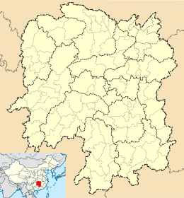 Jishou Location in Hunan | |
| Coordinates: 28°16′34″N 109°42′43″E[1] | |
| Country | People's Republic of China |
| Province | Hunan |
| Autonomous prefecture | Xiangxi |
| Area | |
| • County-level city | 1,062.46 km2 (410.22 sq mi) |
| • Urban | 48.00 km2 (18.53 sq mi) |
| Population (2010)[4] | |
| • County-level city | 301,460 |
| • Estimate (2017) | 386,000 |
| • Density | 280/km2 (730/sq mi) |
| • Urban | 291,000 |
| Time zone | UTC+8 (China Standard) |
| Postal code | 4160XX |
| Website | zgjs |
Located on the west of the province, the city is bordered to the northwest by Huayuan and Baojing Counties, to the northeast by Guzhang County, to the southeast by Luxi County, to the southwest by Fenghuang County. Jishou City covers 1,078.33 km2 (416.35 sq mi), as of 2015, It had a registered population of 301,000 and a resident population of 286,400.[5] Jishou has four subdistricts, five towns and a township under its jurisdiction, the seat of the city is Qianzhou Subdistrict (乾州街道).[6]
History
Jishou has a history of more than 2,000 years dating back to the Qin dynasty. In those days, it was affiliated with Qianzhong Prefecture (黔中郡). During the Song dynasty, a town government was established in a stockaded village, Zhenxi (镇溪寨; 鎮溪寨), which in the Ming dynasty became the Zhenxi soldiers and civilians battalion (镇溪军民千户所; 鎮溪軍民千戶所). Qianzhou Prefecture (乾州厅) was created during the Qing dynasty. During the Republic of China era it was known as Qian County (乾县; 乾縣) In 1953 the area was renamed Jishou county, with two adjacent cities, Jishou and Qianzhou. In 1982 Jishou city became the capital of Xiangxi Tujia and Miao Autonomous Prefecture. The city of Qianzhou (乾城) now lies just south of Jishou city.[7]
Geography
Jishou lies east of the Wuling Mountain range. About 80% of the city's terrain is low hills or low mountains. The highest elevation is 964.5 meters, at Liantaifeng (莲台峰; 蓮台峰, near the town of Aizhai (矮寨) and the lowest point is 142 meters, near the town of Hexi (simplified Chinese: 河溪镇; traditional Chinese: 河溪鎮).[8] The Dong River (峒河), a tributary of the Yuan River, runs west to east through the city.
.JPG)
Population
Jishou County had a population of 291,200 in the year 2008, including an agricultural population of 163,100, or 56% of the population. The urban population was 192,500. About 77.3% of the population belonged to the Miao or Tujia minorities, with 121,000 Miao and 101,200 Tujia. Members of China's predominant Han ethnic group comprise the rest of the population.[9]
Education
Jishou has two institutions of higher education:
- Jishou University (吉首大学)
- Normal College of Jishou University (吉首大学师范学院)
Economy
In 2001, the Gross Domestic Product in Jishou was 19.45 billion yuan, with a revenue of 1.45 billion yuan. Jishou produces fruits, especially kiwis and oranges, vegetables, livestock and poultry, and tobacco.[10] Tourism is becoming an important industry, since the ancient city of Fenghuang, is about 30 minutes away and Dehang National Park is about 40 minutes away.
According to preliminary estimation, the gross domestic product in 2018 was CN¥16,762 million ($2,533 million), up by 10.1 percent over the previous year. Of this total, the value added of the primary industry was CN¥716 million ($108 million), up by 3.5 percent, that of the secondary industry was CN¥4,841 million ($732 million), up by 11.8 percent and that of the tertiary industry was CN¥11,206 million ($1,693 million), up by 9.8 percent. The value added of the primary industry accounted for 4.27 percent of the GDP; that of the secondary industry accounted for 28.88 percent; and that of the tertiary industry accounted for 66.85 percent. The GDP per capita in 2018 was CN¥44,849 ($6,777), up by 5.9 percent compared with the previous year.[11]
Transportation
- Bus routes run from Jishou to numerous towns and cities within Xiangxi and farther afield.
- Direct trains connect Jishou to many of China's major cities, including Beijing, Shanghai, Guangzhou, and Changsha.
- Jishou lacks an airport; the closest one with commercial service is located two hours away in Zhangjiajie.
- G56 Hangzhou–Ruili Expressway and G65 Baotou–Maoming Expressway
- China National Highway 209, China National Highway 319
- The Aizhai Bridge, one of the world's highest and longest suspension bridges, is located approximately 20 minutes outside of town.
Climate
| Climate data for Jishou (1981−2010) | |||||||||||||
|---|---|---|---|---|---|---|---|---|---|---|---|---|---|
| Month | Jan | Feb | Mar | Apr | May | Jun | Jul | Aug | Sep | Oct | Nov | Dec | Year |
| Record high °C (°F) | 23.0 (73.4) |
29.5 (85.1) |
32.5 (90.5) |
35.5 (95.9) |
36.2 (97.2) |
37.5 (99.5) |
39.6 (103.3) |
39.5 (103.1) |
38.2 (100.8) |
35.1 (95.2) |
32.4 (90.3) |
23.9 (75.0) |
39.6 (103.3) |
| Average high °C (°F) | 9.1 (48.4) |
11.2 (52.2) |
15.7 (60.3) |
22.1 (71.8) |
26.6 (79.9) |
29.6 (85.3) |
32.6 (90.7) |
32.6 (90.7) |
28.8 (83.8) |
22.6 (72.7) |
17.5 (63.5) |
12.1 (53.8) |
21.7 (71.1) |
| Daily mean °C (°F) | 5.3 (41.5) |
7.3 (45.1) |
11.1 (52.0) |
16.9 (62.4) |
21.4 (70.5) |
24.8 (76.6) |
27.5 (81.5) |
27.2 (81.0) |
23.4 (74.1) |
17.8 (64.0) |
12.6 (54.7) |
7.5 (45.5) |
16.9 (62.4) |
| Average low °C (°F) | 2.9 (37.2) |
4.7 (40.5) |
8.0 (46.4) |
13.4 (56.1) |
17.8 (64.0) |
21.5 (70.7) |
23.9 (75.0) |
23.5 (74.3) |
19.8 (67.6) |
14.8 (58.6) |
9.5 (49.1) |
4.6 (40.3) |
13.7 (56.7) |
| Record low °C (°F) | −4.1 (24.6) |
−3.7 (25.3) |
−0.7 (30.7) |
3.1 (37.6) |
8.1 (46.6) |
13.0 (55.4) |
16.9 (62.4) |
16.1 (61.0) |
12.5 (54.5) |
4.2 (39.6) |
−1.4 (29.5) |
−3.9 (25.0) |
−4.1 (24.6) |
| Average precipitation mm (inches) | 45.5 (1.79) |
54.8 (2.16) |
77.9 (3.07) |
147.4 (5.80) |
201.5 (7.93) |
215.1 (8.47) |
222.2 (8.75) |
129.1 (5.08) |
71.7 (2.82) |
100.3 (3.95) |
65.7 (2.59) |
33.3 (1.31) |
1,364.5 (53.72) |
| Average relative humidity (%) | 79 | 78 | 79 | 80 | 81 | 82 | 80 | 79 | 78 | 81 | 79 | 76 | 79 |
| Source: China Meteorological Data Service Center[12] | |||||||||||||
Photo

References
- Google (2014-07-02). "Jishou" (Map). Google Maps. Google. Retrieved 2014-07-02.
- Xiangxi Tujia and Miao Autonomous Prefecture Land Use Plan (2006–20)/《湘西土家族苗族自治州土地利用总体规划(2006-2020年)》.(in Chinese) Accessed 8 July 2014.
- Ministry of Housing and Urban-Rural Development, ed. (2019). China Urban Construction Statistical Yearbook 2017. Beijing: China Statistics Press. p. 68. Retrieved 11 January 2020.
- 湘西自治州2010年第六次全国人口普查主要数据公报 (in Chinese). Xiangxi Prefecture People's Government. Archived from the original on 27 November 2012. Retrieved 9 July 2014.
- the population of Jishou City in 2015, according to the 2015年吉首市国民经济和社会发展统计公报 [Statistical Communiqué of Jishou City on the 2015 National Economic and Social Development]. www.tjcn.org. or ahmhxc.com
- the divisions of Jishou City in 2015, according to the 《湖南省民政厅关于同意吉首市乡镇区划调整方案的批复》(湘民行发〔2015〕110号) [result on adjustment of township-level administrative divisions of Jishou City on 30 November 2015]. rednet.cn. 2015-12-04. or jishou.gov.cn Archived 2017-02-02 at the Wayback Machine. also see 《湖南省乡镇区划调整改革109个县市区批复方案》. people.com. or xinhuanet.com
- "Archived copy". Archived from the original on 2011-07-07. Retrieved 2010-07-25.CS1 maint: archived copy as title (link)
- About Jishou City (吉首市资讯):cntics.com
- "Archived copy". Archived from the original on 2011-09-04. Retrieved 2010-07-25.CS1 maint: archived copy as title (link)
- "Archived copy". Archived from the original on 2010-01-29. Retrieved 2010-07-25.CS1 maint: archived copy as title (link)
- "Statistical Communiqués Statistical Communiqué of Jishou City on the 2018 National Economic and Social Development" (Press release). Statistical authority of Jishou City. April 1, 2019. Retrieved 2009-06-18.
- 中国地面气候标准值月值(1981-2010) (in Chinese). China Meteorological Data Service Center. Retrieved 20 October 2018.