Dongxing, Guangxi
Dongxing (东兴) is a county-level city of Guangxi, People's Republic of China, on the border with Móng Cái, in Vietnam.
Dongxing 东兴市 · Dunghhingh Si Tunghing | |
|---|---|
 | |
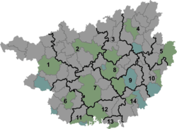 Dongxing Location in Guangxi | |
| Coordinates (Dongxing government): 21°32′52″N 107°58′18″E | |
| Country | People's Republic of China |
| Region | Guangxi |
| Prefecture-level city | Fangchenggang |
| Municipal seat | Dongxing Town (东兴镇) |
| Area | |
| • Total | 548.8 km2 (211.9 sq mi) |
| Elevation | 12 m (39 ft) |
| Population (2007) | |
| • Total | 110,000 |
| • Density | 200/km2 (520/sq mi) |
| Time zone | UTC+8 (China Standard) |
| Postal code | 538100 |
| Area code(s) | 0770 |
| Dongxing, Guangxi | |||||||||||
|---|---|---|---|---|---|---|---|---|---|---|---|
| Chinese name | |||||||||||
| Simplified Chinese | 东兴市 | ||||||||||
| Traditional Chinese | 東興市 | ||||||||||
| |||||||||||
| Vietnamese name | |||||||||||
| Vietnamese | Thị xã Đông Hưng / Đông Hưng thị | ||||||||||
| Chữ Hán | 東興市 | ||||||||||
| Chữ Nôm | 市社東興 | ||||||||||
| Zhuang name | |||||||||||
| Zhuang | Dunghhingh Si | ||||||||||
| 1957 orthography | Duŋƅhiŋƅ Si | ||||||||||
History
Refugees from Vietnam
In the summer of 1978, the Friendship Bridge that connected Dongxing and Mong Cai in Vietnam became a makeshift refugee camp for thousands of ethnic Chinese fleeing Vietnam. Ethnic Chinese had lived in Northern Vietnam for decades under Communist rule, but after the North and South unified in April 1975, the Communist government saw the Chinese in the South, many of whom were successful capitalists and receiving political support financed by Beijing following the Vietnam War, as a threat to their socialist system and began persecuting the Chinese, forcing many to flee by boat. They became part of the known Boat People. This caused an exodus of over 250,000 Chinese from Vietnam to China, mainly to Dongxing.[1]
Climate
Dongxing has a monsoon-influenced humid subtropical climate (Köppen Cwa), with mild to warm winters and long, hot (but not especially) summers, and very humid conditions year-round. The monthly 24-hour average temperature ranges from 15.1 °C (59.2 °F) in January to 28.0 °C (82.4 °F) in July, while extremes have ranged from 3.3 to 37.1 °C (38 to 99 °F). Rain is both the heaviest and most frequent from June to September, when 70% of the annual rainfall also occurs. This is in contrast to the autumn and winter months, where only 30 to 50 millimetres (1.2 to 2.0 in) of rain falls per month.
| Climate data for Dongxing (1971−2000) | |||||||||||||
|---|---|---|---|---|---|---|---|---|---|---|---|---|---|
| Month | Jan | Feb | Mar | Apr | May | Jun | Jul | Aug | Sep | Oct | Nov | Dec | Year |
| Record high °C (°F) | 27.2 (81.0) |
29.8 (85.6) |
33.6 (92.5) |
33.1 (91.6) |
35.8 (96.4) |
37.9 (100.2) |
36.5 (97.7) |
38.4 (101.1) |
36.7 (98.1) |
35.0 (95.0) |
32.5 (90.5) |
30.1 (86.2) |
38.4 (101.1) |
| Average high °C (°F) | 18.8 (65.8) |
19.2 (66.6) |
21.9 (71.4) |
26.1 (79.0) |
29.8 (85.6) |
31.2 (88.2) |
31.5 (88.7) |
31.6 (88.9) |
31.4 (88.5) |
29.1 (84.4) |
25.5 (77.9) |
21.8 (71.2) |
26.5 (79.7) |
| Daily mean °C (°F) | 15.1 (59.2) |
16.0 (60.8) |
18.9 (66.0) |
22.9 (73.2) |
26.1 (79.0) |
27.7 (81.9) |
28.0 (82.4) |
27.7 (81.9) |
26.9 (80.4) |
24.3 (75.7) |
20.5 (68.9) |
16.9 (62.4) |
22.6 (72.7) |
| Average low °C (°F) | 12.6 (54.7) |
13.8 (56.8) |
16.7 (62.1) |
20.5 (68.9) |
23.5 (74.3) |
25.1 (77.2) |
25.2 (77.4) |
24.9 (76.8) |
23.8 (74.8) |
21.1 (70.0) |
17.1 (62.8) |
13.6 (56.5) |
19.8 (67.7) |
| Record low °C (°F) | 4.0 (39.2) |
4.1 (39.4) |
5.0 (41.0) |
11.1 (52.0) |
15.7 (60.3) |
19.5 (67.1) |
21.5 (70.7) |
21.2 (70.2) |
17.3 (63.1) |
10.8 (51.4) |
5.5 (41.9) |
3.3 (37.9) |
3.3 (37.9) |
| Average precipitation mm (inches) | 46.8 (1.84) |
51.4 (2.02) |
69.9 (2.75) |
151.2 (5.95) |
325.8 (12.83) |
463.0 (18.23) |
570.9 (22.48) |
537.8 (21.17) |
303.4 (11.94) |
175.2 (6.90) |
56.9 (2.24) |
32.5 (1.28) |
2,784.8 (109.63) |
| Average precipitation days (≥ 0.1 mm) | 12.7 | 15.1 | 16.2 | 15.4 | 16.8 | 19.3 | 21.8 | 19.7 | 13.6 | 10.7 | 7.3 | 7.4 | 176.0 |
| Source: Weather China | |||||||||||||
References
- "Vietnam-China". Mongbay.com.
- 2011年统计用区划代码和城乡划分代码:灵山县 (in Chinese). National Bureau of Statistics of the People's Republic of China. Retrieved 2013-01-03.
External links
| Authority control |
|
|---|