Kangding
Kangding (Chinese: 康定), or Dartsedo (Tibetan: དར་རྩེ་མདོ། ; Chinese: 打箭炉), is a county-level city and the seat of Garzê Tibetan Autonomous Prefecture in Sichuan province of Southwest China. Kangding's urban center is called Lucheng, which has around 134,000 inhabitants.
Kangding 康定市 · དར་མདོ་གྲོང་ཁྱེར། | |
|---|---|
 Kangding from above | |
.png) Location of Kangding City (red) within Garzê Tibetan Autonomous Prefecture (yellow) and Sichuan | |
 Kangding Location of the city center in Sichuan | |
| Coordinates (Kangding government): 29°59′55″N 101°57′25″E | |
| Country | People's Republic of China |
| Province | Sichuan |
| Autonomous prefecture | Garzê |
| Area | |
| • Total | 11,486 km2 (4,435 sq mi) |
| Elevation | 2,560 m (8,400 ft) |
| Population (2014) | 134,063 |
| • Major ethnic groups | Han Tibetan |
| Time zone | UTC+8 (China Standard) |
| Postal code | 610000 |
| Website | www |
| Kangding | |||||||
|---|---|---|---|---|---|---|---|
| Chinese name | |||||||
| Chinese | 康定 | ||||||
| Hanyu Pinyin | Kāngdìng | ||||||
| Postal | Kangting | ||||||
| |||||||
| Dartsedo (Darzêdo) | |||||||
| Simplified Chinese | 打箭炉 | ||||||
| Traditional Chinese | 打箭爐 | ||||||
| Hanyu Pinyin | Dǎjiànlú | ||||||
| |||||||
| Tibetan name | |||||||
| Tibetan | དར་རྩེ་མདོ། | ||||||
| |||||||
Names
Historically, the urban center was known by Chinese as Dajianlu (written also as Tachienlu or Tatsienlu) from the Chinese transliteration of the Tibetan name Dartsedo or Darzêdo.
History
Kangding was on the historical border between Tibet and China, from Kangding to the west lies Tibetan civilization where as to the east Chinese cultural areas; It was the capital of the Kingdom of Chakla. During its history, Kangding has witnessed many conflicts between Tibetan and Chinese polities. Kangding was for many centuries an important trading city where Chinese brick tea was carried by porters from Chengdu and other centres to trade for Tibetan wool.[1] A dispute involving the sovereignty over the city between Tibet and the Qing was resolved when the Manchu forces took the city by storm in the Battle of Dartsedo in 1701.
On July 1, 1786 an earthquake of 7.75 on the Moment magnitude scale ruined nearly the entire city.[2]
- "Tachienlu is surely sui generis; there can be no other town quite like it. Situated eight thousand four hundred feet above the sea, it seems to lie at the bottom of a well, the surrounding snow-capped mountains towering perhaps fifteen thousand feet in the air above the little town which, small as it is, has hardly room to stand, while outside the wall there is scarcely a foot of level ground. It is wedged into the angle where three valleys come together, the Tar and the Chen rivers meeting just below the town to form the Tarchendo, and our first view of the place as we turned the cliff corner that here bars the gorge, was very striking, grey walls and curly roofs standing out sharply from the flanking hillsides."[3]
The city was renamed 'Kangding' in 1904. The American author Dorris Shelton Still, author of "Sue in Tibet", was born here.
During time of the Republic of China administration, Kangding was the capital of the now-defunct province of Xikang.
Dartsedo had a "reform through labor" prison or laogai after 1959. Jasper Becker in Hungry Ghosts: Mao's Secret Famine[4] wrote, "The highest death rate was probably experienced by the Tibetans imprisoned after the abortive revolt of 1959. One survivor, Ama Adhe, describes in A Strange Liberation: Tibetan Lives in Chinese Hands what happened at the Dartsedo camp bordering Sichuan. By the roadside the authorities opened a mass grave which was filled with corpses and gave off a terrible stench. 'Every day,' she recalls, 'they would deliver nine or ten truck loads of bodies to put there...' Of the 300 women arrested with her, only 100 survived."
Climate
Kangding has a monsoon-influenced climate, lying in the transition between a humid continental (Dwb) and a subtropical highland climate (Cwb) on the Köppen system. Despite the elevation of 2,560 metres (8,400 ft), the diurnal temperature variation averages at most 10.6 °C (19.1 °F) in any month. From April to September, rain is a very common occurrence, with around two-thirds of the days receiving some rainfall; in addition, 77% of the annual precipitation is delivered from May to September. Monthly daily average temperatures range from −1.9 °C (28.6 °F) in January to 15.7 °C (60.3 °F) in July; the annual mean is 7.29 °C (45.1 °F). Over the course of the year, the frost-free period lasts 177 days and there are 1,738 hours of sunshine.
| Climate data for Kangding (1981−2010) | |||||||||||||
|---|---|---|---|---|---|---|---|---|---|---|---|---|---|
| Month | Jan | Feb | Mar | Apr | May | Jun | Jul | Aug | Sep | Oct | Nov | Dec | Year |
| Record high °C (°F) | 22.2 (72.0) |
23.2 (73.8) |
30.1 (86.2) |
27.3 (81.1) |
29.4 (84.9) |
26.5 (79.7) |
28.3 (82.9) |
27.5 (81.5) |
26.4 (79.5) |
21.2 (70.2) |
20.5 (68.9) |
17.8 (64.0) |
30.1 (86.2) |
| Average high °C (°F) | 3.9 (39.0) |
5.9 (42.6) |
9.8 (49.6) |
14.0 (57.2) |
16.6 (61.9) |
18.1 (64.6) |
20.4 (68.7) |
20.2 (68.4) |
16.7 (62.1) |
12.4 (54.3) |
9.0 (48.2) |
5.4 (41.7) |
12.7 (54.9) |
| Daily mean °C (°F) | −1.9 (28.6) |
−0.1 (31.8) |
3.5 (38.3) |
7.7 (45.9) |
11.0 (51.8) |
13.4 (56.1) |
15.7 (60.3) |
15.3 (59.5) |
12.1 (53.8) |
7.8 (46.0) |
3.5 (38.3) |
−0.5 (31.1) |
7.3 (45.1) |
| Average low °C (°F) | −5.6 (21.9) |
−3.9 (25.0) |
−0.6 (30.9) |
3.4 (38.1) |
6.9 (44.4) |
10.1 (50.2) |
12.2 (54.0) |
12.0 (53.6) |
9.2 (48.6) |
4.9 (40.8) |
0.0 (32.0) |
−4.2 (24.4) |
3.7 (38.7) |
| Record low °C (°F) | −13.3 (8.1) |
−13.8 (7.2) |
−11.2 (11.8) |
−4.5 (23.9) |
−1.3 (29.7) |
1.5 (34.7) |
2.7 (36.9) |
1.0 (33.8) |
0.2 (32.4) |
−3.1 (26.4) |
−7.3 (18.9) |
−12.4 (9.7) |
−13.8 (7.2) |
| Average precipitation mm (inches) | 5.6 (0.22) |
12.4 (0.49) |
38.7 (1.52) |
62.7 (2.47) |
108.0 (4.25) |
172.9 (6.81) |
125.4 (4.94) |
119.2 (4.69) |
127.6 (5.02) |
63.8 (2.51) |
16.3 (0.64) |
5.8 (0.23) |
858.4 (33.79) |
| Average precipitation days (≥ 0.1 mm) | 6.5 | 9.8 | 12.5 | 17.4 | 20.4 | 23.1 | 21.8 | 19.7 | 20.1 | 14.8 | 7.7 | 5.2 | 179.0 |
| Average relative humidity (%) | 65 | 67 | 69 | 70 | 74 | 80 | 79 | 79 | 82 | 81 | 73 | 65 | 74 |
| Source 1: China Meteorological Data Service Center[5] | |||||||||||||
| Source 2: Weather China (precipitation days 1971–2000) | |||||||||||||
Administrative divisions
Kangding is divided into three towns and 18 townships:
- Lucheng 炉城镇
- Guzan 姑咱镇
- Xinduqiao 新都桥镇
- Yala 雅拉乡
- Shiji 时济乡
- Qianxi 前溪乡
- Shelian 舍联乡
- Maibeng 麦崩乡
- Sanhe 三合乡
- Jintang 金汤乡
- Pengta 捧塔乡
- Shade 沙德乡
- Gonggashan 贡嘎山乡
- Pusharong 普沙绒乡
- Jiju Township 吉居乡
- Waze Township 瓦泽乡
- Xiaba 呷巴乡
- Jiagenba 甲根坝乡
- Pengbuxi 朋布西乡
- Tagong 塔公乡
- Kongyu 孔玉乡
Description
Kangding is located in a valley of the Tibetan Plateau about 210 kilometres (130 mi) west-southwest of Chengdu, the provincial capital, and 100 kilometres (62 mi) west of Ya'an. It is a city populated by significant proportions of both Tibetans and Han, and is part of the historical Tibetan region of Kham. The raging Zheduo river flows through the city, thus the constant sound of water reverberates throughout much of the city. At the north end of Kangding near the bus station the Zheduo river converges with the Yala River. The city features a sizable square, People's Square, where young and old alike gather in the early hours of the morning to do Tai Chi, play badminton, or socialise. This square comes alive on the weekends as well, when families tend to fill it. Traditional Tibetan and Sichuanese restaurants are easily found throughout the city. Dentok, a Tibetan Buddhist monastery sits on the Paoma Mountain overlooking the city, and is accessible by cable car. As of October 2006, a stone amphitheatre is under construction at the upper monastery.
It is a fast-growing city, with a rapidly developing tourist infrastructure, including a scenic cable car imported from Germany.
In 2008 the PRC government opened an airport at Kangding in the province of Sichuan, with a 4,000 metres (13,000 ft) runway. At the time this was the second-highest in the world, at 4,280 metres (14,040 ft) above sea level,[6][7] with the highest position held by Qamdo Bamda Airport at 4,400m. Since 2013, with the opening of the Daocheng Yading Airport at an elevation 4,411m, Kangding Airport is the third highest in the world.
The folk song Kangding Qingge enjoys popularity throughout China.
Kangding contains some notable Buddhist monasteries, including Nanwu Si Monastery, Anjue Monastery and Jinggang Monastery.
It was from 1857 the see of the Roman Catholic Diocese of Kangding, administered by Paris Foreign Missions Society. The Catholic church was destroyed during the Cultural Revolution and rebuilt in the 1980s. Today it is no longer in use and has been converted to shops and a hotel.
Transport
- Kangding Airport
- China National Highway 318
- G4218 Ya'an–Yecheng Expressway (雅叶高速公路) Ya'an–Kangding Section[8][9]
References
Notes
- Leffman, et al (2005), p. 946.
- http://bssa.geoscienceworld.org/content/73/2/537.abstract "Source processes of large earthquakes along the Xianshuihe fault in southwestern China"
- Kendall (1913), pp. 122-123.
- Becker, Jasper (1996). Hungry Ghosts: Mao's Secret Famine (1st ed.). New York, NY: The Free Press. p. 186. ISBN 0-684-83457-X.
- 中国地面气候标准值月值(1981-2010) (in Chinese). China Meteorological Data Service Center. Retrieved 20 October 2018.
- Aviation Week & Space Technology Vol 169 No 17, "Second-Highest Airport", p. 26
- "World's second highest airport opens in SW China" Kham Aid Foundation. Oct. 22, 2008 Archived 2009-04-13 at the Wayback Machine
- "An expressway linking Ya'an and Kangding in southwest China's Sichuan Province went into trial operation Monday morning. With a total length of about 135 kilometers, it costs about 23 billion yuan (3.3 billion U.S. dollars) and serves as the first express highway to Kangding City, capital of Sichuan's Garze Tibetan Autonomous Prefecture". news.cgtn.com. Retrieved 2018-12-31.
- 川藏"新干线"雅康高速公路全线建成并试通车_新闻频道_央视网(cctv.com). CCTV News. 2018-12-31.
Bibliography
- Dorje, Gyurme (1999). Footprint Tibet Handbook with Bhutan. 2nd Edition. Footprint Handbooks, Bath, England. ISBN 1-900949-33-4.
- Forbes, Andrew ; Henley, David (2011). China's Ancient Tea Horse Road. Chiang Mai: Cognoscenti Books. ASIN: B005DQV7Q2
- Kendall, Elizabeth (1913). A Wayfarer in China: Impressions of a trip across West China and Mongolia. The Riverside Press, Cambridge. Boston and New York.
- Leffman, David, et al. (2005). The Rough Guide to China. 4th Edition. Rough Guides, New York, London, Delhi. ISBN 978-1-84353-479-2.
External links
| Wikimedia Commons has media related to Kangding. |

| County-level divisions | 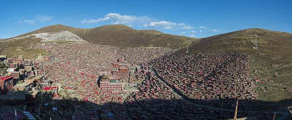  | |
|---|---|---|
| Towns and villages |
| |
| Geography |
| |
| Landmarks | ||