Altay City
Altay is a county-level city in Altay Prefecture within Ili Kazakh Autonomous Prefecture, in far Northern Xinjiang, China. The city centre is located on the slopes of Kelan River.
Altay 阿勒泰市 ئالتاي شەھىرى | |
|---|---|
 | |
.png) | |
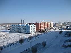
 Altay Location of the city center in Xinjiang | |
| Coordinates (Altay City government): 47°49′37″N 88°07′55″E | |
| Country | People's Republic of China |
| Autonomous region | Xinjiang |
| Prefecture | Altay |
| Area | |
| • County-level city | 11,400 km2 (4,400 sq mi) |
| Elevation | 887 m (2,910 ft) |
| Population (2016)[1] | |
| • County-level city | 199,037 |
| • Density | 17/km2 (45/sq mi) |
| • Urban (2016)[1] | 114,995 |
| • Rural (2016)[1] | 83,945 |
| • Major ethnic groups (2016)[1] | Han - 51.56% Kazakhs - 40.29% Hui - 3.31% Uyghurs - 2.45% Mongols - 1.41% Others - 1.08% |
| Time zone | UTC+8 (China Standard) |
| Postal code | 836500 |
| Area code(s) | 0906 |
| GDP (Nominal) | 2016[1] |
| - Total | ¥6.483 billion $1.007 billion |
| - per capita | ¥32.574 $5.060 |
| Website | Altay City Government Website |
| Altay City | |||||||||||
|---|---|---|---|---|---|---|---|---|---|---|---|
| Chinese name | |||||||||||
| Chinese | 阿勒泰 | ||||||||||
| |||||||||||
| Alternative Chinese name | |||||||||||
| Chinese | 承化 | ||||||||||
| |||||||||||
| Uyghur name | |||||||||||
| Uyghur | ئالتاي | ||||||||||
| |||||||||||
| Kazakh name | |||||||||||
| Kazakh | التاي Altaı Алтай | ||||||||||
Administrative divisions
Subdistricts (街道)
- Jinshan Road Subdistrict (金山路街道), Jiefang Road Subdistrict (解放路街道), Tuanjie Road Subdistrict (团结路街道)
Town (镇)
- Aweitan (阿苇滩镇), Hongdun (红墩镇)
Township (乡)
- Qimuerqieke Township (切木尔切克乡), Alahake Township (阿拉哈克乡), Handagait Mongol Township (汗德尕特蒙古族乡), Lasite Township (拉斯特乡), Kalaxilike Township (喀拉希力克乡), Sa'erhusong Township (萨尔胡松乡), Balibagai Township (巴里巴盖乡), Qie'erkeqi Township (切尔克齐乡)
Others
- Kalagashi Ranch (喀拉尕什牧场), Aketumusike Ranch (阿克吐木斯克牧场), XPCC No. 181 (兵团181团), XPCC No. 189 (兵团189团)
Geography
Climate
Altay has a cold semi-arid climate (Köppen BSk), without the strong monsoonal influence on seasonal precipitation patterns that defines the climate across much of China and an annual precipitation total of only 191 millimetres (7.5 in). Winters are long, bitterly cold and dry, with a January 24-hour average of −15.5 °C (4.1 °F); however, the presence of the Altay Mountains to the north helps moderate the severity of winter cold as compared to locations further to the east. Spring and autumn are short but mild. Summers are very warm, but dry, with a July 24-hour average of 21.8 °C (71.2 °F). The annual mean is 4.53 °C (40.2 °F). With monthly percent possible sunshine ranging from 50% in December to 74% in August and September, sunshine is abundant and the city receives 2,993 hours of bright sunshine annually.
| Climate data for Altay City (1971−2000) | |||||||||||||
|---|---|---|---|---|---|---|---|---|---|---|---|---|---|
| Month | Jan | Feb | Mar | Apr | May | Jun | Jul | Aug | Sep | Oct | Nov | Dec | Year |
| Average high °C (°F) | −9.4 (15.1) |
−6.8 (19.8) |
0.0 (32.0) |
14.0 (57.2) |
21.7 (71.1) |
26.5 (79.7) |
28.2 (82.8) |
26.8 (80.2) |
21.1 (70.0) |
12.1 (53.8) |
0.8 (33.4) |
−6.9 (19.6) |
10.7 (51.2) |
| Average low °C (°F) | −21.0 (−5.8) |
−19.1 (−2.4) |
−11.3 (11.7) |
2.2 (36.0) |
8.7 (47.7) |
13.3 (55.9) |
15.1 (59.2) |
13.4 (56.1) |
7.9 (46.2) |
1.0 (33.8) |
−9.1 (15.6) |
−17.5 (0.5) |
−1.4 (29.5) |
| Average precipitation mm (inches) | 12.5 (0.49) |
9.1 (0.36) |
8.7 (0.34) |
13.1 (0.52) |
16.6 (0.65) |
15.7 (0.62) |
25.8 (1.02) |
16.1 (0.63) |
15.6 (0.61) |
15.0 (0.59) |
22.3 (0.88) |
20.8 (0.82) |
191.3 (7.53) |
| Average precipitation days (≥ 0.1 mm) | 7.4 | 6.7 | 5.8 | 5.8 | 6.6 | 6.8 | 7.9 | 6.5 | 6.0 | 5.9 | 8.5 | 9.9 | 83.8 |
| Average relative humidity (%) | 74 | 73 | 71 | 48 | 43 | 48 | 52 | 49 | 49 | 54 | 68 | 75 | 59 |
| Mean monthly sunshine hours | 163.6 | 182.4 | 247.7 | 281.9 | 325.4 | 338.2 | 343.5 | 326.6 | 278.6 | 220.8 | 153.5 | 131.1 | 2,993.3 |
| Percent possible sunshine | 60 | 64 | 68 | 69 | 70 | 71 | 71 | 74 | 74 | 66 | 55 | 50 | 68 |
| Source: China Meteorological Administration[2] | |||||||||||||

Transport
- China National Highway 216
- China National Highway 217
- Altay Airport
- Train until Beitun city which is about one hour by car from Altay City.
From Ürümqi (capital of Xinjiang Province) to Altay, it takes about one hour by plane, 9 hours by day bus, 12 hours by night bus and about 14 hours by train (towards Beitun City).
Culture
Like other cities in Xinjiang Uyghur Autonomous Region, there are many minorities in Altay, in particular Uyghurs and Kazakhs.
The Dundbulag rock carvings (敦德布拉克岩画) in the Handagait Mongol Township (A.K.A. Handagaitu, Handgait; tyv. Handagaity; uyg. Handigati; cmn. Handegate) under this city is an earliest evidence of ski.
Education
In schools, students are taught mainly in Chinese (Mandarin) and there are courses for Uyghur and Kazakh languages.
Tourism
The most important tourist site is Kanas Lake where there is a legend of a large creature.
Economy
People
- Ma Fuxiang (1876–1932), military governor of Altay
- Rebiya Kadeer (born 1947), political activist
- Kanat Islam (born 1984), boxer
References
- "2016 Altay City National Economic and Social Development Statistical Communique". Retrieved 17 June 2018.
- 中国地面国际交换站气候标准值月值数据集(1971-2000年) (in Chinese). China Meteorological Administration. Archived from the original on 2013-09-21. Retrieved 2010-05-23.
External links
| Wikivoyage has a travel guide for Aletai. |