Payzawat County
Payzawat County,[6][7][8][5] also via SASM/GNC romanization as Payziwat County[9] (Uyghur: پەيزاۋات ناھىيىسى ; Chinese: 排孜阿瓦提县[3]), (also Faizabad and Fayzawat) and via Mandarin Chinese as Jiashi County (Chinese: 伽师县) is a county in Kashgar Prefecture, Xinjiang Uyghur Autonomous Region, China, on the western rim of the Taklamakan Desert. To the east, the county borders Maralbexi County, to the south Yopurga County.[3]
Payzawat County پەيزاۋات ناھىيىسى 伽师县 Jiashi, Ch'ieh-shih, Faiz Abad | |
|---|---|
County | |
.png) Location of Jiashi / Peyziwat County (red) and Kashgar Prefecture (yellow) within Xinjiang | |
| Country | People's Republic of China |
| Autonomous region | Xinjiang |
| Prefecture | Kashgar / Kashi |
| Seat | Barin (Baren; بارىن بازىرى / 巴仁镇)[1] |
| Area | |
| • Total | 6,600.68 km2 (2,548.54 sq mi) |
| Population (2010)[1] | |
| • Total | 381,767 |
| • Density | 58/km2 (150/sq mi) |
| Ethnic groups | |
| • Major ethnic groups | Uyghur[3][4][5] |
| Time zone | UTC+8 (China Standard) |
| Postal code | 844300 |
| Website | www |
| Payzawat County | |||||||||||
|---|---|---|---|---|---|---|---|---|---|---|---|
| Uyghur name | |||||||||||
| Uyghur | پەيزاۋات ناھىيىسى | ||||||||||
| |||||||||||
| Chinese name | |||||||||||
| Simplified Chinese | 伽师县 | ||||||||||
| Traditional Chinese | 伽師縣 | ||||||||||
| |||||||||||
| Alternative Chinese name | |||||||||||
| Simplified Chinese | 排孜阿瓦提县 | ||||||||||
| Traditional Chinese | 排孜阿瓦提縣 | ||||||||||
| |||||||||||
Name
The name "Jiashi" was first used in Chinese documents of Tang Dynasty and was adopted when Emperor Guangxu established the county in 1902. Allegedly the word is a transliteration of a celestial Turkic word for jade and has the same origin to "Kashi", Mandarin transliteration for "Kashgar". The Uyghur name "Payziwat" means "God's blessing of fortune" and was sometimes used in documents in Qing Dynasty. Payzawat means 'beautiful land of plenty'.[3]
The region is also sometimes called "Faizabad" in historic literature.[10][11]
History
Peyziwat County was established in July 1902.[2][12]
In 1981 there was a brief pro-independence rebellion in the county staged by Uyghur activists.[13]
Between 1997-2003 there were a series of deadly earthquakes in the county.[5]
On October 20, 2014, Shaptul (Xiaputule) was changed from a township to a town.[1][14]
On the night of January 19, 2020, a strong earthquake (2020年喀什地震) damaged buildings and seriously injured at least one person in the county.[15][16][17]
Administrative divisions
Payzawat County includes six towns, seven townships, and one other area:[1][18]
Towns (بازىرى / 镇)
- Barin (Baren; بارىن بازىرى[19] / 巴仁镇), Shekerkol (Xike'erkule; شېكەركۆل بازىرى / 西克尔库勒镇), Gholtoghraq (Wolituogelake; غولتوغراق بازىرى / 卧里托格拉克镇, formerly 卧里托格拉克乡), Shaptul Township[20] (Xiaputule; شاپتۇل بازىرى / 夏普吐勒镇, formerly شاپتۇل يېزىسى / 夏普吐勒乡), Qizilboyi (Kezileboyi; 克孜勒博依镇, formerly قىزىلبويى يېزىسى / 克孜勒博依乡), Qoshawat (Hexia'awati; 和夏阿瓦提镇, formerly قوشئاۋات يېزىسى / 和夏阿瓦提乡)
Townships (يېزىسى / 乡)
- Terim Township (Tierimu; تېرىم يېزىسى / 铁日木乡), Yengimehelle Township (Yingmaili; يېڭىمەھەللە يېزىسى / 英买里乡), Janbaz Township (Jiangbazi; جانباز يېزىسى / 江巴孜乡), Misha Township (Mixia; مىشا يېزىسى / 米夏乡), Kizilsu Township[21] (Kezilesu, Qizilsu; قىزىلسۇ يېزىسى / 克孜勒苏乡), Gulluk Township (Guleluke; گۈللۈك يېزىسى / 古勒鲁克乡), Ordeklik Township (Yudaikelike; ئۆردەكلىك يېزىسى / 玉代克力克乡)
Others
- Nongsanshijiashizong Farm (农三师伽师总场)
Economy
The system of irrigation is well-developed. Agricultural products include wheat, corn, sorghum, cotton and muskmelon. Animal herding is also common, primarily sheep. Specialities of the county include the 'Payzawat melon' (伽师瓜) and white grapes without pits. Industries include tractors, electronics, leather making, construction, and cotton and melon processing.[2]
Demographics
| Historical population | ||
|---|---|---|
| Year | Pop. | ±% p.a. |
| 2000 | 311,733 | — |
| 2010 | 381,767 | +2.05% |
| [1] | ||
As of 2015, 437,073 of the 445,846 residents of the county were Uyghur, 8,342 were Han Chinese, 431 were from other ethnic groups.[22]
As of 2009, Uyghurs made up 98.9% of the county's population.[3]
According to the 2002 census, it has a population of 320,000.
As of 1999, 96.46% of the population of Payzawat (Jiashi) County was Uyghur and 3.52% of the population was Han Chinese.[23]
In 1997, Uyghurs made up 97.2% of the county's population.[4]
Transportation
Historical maps
Historical English-language maps including Payzawat:
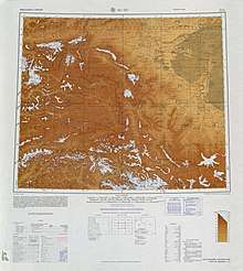 Map including Payzawat (labeled as CH'IEH-SHIH (FAIZ ABAD)) from the International Map of the World (AMS, 1966)[lower-alpha 1]
 Map including Payzawat (labeled as CH'IEH-SHIH) (DMA, 1974)
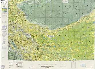 From the Operational Navigation Chart; map including Payzawat (labeled as Jiashi (Ch'ieh-shih)) (DMA, 1980)[lower-alpha 2]
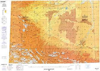 Map including Payzawat (labeled as Jiashi (Ch'ieh-shih)) (DMA, 1984)[lower-alpha 3]
Notes
- From map: "DELINEATION OF INTERNATIONAL BOUNDARIES MUST NOT BE CONSIDERED AUTHORITATIVE"
- From map: "The representation of international boundaries is not necessarily authoritative."
- From map: "The representation of international boundaries is not necessarily authoritative"
References
- 伽师县历史沿革. XZQH.org. 14 November 2014. Retrieved 21 March 2020.
2000年第五次人口普查,伽师县常住总人口311733人,{...}2003年,伽师县总面积6600.68平方千米,{...}县政府驻巴仁镇。{...}2010年第六次人口普查,伽师县常住总人口381767人,{...}2014年10月20日,自治区政府(新政函[2014]183号)同意撤销夏普吐勒乡,设立夏普吐勒镇。调整后,全县辖3个镇、10个乡:巴仁镇、西克尔库勒镇、夏普吐勒镇、铁日木乡、英买里乡、江巴孜乡、卧里托格拉克乡、克孜勒博依乡、米夏乡、和夏阿瓦提乡、克孜勒苏乡、古勒鲁克乡、玉代克力克乡。
- 夏征农; 陈至立, eds. (September 2009). 辞海:第六版彩图本 [Cihai (Sixth Edition in Color)] (in Chinese). 上海. Shanghai: 上海辞书出版社. Shanghai Lexicographical Publishing House. p. 1046. ISBN 9787532628599.
面积6 601平方千米。{...}1902年(清光绪二十八年)置伽师县。{...}灌溉发达。农产有小麦、玉米、高粱、棉花和甜瓜。畜牧业亦盛,以绵羊为主。特产“伽师瓜”、无核白葡萄。工业有农机、电力、制革、建材、棉花和瓜果加工等。
- 伽师概况 [Payzawat Overview]. 伽师县人民政府网. 18 May 2009. Retrieved 21 March 2020.
伽师,维吾尔语称“排孜阿瓦提”,意为美丽富饶的地方,{...}位于新疆维吾尔自治区西南部,东邻把楚,西接疏勒,南连岳普湖,北依天山山脉的柯坪南支,西北与克孜勒苏柯尔克孜自治州阿图什毗邻{...}是塔克拉玛干沙漠西缘的一块绿洲{...} 总人口36万,其中维吾尔族占98.9%。
- 1997年伽师县行政区划. XZQH.org (in Chinese). 19 November 2010. Retrieved 21 March 2020.
喀什地区辖县。位于塔克拉玛干沙漠西缘。面积6715.4平方千米,人口28.2万,有维吾尔、汉、柯尔克孜、回等14个民族,其中维吾尔族占97.2%,辖2镇11乡,县政府驻巴仁镇。
- "DEATH TOLL RISING FAST IN XINJIANG QUAKE". Radio Free Asia. 25 February 2003. Retrieved 22 March 2020.
The two areas hardest-hit by the quake, which China says measured 6.8 on the open-ended Richter scale, were Maralbeshi and Payzawat (Jiashi) counties.{...}According to official Chinese media, Payzawat (Jiashi) has a population of at least 300,000, while Maralbeshi (Bachu) has a population of 260,000. Both counties are 90 percent Uyghur.
- Ministry of Housing and Urban-Rural Development (2010). 建筑抗震设计规范 [GB50011-2010: Code for Seismic Design of Buildings] (in English and Chinese). Beijing: China Architecture & Building Press. p. 203 – via Google Books.
Payzawat County
- yan, ed. (18 January 2020). "5.4-magnitude earthquake hits Xinjiang: CENC". Xinhua News Agency. Retrieved 21 March 2020.
A 5.4-magnitude earthquake hit Payzawat County of Kashgar Prefecture in northwest China's Xinjiang Uygur Autonomous Region at 00:05 a.m. Saturday (Beijing Time), according to the China Earthquake Networks Center (CENC).
- Payzawat Xian (Variant - V) at GEOnet Names Server, United States National Geospatial-Intelligence Agency
- Eset Sulayman, Gulchehra Hoja, Jilil Kashgary, Joshua Lipes (19 May 2017). "Uyghurs Forced to Undergo Medical Exams, DNA Sampling". Radio Free Asia. Translated by Alim Seytoff and Mamatjan Juma. Retrieved 21 March 2020.
A farmer from Payziwat (Gashi) county in Kashgar (Kashi) prefecture told RFA that county officials and medical personnel had set up a health checkpoint in front of the area hospital, and local cadres “urged” residents to get examined.
CS1 maint: multiple names: authors list (link) - Reginald C. F. Schomberg and Matthew Arnold (1930). "The Climatic Conditions of the Tarim Basin". The Geographical Journal. 75 (4): 318. doi:10.2307/1784816. JSTOR 1784816.
- Michell, John; Valikhanov, Chokan Chingisovich; Venyukov, Mikhail Ivanovich (1865), The Russians in Central Asia: their occupation of the Kirghiz steppe and the line of the Syr-Daria: their political relations with Khiva, Bokhara, and Kokan: also descriptions of Chinese Turkestan and Dzungaria; by Capt. Valikhanof, M. Veniukof and [others]. Translated by John Michell, Robert Michell, E. Stanford, p. 152
- Peyziwat County Archived 2010-09-02 at the Wayback Machine. Kashgar Government.
- Dillon, Michael (2004). Xinjiang: China's Muslim far northwest. Routledge. pp. 59–60. ISBN 9780203166642.
- "Archived copy" 关于同意伽师县夏普吐勒乡撤乡设镇的批复(新政函[2014]183号). 新疆民政 (in Chinese). 27 October 2014. Archived from the original on 12 August 2019. Retrieved 9 April 2020.
2014年10月20日,自治区人民政府同意撤销伽师县夏普吐勒乡建制,设立夏普吐勒镇,其行政区域界线、政府驻地及隶属关系不变。
CS1 maint: archived copy as title (link) - "Quake causes damage, injuries in China's Xinjiang region". Taiwan News. 20 January 2020. Retrieved 21 March 2020.
- "6.4-magnitude Earthquake Jolted Xinjiang, Causing Injuries, Damaging Houses, Disrupting Service". China Central Television. 20 January 2020. Retrieved 21 March 2020 – via YouTube.
- [天下财经]新疆伽师县发生6.4级地震 多人受伤 CCTV财经. China Central Television. 20 January 2020. Retrieved 22 March 2020 – via YouTube.
- 2019年统计用区划代码和城乡划分代码:伽师县 (in Chinese). National Bureau of Statistics of the People's Republic of China. 2019. Retrieved 21 March 2020.
统计用区划代码 名称 653129100000 巴仁镇 653129101000 西克尔库勒镇 653129102000 夏普吐勒镇 653129103000 卧里托格拉克镇 653129104000 克孜勒博依镇 653129107000 和夏阿瓦提镇 653129200000 铁日木乡 653129201000 英买里乡 653129202000 江巴孜乡 653129205000 米夏乡 653129208000 克孜勒苏乡 653129209000 古勒鲁克乡 653129210000 玉代克力克乡 653129500000 兵团伽师总场
- بارىن بازىرى ئالاھىدە كەسىپلەر ئارقىلىق بېيىش يولىغا ئاتلاندى. People's Daily (in Uyghur). 8 January 2018. Retrieved 22 March 2020.
پەيزاۋات ناھىيەسىنىڭ بارىن بازىرى ناھىيە ئىچىگە جايلاشقان.
- Alessandra Cappelletti (2020). Socio-Economic Development in Xinjiang Uyghur Autonomous Region Disparities and Power Struggle in China's North-West. Palgrave Macmillan. p. 243. ISBN 978-981-15-1536-1 – via Google Books.
Xiaputule/Shaptul (夏普吐勒乡, شاپتۇل يېزىسى), Village 13, 14 and 15, in Jiashi/Peyzawat County
- Kizilsu (Approved - N) at GEOnet Names Server, United States National Geospatial-Intelligence Agency
- 3-7 各地、州、市、县(市)分民族人口数 (in Chinese). شىنجاڭ ئۇيغۇر ئاپتونوم رايونى 新疆维吾尔自治区统计局 Statistic Bureau of Xinjiang Uygur Autonomous Region. 15 March 2017. Archived from the original on 11 October 2017. Retrieved 3 September 2017.
- Morris Rossabi, ed. (2004). Governing China’s Multiethnic Frontiers (PDF). University of Washington Press. p. 179. ISBN 0-295-98390-6.