Jinghe County
Jinghe County (Chinese: 精河县) as the official romanized name, also transliterated from Uyghur as Jing County (Uyghur: قاغىلىق ناھىيىسى ; Chinese: 精县), is a county of the Xinjiang Uyghur Autonomous Region and is under the administration of the Börtala Mongol Autonomous Prefecture. It contains an area of 11,181 square kilometres (4,317 sq mi). According to the 2002 census, it has a population of 120,000.
Jinghe County 精河县 • جىڭ ناھىيىسى | |
|---|---|
.png) Jinghe County (red) within Bortala Prefecture (yellow) and Xinjiang | |
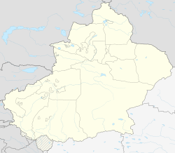 Jinghe Location in Xinjiang | |
| Coordinates: 44°36′N 82°54′E | |
| Country | People's Republic of China |
| Region | Xinjiang |
| Autonomous prefecture | Bortala |
| County seat | Jinghe Town (精河镇) |
| Area | |
| • Total | 11,181 km2 (4,317 sq mi) |
| Elevation | 321 m (1,053 ft) |
| Population (2002) | |
| • Total | 120,000 |
| • Density | 11/km2 (28/sq mi) |
| Time zone | UTC+8 (China Standard) |
| Jinghe County | |||||||||||
|---|---|---|---|---|---|---|---|---|---|---|---|
| Chinese name | |||||||||||
| Simplified Chinese | 精河县 | ||||||||||
| Traditional Chinese | 精河縣 | ||||||||||
| |||||||||||
| Alternative Chinese name | |||||||||||
| Simplified Chinese | 精县 | ||||||||||
| Traditional Chinese | 精縣 | ||||||||||
| |||||||||||
| Uyghur name | |||||||||||
| Uyghur | جىڭ ناھىيىسى | ||||||||||
| |||||||||||
Geography and climate
Jinghe has a desert climate (Köppen BWk), with a mean total of only 102 millimetres (4.02 in) of precipitation per annum and great seasonal differences in temperature, with long, very cold winters, and hot, dry summers. As spring and autumn are short, winter and summer are the main seasons. Temperatures can easily fall below −20 °C (−4 °F) in winter or rise above 35 °C (95 °F) in summer. The monthly 24-hour average temperature ranges from −15.2 °C (4.6 °F) in January to 25.5 °C (77.9 °F) in July; the annual mean is 7.78 °C (46.0 °F). With monthly percent possible sunshine ranging from 35% in December to 70% in August and September, the county receives 2,554 hours of bright sunshine annually.
| Climate data for Jinghe County (1971−2000) | |||||||||||||
|---|---|---|---|---|---|---|---|---|---|---|---|---|---|
| Month | Jan | Feb | Mar | Apr | May | Jun | Jul | Aug | Sep | Oct | Nov | Dec | Year |
| Average high °C (°F) | −9.8 (14.4) |
−5.6 (21.9) |
5.8 (42.4) |
19.4 (66.9) |
26.7 (80.1) |
31.4 (88.5) |
33.2 (91.8) |
31.4 (88.5) |
25.2 (77.4) |
15.3 (59.5) |
3.6 (38.5) |
−6 (21) |
14.2 (57.6) |
| Average low °C (°F) | −19.7 (−3.5) |
−16 (3) |
−4.4 (24.1) |
5.7 (42.3) |
12.5 (54.5) |
17.1 (62.8) |
18.6 (65.5) |
16.6 (61.9) |
10.8 (51.4) |
2.9 (37.2) |
−4.5 (23.9) |
−13.5 (7.7) |
2.2 (35.9) |
| Average precipitation mm (inches) | 4.0 (0.16) |
4.1 (0.16) |
5.2 (0.20) |
10.0 (0.39) |
15.5 (0.61) |
13.1 (0.52) |
11.5 (0.45) |
11.0 (0.43) |
9.2 (0.36) |
7.1 (0.28) |
4.5 (0.18) |
7.0 (0.28) |
102.2 (4.02) |
| Average precipitation days (≥ 0.1 mm) | 10.1 | 7.7 | 5.2 | 4.5 | 5.7 | 7.4 | 8.0 | 6.1 | 4.6 | 3.5 | 4.8 | 10.9 | 78.5 |
| Average relative humidity (%) | 81 | 78 | 68 | 49 | 45 | 46 | 50 | 50 | 53 | 64 | 76 | 81 | 62 |
| Mean monthly sunshine hours | 131.0 | 143.9 | 176.4 | 234.5 | 279.6 | 290.0 | 312.8 | 302.2 | 261.8 | 209.6 | 117.2 | 95.2 | 2,554.2 |
| Percent possible sunshine | 46 | 49 | 48 | 58 | 61 | 63 | 67 | 70 | 70 | 62 | 41 | 35 | 58 |
| Source: China Meteorological Administration | |||||||||||||
Municipalities
Jinghe County includes the towns of Jinghe (精河镇) and Daheyanzi (大河沿子镇).
Rural townships include Mangding (茫丁乡), Tuoli (托里乡), and Todok (托托乡, Tuōtuōxiāng).
Similar-level units include the Aheqi (阿合其农场, Āhéqí Nóngchǎng) and Bajiahu Farms (八家户农场, Bājiāhù Nóngchǎng) and the Bingtuan Bashisantuan (兵团八十三团) and Bingtuan Jiushiyituan (兵团九十一团).
Transport
Jinghe is served by China National Highway 312. It is a railway junction for the Northern Xinjiang, Second Ürümqi-Jinghe and Jinghe-Yining-Horgos Railways.